Kei Ling Ha on:
[Wikipedia]
[Google]
[Amazon]


 Kei Ling Ha () is an
MacLehose Trail Stage 4
Delineation of area of existing village Kei Ling Ha Lo Wai (Sai Kung North) for election of resident representative (2019 to 2022)
Delineation of area of existing village Kei Ling Ha San Wai (Sai Kung North) for election of resident representative (2019 to 2022)
{{coord, 22.413488, 114.272404, display=title Villages in Tai Po District, Hong Kong Sai Kung North Walled villages of Hong Kong


 Kei Ling Ha () is an
 area
Area is the quantity that expresses the extent of a region on the plane or on a curved surface. The area of a plane region or ''plane area'' refers to the area of a shape
A shape or figure is a graphics, graphical representation of an obje ...
of Shap Sze Heung
Shap Sze Heung, sometimes transliterated as Shap Sz Heung (), is an area in Hong Kong located in the northern part of the Sai Kung Peninsula.
Administration
Despite its proximity to the neighbouring areas administered by Sha Tin and Sai Kun ...
, on the Sai Kung Peninsula
The Sai Kung Peninsula () is a peninsula in the easternmost part of the New Territories in Hong Kong. Its name comes from Sai Kung Town in the central southern area of the peninsula. The southern part of the peninsula is administrated by Sai ...
, in eastern New Territories
The New Territories is one of the three main regions of Hong Kong, alongside Hong Kong Island and the Kowloon Peninsula. It makes up 86.2% of Hong Kong's territory, and contains around half of the population of Hong Kong. Historically, it ...
of Hong Kong
Hong Kong ( (US) or (UK); , ), officially the Hong Kong Special Administrative Region of the People's Republic of China ( abbr. Hong Kong SAR or HKSAR), is a city and special administrative region of China on the eastern Pearl River Delt ...
. Administratively, it is part of Tai Po District
Tai Po District is one of the 18 districts of Hong Kong. The suburban district covers the areas of Tai Po New Town (including areas such as Tai Po Market, , Tai Po Industrial Estate, Tai Wo Estate), Tai Po Tau, Tai Po Kau, Hong Lok Yuen, Ti ...
. It is a popular place for countryside visits, picnicking and bird watching.
Location
Kei Ling Ha is located at the coastal area nearSai Sha Road
Sai Sha Road () is a main road connecting Sai Kung Town, Sai Kung and Ma On Shan (town), Ma On Shan. It begins at the roundabout at Sai Kung Town, Mak Pin, Sai Kung and passes through Three Fathoms Cove and Shap Sze Heung before traversing the ne ...
, at the junction of Ma On Shan Country Park
Ma On Shan Country Park () is a park located in the central neck of the Sai Kung Peninsula in the eastern New Territories of Hong Kong. The park covers an area of and links Sai Kung Country Park and Lion Rock Country Park to form an extensive ...
and Sai Kung West Country Park
Sai Kung West Country Park () is a country park on the Sai Kung Peninsula in northeast Hong Kong.
Opened in 1978 the park's sights include:
* Wong Chuk Wan ()
* Tai Mong Tsai ()
* Pak Tam Chung
* Yung Shue O
* Lai Chi Chong
* Hoi Ha Marine Pa ...
. It is located in the innermost shore of Three Fathoms Cove
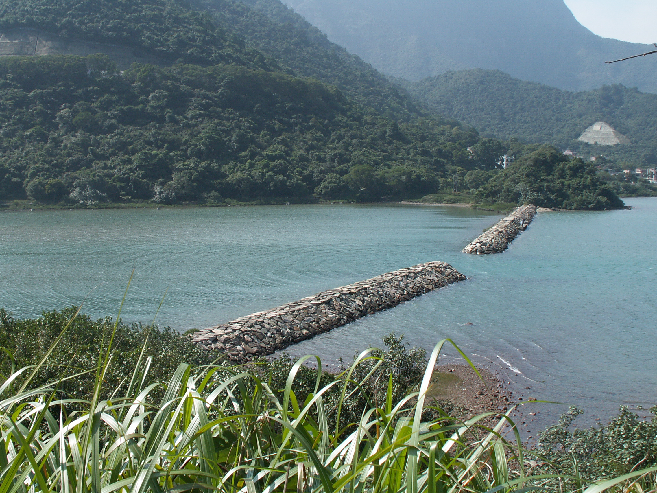
Three Fathoms Cove or Kei Ling Ha Hoi () is a cove in Tai Po District, Hong Kong.
Geography
Three Fathoms Cove is surrounded by Shap Sze Heung (Tseng Tau, Nga Yiu Tau, Sai Keng
Sai Keng () is a village of in the Shap Sze Heung area of Sai K ...
which is known as Kei Ling Ha Hoi indigenously.
Villages
Kei Ling Ha Lo Wai () and Kei Ling Ha San Wai () are the two mainvillages
A village is a clustered human settlement or community, larger than a hamlet but smaller than a town (although the word is often used to describe both hamlets and smaller towns), with a population typically ranging from a few hundred to ...
within this area. Kei Ling Ha Lo Wai is a Hakka
The Hakka (), sometimes also referred to as Hakka Han, or Hakka Chinese, or Hakkas are a Han Chinese subgroup whose ancestral homes are chiefly in the Hakka-speaking provincial areas of Guangdong, Fujian, Jiangxi, Guangxi, Sichuan, Hunan, Zhej ...
walled village
A walled village () is a type of large traditional multi-family communal living structure found in China, that is designed to be easily defensible. It is completely surrounded by thick defensive walls, protecting the residents from the attack o ...
. Both villages are occupied by members of the Ho () lineage.
The settlement of Kei Ling Ha Lo Wai probably dates back to the late 16th century. The New Village branched off from the "old Wai" around 1876. The combined population of the two villages was 135 in 1960.
As a walled village, Kei Ling Ha Lo Wai features an entrance gate and a Ho Ancestral Hall. A drystone wall marks the outer edge of the village platform on a piedmont site. The site faces almost directly north so that the wall has a most likely a geomantic
Geomancy (Greek language, Greek: γεωμαντεία, "earth divination") is a method of divination that interprets markings on the ground or the patterns formed by tossed handfuls of soil, rock (geology), rocks, or sand. The most prevalent ...
as well as a practical function.
Kei Ling Ha Lo Wai and Kei Ling Ha San Wai are recognized villages under the New Territories
The New Territories is one of the three main regions of Hong Kong, alongside Hong Kong Island and the Kowloon Peninsula. It makes up 86.2% of Hong Kong's territory, and contains around half of the population of Hong Kong. Historically, it ...
Small House Policy
The Small House Policy (SHP, ) was introduced in 1972 in Hong Kong. The objective was to improve the then prevailing low standard of housing in the rural areas of the New Territories. The Policy allows an indigenous male villager who is 18 ye ...
.
Ecology
Kei Ling Ha is the site of arocky shore
A rocky shore is an intertidal area of seacoasts where solid rock predominates. Rocky shores are biologically rich environments, and are a useful "natural laboratory" for studying intertidal ecology and other biological processes. Due to their ...
. Mangrove
A mangrove is a shrub or tree that grows in coastal saline water, saline or brackish water. The term is also used for tropical coastal vegetation consisting of such species. Mangroves are taxonomically diverse, as a result of convergent evoluti ...
can be found at Kei Ling Ha Lo Wai, and the site has been a Site of Special Scientific Interest
A Site of Special Scientific Interest (SSSI) in Great Britain or an Area of Special Scientific Interest (ASSI) in the Isle of Man and Northern Ireland is a conservation designation denoting a protected area in the United Kingdom and Isle of ...
since 1994. It is the habitat of fiddler crab
The fiddler crab or calling crab may be any of more than one hundred species of semiterrestrial marine crabs in the family Ocypodidae, well known for their sexual dimorphism, sexually dimorphic claws; the males' major claw is much larger than th ...
s.
Transport
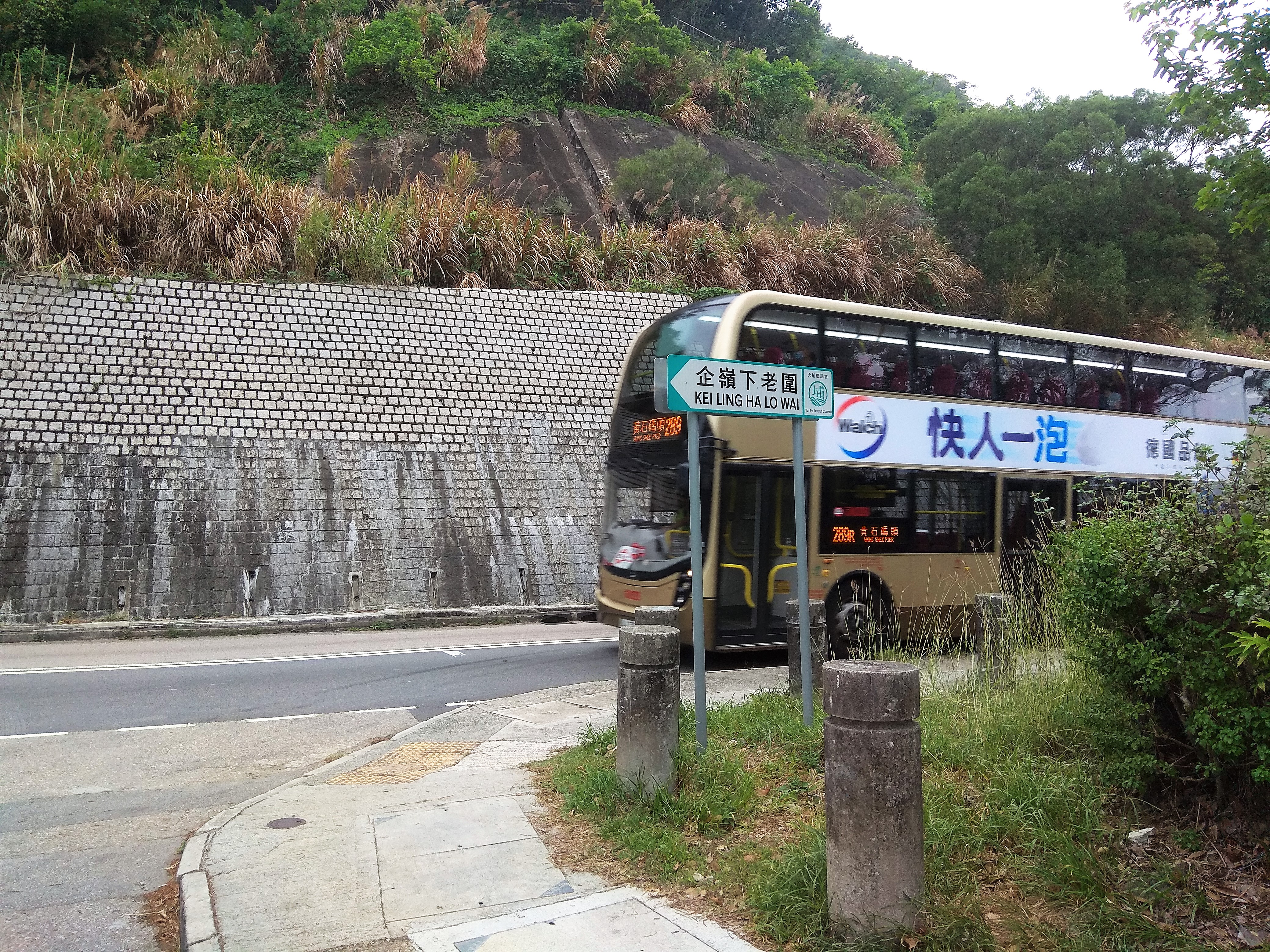
Kei Ling Ha is served bySai Sha Road
Sai Sha Road () is a main road connecting Sai Kung Town, Sai Kung and Ma On Shan (town), Ma On Shan. It begins at the roundabout at Sai Kung Town, Mak Pin, Sai Kung and passes through Three Fathoms Cove and Shap Sze Heung before traversing the ne ...
. The end of Stage 3 and start of Stage 4 of the MacLehose Trail
The MacLehose Trail is a 100-kilometre hiking trail that crosses much of the New Territories, Hong Kong, starting from Pak Tam Chung, Sai Kung District in the east to Tuen Mun Town, Tuen Mun District in the west. The path is marked by distance po ...
is located at Shui Long Wo
Shui Long Wo () is an area of Hong Kong, part of Kei Ling Ha, in the eastern New Territories of Hong Kong. Administratively, it is part of Tai Po District. The end of Stage 3 and start of Stage 4 of the MacLehose Trail is located at Shui Long Wo.
...
(), part of Kei Ling Ha.Agriculture, Fisheries and Conservation Department
The Agriculture, Fisheries and Conservation Department (; formerly the Agriculture and Fisheries Department () before 2000, of the Hong Kong Government is responsible for agriculture and fisheries in Hong Kong, conservation projects and issu ...
MacLehose Trail Stage 4
See also
*Environment of Hong Kong
The ecology of Hong Kong is mostly affected by the results of climatic changes. Hong Kong's climate is seasonal due to alternating wind direction between winter and summer.
Hong Kong has been geologically stable for millions of years. Flora an ...
* List of places in Hong Kong
The following is a list of areashttp://www.lcsd.gov.hk/CE/CulturalService/MusicOffice/download/imts18.pdf of Hong Kong.
Hong Kong Island
* Central and Western District
** Central District
***Admiralty
** Mid-Levels
***Soho
**Sai Wan
***Kenned ...
* Walled villages of Hong Kong
Most of the walled villages of Hong Kong are located in the New Territories.
History
During the Ming and Qing dynasties, the shore of Guangdong suffered from pirates, and the area of present-day Hong Kong was particularly vulnerable to pira ...
* List of villages in Hong Kong
The following is a list of villages in Hong Kong.
Villages in the New Territories
Non-indigenous villages are ''italicised''. Composite villages are bolded.
Each village has one resident representative and at least one indigenous inhabitant repr ...
References
External links
Delineation of area of existing village Kei Ling Ha Lo Wai (Sai Kung North) for election of resident representative (2019 to 2022)
Delineation of area of existing village Kei Ling Ha San Wai (Sai Kung North) for election of resident representative (2019 to 2022)
{{coord, 22.413488, 114.272404, display=title Villages in Tai Po District, Hong Kong Sai Kung North Walled villages of Hong Kong