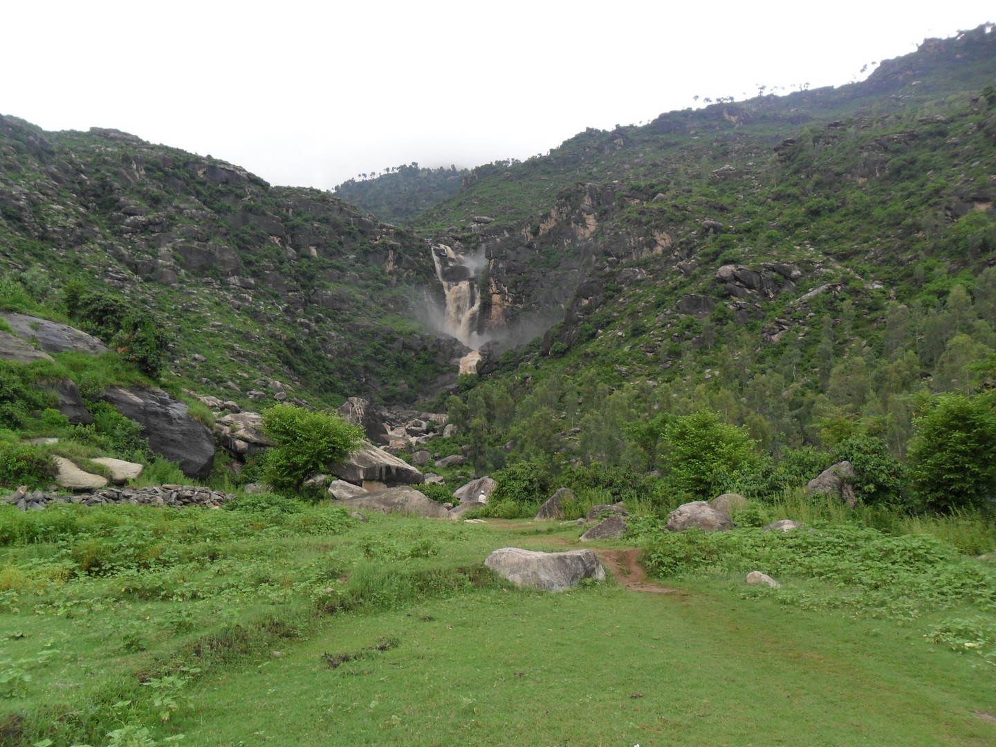
Karakar Pass on:
[Wikipedia]
[Google]
[Amazon]
Karakar Pass ( ps, کړاکړ دره; el. 1336 m./4384 ft.) is a 
mountain pass
A mountain pass is a navigable route through a mountain range or over a ridge. Since many of the world's mountain ranges have presented formidable barriers to travel, passes have played a key role in trade, war, and both Human migration, human a ...
in the Hindu Kush
The Hindu Kush is an mountain range in Central and South Asia to the west of the Himalayas. It stretches from central and western Afghanistan, Quote: "The Hindu Kush mountains run along the Afghan border with the North-West Frontier Provinc ...
, connecting Swat
In the United States, a SWAT team (special weapons and tactics, originally special weapons assault team) is a police tactical unit that uses specialized or military equipment and tactics. Although they were first created in the 1960s to ...
and Buner
Buner District ( ps, بونیر ولسوالۍ, ur, ) is a district in Malakand Division of Khyber Pakhtunkhwa province in Pakistan. Before becoming a district in 1991, it was a tehsil within Swat District.
History
The Buner Valley lies bet ...
in Khyber Pakhtunkhwa
Khyber Pakhtunkhwa (; ps, خېبر پښتونخوا; Urdu, Hindko: خیبر پختونخوا) commonly abbreviated as KP or KPK, is one of the Administrative units of Pakistan, four provinces of Pakistan. Located in the Geography of Pakistan, ...
, Pakistan
Pakistan ( ur, ), officially the Islamic Republic of Pakistan ( ur, , label=none), is a country in South Asia. It is the world's List of countries and dependencies by population, fifth-most populous country, with a population of almost 24 ...
. From the top of the pass, one can view Buner Valley.
It was at this pass in February 1586 where about 8,000 Mughal soldiers, including their commander-in-chief Birbal
Birbal (; born Mahesh Das; 1528 16 February 1586), or Raja Birbal, was a Saraswat Hindu Bhatt Brahmin advisor and main commander (''Mukhya Senapati'') of army in the court of the Mughal emperor, Akbar. He is mostly known in the Indian subcon ...
, were killed by the Yusufzai
The Yusufzai or Yousafzai ( ps, یوسفزی, ), also referred to as the Esapzai (, ) are one of the largest Pashtun tribes, tribes of ethnic Pashtuns. They are natively based in Khyber Pakhtunkhwa, Pakistan, to which they migrated to from Sulim ...
lashkar led by Kalu Khan. This was the greatest disaster faced by the Mughal Army
The Army of the Mughal Empire was the force by which the Mughal emperors established their empire in the 15th century and expanded it to its greatest extent at the beginning of the 18th century. Although its origins, like the Mughals themselves, ...
during Akbar
Abu'l-Fath Jalal-ud-din Muhammad Akbar (25 October 1542 – 27 October 1605), popularly known as Akbar the Great ( fa, ), and also as Akbar I (), was the third Mughal emperor, who reigned from 1556 to 1605. Akbar succeeded his father, Hum ...
's reign.
The 45 km-long road from Pir Baba
Sayyid Ali Tirmizi ( ps, سيد علي ترمذي), more commonly known as Pir Baba (), was a Naqvi Sayyid, and a Sufi who settled in Buner (present-day Khyber Pakhtunkhwa, Pakistan) among the Yusufzai Pashtuns. He was probably born in 908 AH (1 ...
to Barikot
Barikot ( ur, بریکوٹ) (Pashto: بریکوټ) is a town located in the middle course of the Swat River in Khyber Pakhtunkhwa, Pakistan. It is located about away from Mingora and the Butkara Stupa. It is the entrance town to the central ...
passes through Elum Ghar
Elum Ghar, also known as Mount Ilam is a mountain located between the Swat and Buner districts of Pakistan. Elum Ghar is the highest peak in the region, and is snow-covered most of the year. It is located west of Pir Baba's shrine in the Buner ...
rising through mature pine forests to Karakar Pass.
See also
*Karakar Tunnel
Karakar Tunnel is an under-construction 2 km long tunnel connecting Buner to Swat District. The tunnel will shortcut the 11 km long distance of Karakar Pass
Karakar Pass ( ps, کړاکړ دره; el. 1336 m./4384 ft.) is a mountain pass ...
* Elum Ghar
Elum Ghar, also known as Mount Ilam is a mountain located between the Swat and Buner districts of Pakistan. Elum Ghar is the highest peak in the region, and is snow-covered most of the year. It is located west of Pir Baba's shrine in the Buner ...
References
Mountain passes of Khyber Pakhtunkhwa Mountain passes of the Hindu Kush {{KhyberPakhtunkhwa-geo-stub