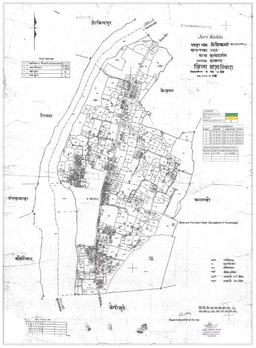
Jori Kalan on:
[Wikipedia]
[Google]
[Amazon]
Jori Kalan is also known as Jori, is a small town in
total number of households 1301 where 7711 people are residing out of them 4,057 are males and 3,654 are females, which represents poor

Current weather in JoriChatra district official site, Government of JharkhandGovernment of Jharkhand official site
Cities and towns in Chatra district Chatra_district
Chatra district
Chatra district is one of the twenty-four districts of Jharkhand state, India. The district was formed after separation from Hazaribagh district in 1991. Chatra is the administrative headquarters of this district. The district covers an area of ...
in state of Jharkhand
Jharkhand (; ; ) is a state in eastern India. The state shares its border with the states of West Bengal to the east, Chhattisgarh to the west, Uttar Pradesh to the northwest, Bihar to the north and Odisha to the south. It has an area of . It ...
, India
India, officially the Republic of India (Hindi: ), is a country in South Asia. It is the seventh-largest country by area, the second-most populous country, and the most populous democracy in the world. Bounded by the Indian Ocean on the so ...
. The town is separated into two parts the one main town Jori Kalan and another part of the town is Jori Khurd.
Introduction
Jori is located on the bank of river Lilajan also known as Falgu and all the sides of the town fortress with mountains. Town is scattered in radius of 5 kilometers and connecting too many villages around it.Civilians
According to census 2011total number of households 1301 where 7711 people are residing out of them 4,057 are males and 3,654 are females, which represents poor
Sex ratio
The sex ratio (or gender ratio) is usually defined as the ratio of males to females in a population. As explained by Fisher's principle, for evolutionary reasons this is typically about 1:1 in species which reproduce sexually. Many species devia ...
in compare to other developed cities. Total 75.23% population of Jori is literate, percentage of literate male is 81.56% and female 68.04%. Where other of part of Jori, Jori Khurd is doing fabulous in literacy where 100% male and females are literate.
The major issue civilians are facing are lack of employment, most of the educated youth are unemployed because there is no source of income and industrial development is yet too happen in this area. Major source of employment is Agriculture
Agriculture or farming is the practice of cultivating plants and livestock. Agriculture was the key development in the rise of sedentary human civilization, whereby farming of domesticated species created food surpluses that enabled people to ...
that is completely based on the monsoon
A monsoon () is traditionally a seasonal reversing wind accompanied by corresponding changes in precipitation but is now used to describe seasonal changes in atmospheric circulation and precipitation associated with annual latitudinal oscil ...
.
Tourism
Kali Mandir
Kali Mandir is a prominent Hindu temple in Jori which is famous for performing the ritual of marriage. Every year hundreds of Groom and Bride visit this temple to perform the ritual of marriage and bond themselves in the precious relation of husband and wife.Kauleshwari Hill and Temple
Kauleshwari hill lies 5 km away in right direction of the town which is 1750 feet high from the sea level. On the top of the Kauleshwari hill there areHindu
Hindus (; ) are people who religiously adhere to Hinduism.Jeffery D. Long (2007), A Vision for Hinduism, IB Tauris, , pages 35–37 Historically, the term has also been used as a geographical, cultural, and later religious identifier for ...
temples of Goddess Kauleshwari, people said this temple is from ancient period and famous from vedic period
The Vedic period, or the Vedic age (), is the period in the late Bronze Age and early Iron Age of the history of India when the Vedic literature, including the Vedas (ca. 1300–900 BCE), was composed in the northern Indian subcontinent, betw ...
.
Transportation
Transportation is good since it is located on NH 22 but only during the day hours, there is no transportation service during night. Nearest city is Gaya,Bihar
Bihar (; ) is a state in eastern India. It is the 2nd largest state by population in 2019, 12th largest by area of , and 14th largest by GDP in 2021. Bihar borders Uttar Pradesh to its west, Nepal to the north, the northern part of West Be ...
which is 60 km away and other nearest city is Hazaribagh
Hazaribagh is a city and a municipal corporation in Hazaribagh district in the Indian state of Jharkhand. It is the divisional headquarters of North Chotanagpur division. It is considered as a health resort and is also popular for Hazaribagh ...
, Jharkhand
Jharkhand (; ; ) is a state in eastern India. The state shares its border with the states of West Bengal to the east, Chhattisgarh to the west, Uttar Pradesh to the northwest, Bihar to the north and Odisha to the south. It has an area of . It ...
which is 80 km away.
Nearest Railway station
Rail transport (also known as train transport) is a means of transport that transfers passengers and goods on wheeled vehicles running on rails, which are incorporated in tracks. In contrast to road transport, where the vehicles run on a pre ...
is Gaya station code GAYA and nearest Airport
An airport is an aerodrome with extended facilities, mostly for commercial air transport. Airports usually consists of a landing area, which comprises an aerially accessible open space including at least one operationally active surface ...
is in Bodhgaya Airport (airport code: GAY) at distance of 50 km.
Map

References
{{ReflistExternal links
Current weather in Jori
Cities and towns in Chatra district Chatra_district