Jhinjhuvada on:
[Wikipedia]
[Google]
[Amazon]
 Zinzuwada, also spelled Jhinjhuvada or Jhinjhuwada is a town in Dasada Taluka of


Imperial Gazetteer, on DSAL.UChicago.edu - Kathiawar
{{coord, 23.3500, N, 71.7000, E, source:wikidata, display=title Princely states of Gujarat Cities and towns in Surendranagar district
 Zinzuwada, also spelled Jhinjhuvada or Jhinjhuwada is a town in Dasada Taluka of
 Surendranagar district
Surendranagar is an administrative district in Saurashtra region of Gujarat state in India. It has a population of approximately 1.7 million people. Surendranagar city, along with the twin city of Wadhwan, has a total of 400,000 inhabitants, ...
, Gujarat
Gujarat (, ) is a state along the western coast of India. Its coastline of about is the longest in the country, most of which lies on the Kathiawar peninsula. Gujarat is the fifth-largest Indian state by area, covering some ; and the ninth ...
, India.
History
According to a legend the town was founded by Zanz Lambariya. He had advised Mayanalla Devi, wife ofChaulukya
The Chaulukya dynasty (), also Solanki dynasty, was a dynasty that ruled parts of what are now Gujarat and Rajasthan in north-western India, between and . Their capital was located at Anahilavada (modern Patan). At times, their rule extended ...
ruler Karna
Karna (Sanskrit: कर्ण, IAST: ''Karṇa''), also known as Vasusena, Anga-raja, and Radheya, is one of the main protagonists of the Hindu epic '' Mahābhārata''. He is the son of the sun god Surya and princess Kunti (mother of the ...
, to take blessings from a hermit living on an island in the Rann of Kutch
The Rann of Kutch (alternately spelled as Kuchchh) is a large area of salt marshes that span the border between India and Pakistan. It is located in Gujarat (primarily the Kutch district), India, and in Sindh, Pakistan. It is divided into t ...
. She later gave birth to Jayasimha Siddharaja
Jayasiṃha ( ), who assumed the title Siddharāja (), was an Indian king who ruled western parts of India. He was a member of the Chaulukya (also called Solanki) dynasty.
Jayasimha's capital was located at Anahilapataka (modern Patan) in pres ...
who named the place where he lived as Zinzuwada after him.
The core town is surrounded by 11th century fort built during the rule of Chaulukya dynasty
The Chaulukya dynasty (), also Solanki dynasty, was a dynasty that ruled parts of what are now Gujarat and Rajasthan in north-western India, between and . Their capital was located at Anahilavada (modern Patan). At times, their rule extended ...
. There are inscriptions on the walls of the fort ascribed to Udayana, a minister of Jayasimha Siddharaja.
It was a non-salute princely state
A princely state (also called native state or Indian state) was a nominally sovereign entity of the British Raj, British Indian Empire that was not directly governed by the British, but rather by an Indian ruler under a form of indirect rule, ...
on Saurashtra peninsula during British Raj
The British Raj (; from Hindi ''rāj'': kingdom, realm, state, or empire) was the rule of the British Crown on the Indian subcontinent;
*
* it is also called Crown rule in India,
*
*
*
*
or Direct rule in India,
* Quote: "Mill, who was himsel ...
. The princely state in Jhalawar prant
:''See Jhalawar for namesakes''
Jhalawar(zalawad) was the northernmost of the four ''prant''s (traditional regions) into which the many feudal units (mostly petty princely states) of Kathiawar on Saurashtra peninsula in present Gujarat (western ...
. In 1901, it comprised 18 villages, covering 165 square miles, with a population of 11,732, yielding 73,343 Rupees state revenue (1903-4, mostly from land), paying 11,075 Rupees tribute to the British.https://dsal.uchicago.edu/reference/gazetteer/pager.html?objectid=DS405.1.I34_V15_174.gif Imperial Gazetteer
Places of interest


Fort and gateways
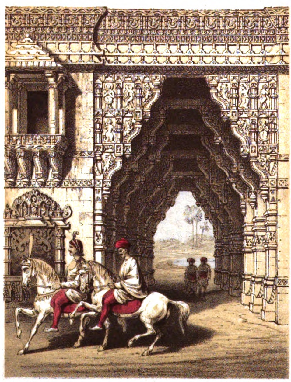
The fort is built with large stone slabs and broad. It is considered as the finest example of Hindu fortification in India along with theDabhoi
Dabhoi is a town and a municipality in the Vadodara district in the state of Gujarat, India.
History
Dabhoi was historically known as Darbhavati, Darbikagrama, Darbhavatipura, and Dabhohi. It is first mentioned in the sixth century astrono ...
fort. The town planning, gateways and decoration of them are according to the Hindu architectural treatises.
There are four gateways in four directions; Madapol Gate, Rakshaspol Gate, Harijan Gate and Dhama Gate. Madapol Gate is fine brackets resting on the pillars and supporting the roof. It is an example of Maru-Gurjara styled gate. The lower niches in the gates houses various Hindu deities while upper niches have well carved balconies.
Others
The town has a Kund (stepwell), sinhsar lake and the Jhileshwar Mahadev temple dated to Chaulukya era.References
External links and Sources
Imperial Gazetteer, on DSAL.UChicago.edu - Kathiawar
{{coord, 23.3500, N, 71.7000, E, source:wikidata, display=title Princely states of Gujarat Cities and towns in Surendranagar district