Isaack Gilsemans on:
[Wikipedia]
[Google]
[Amazon]
 Isaack Gilsemans (ca. 1606, in
"The Merchant of the Zeehaen: Isaac Gilsemans and the Voyages of Abel Tasman" by Grahame Anderson
"Some New Aspects of Tasman's Visit to the East Coast of Tasmania in 1642" by A. L. Meston
1600s births 1646 deaths Dutch Golden Age painters Dutch male painters Painters from Rotterdam Dutch merchants Explorers of Tasmania Maritime history of the Dutch East India Company European exploration of Australia {{Australia-hist-stub
 Isaack Gilsemans (ca. 1606, in
 Rotterdam
Rotterdam ( , , , lit. ''The Dam on the River Rotte'') is the second largest city and municipality in the Netherlands. It is in the province of South Holland, part of the North Sea mouth of the Rhine–Meuse–Scheldt delta, via the ''"N ...
– 1646, in Batavia, Dutch East Indies
Batavia was the capital of the Dutch East Indies. The area corresponds to present-day Jakarta, Indonesia. Batavia can refer to the city proper or its suburbs and hinterland, the Ommelanden, which included the much-larger area of the Residency ...
), was a Dutch merchant and artist.
Biography
Gilsemans is most noted for joining the explorerAbel Tasman
Abel Janszoon Tasman (; 160310 October 1659) was a Dutch seafarer, explorer, and merchant, best known for his voyages of 1642 and 1644 in the service of the Dutch East India Company (VOC). He was the first known European explorer to reach New Z ...
on his expedition in 1642-43 during which Tasmania
)
, nickname =
, image_map = Tasmania in Australia.svg
, map_caption = Location of Tasmania in AustraliaCoordinates:
, subdivision_type = Country
, subdi ...
, New Zealand
New Zealand ( mi, Aotearoa ) is an island country in the southwestern Pacific Ocean. It consists of two main landmasses—the North Island () and the South Island ()—and over 700 smaller islands. It is the sixth-largest island count ...
and several Pacific Islands
Collectively called the Pacific Islands, the islands in the Pacific Ocean are further categorized into three major island groups: Melanesia, Micronesia, and Polynesia. Depending on the context, the term ''Pacific Islands'' may refer to one of se ...
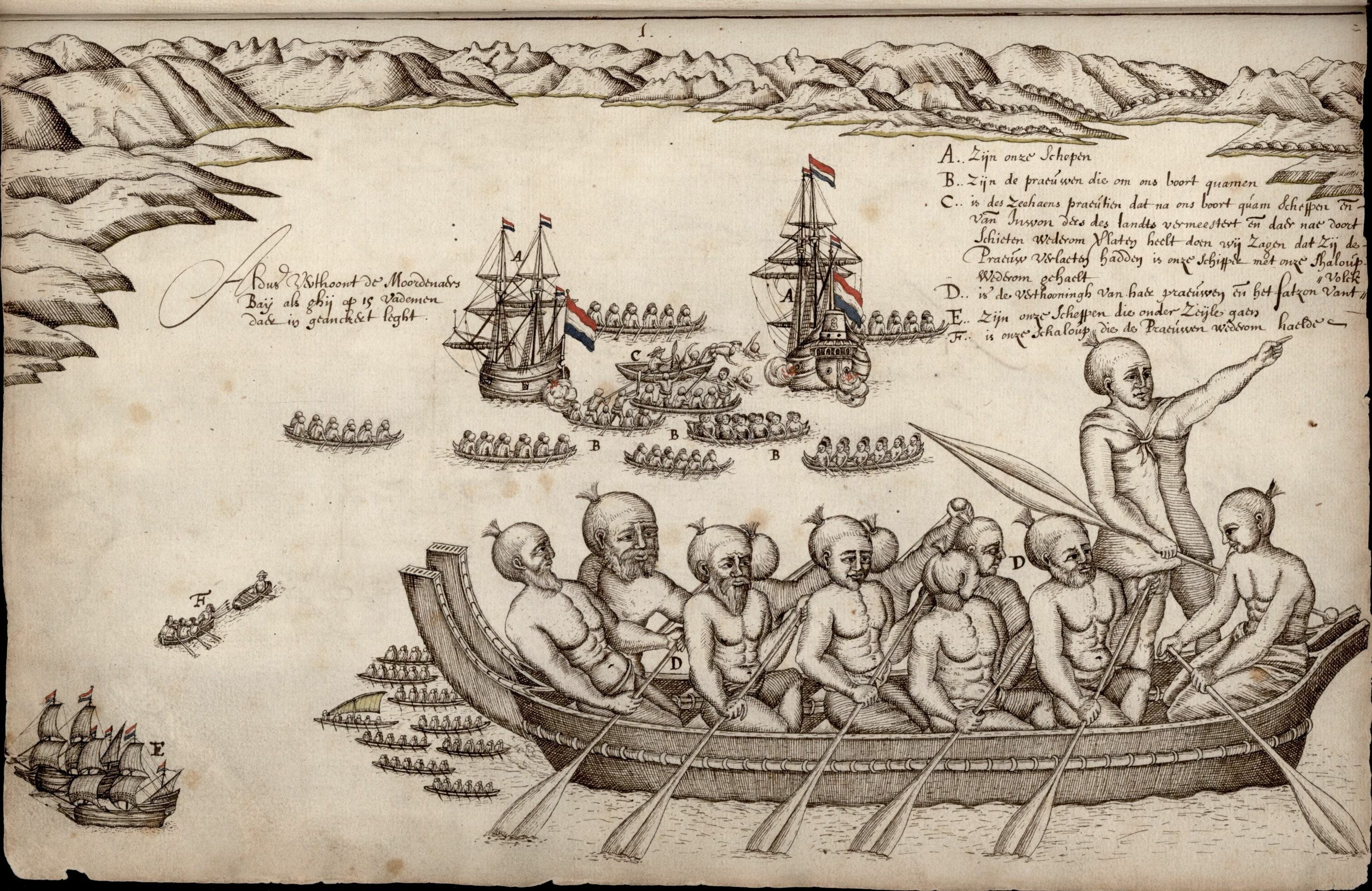
became known to Europeans. Gilsemans produced a number of drawings that documented island and native life. His depictions of the Māori people
The Māori (, ) are the indigenous Polynesian people of mainland New Zealand (). Māori originated with settlers from East Polynesia, who arrived in New Zealand in several waves of canoe voyages between roughly 1320 and 1350. Over several ce ...
were the first for Europeans.
A sketcher and cartographer, he is thought to have been responsible for the coastal profiles in Tasman's journal and therefore the first European to make an image of Van Diemen's Land
Van Diemen's Land was the colonial name of the island of Tasmania used by the British during the European exploration of Australia in the 19th century. A British settlement was established in Van Diemen's Land in 1803 before it became a sepa ...
. Gilsemans' chart is responsible for documenting the first European landing in Tasmania in 1642,https://eprints.utas.edu.au/14423/1/1953_Meston_New_aspects_Tasman's_visit.pdf as a result of which Gilsemans Bay near Dunalley is named after him.
References
External links
"The Merchant of the Zeehaen: Isaac Gilsemans and the Voyages of Abel Tasman" by Grahame Anderson
"Some New Aspects of Tasman's Visit to the East Coast of Tasmania in 1642" by A. L. Meston
1600s births 1646 deaths Dutch Golden Age painters Dutch male painters Painters from Rotterdam Dutch merchants Explorers of Tasmania Maritime history of the Dutch East India Company European exploration of Australia {{Australia-hist-stub