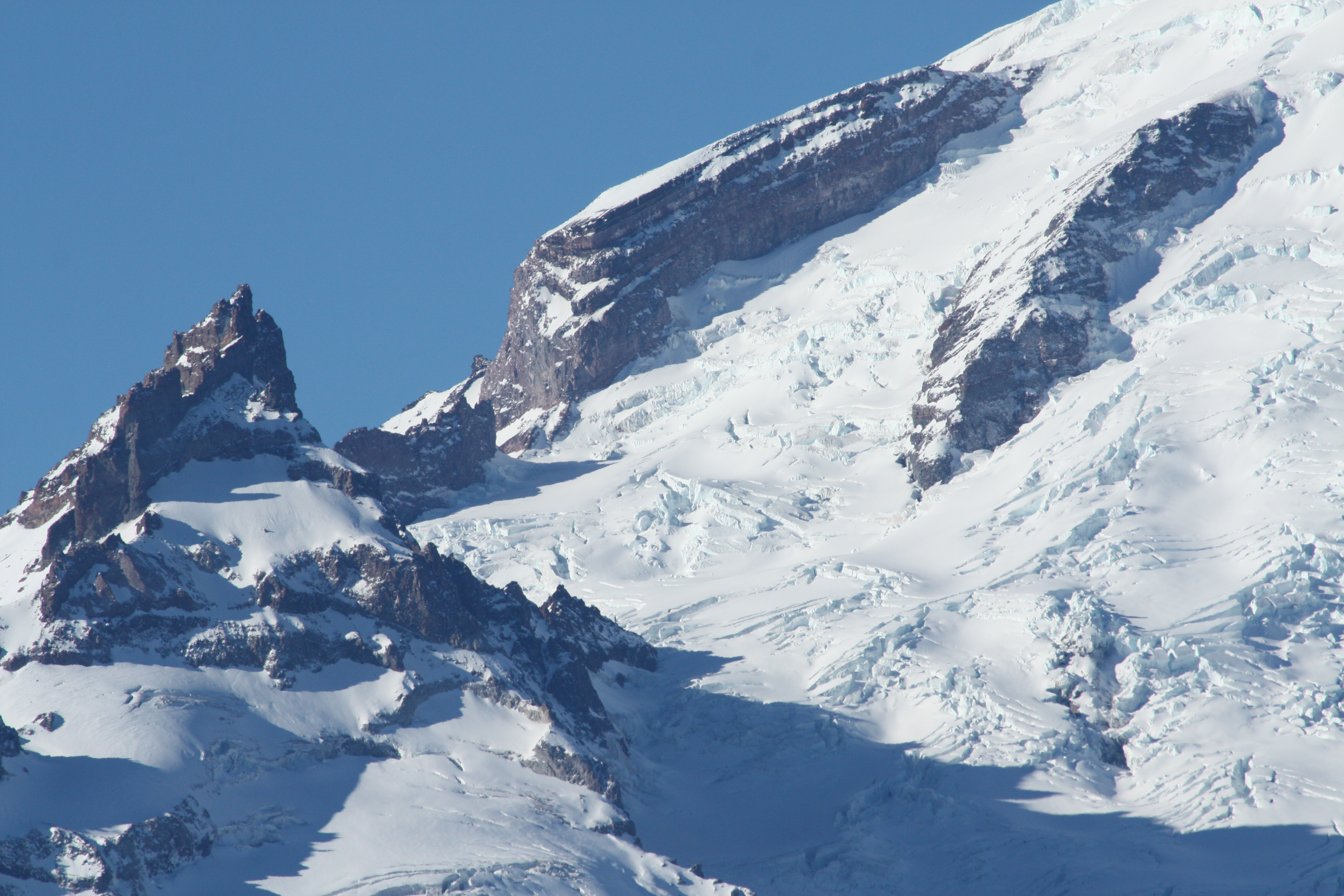
Ingraham Glacier on:
[Wikipedia]
[Google]
[Amazon]
Ingraham Glacier is on the south-eastern flank of

Mount Rainier
Mount Rainier (), indigenously known as Tahoma, Tacoma, Tacobet, or təqʷubəʔ, is a large active stratovolcano in the Cascade Range of the Pacific Northwest, located in Mount Rainier National Park about south-southeast of Seattle. With a s ...
, in the U.S. state
In the United States, a state is a constituent political entity, of which there are 50. Bound together in a political union, each state holds governmental jurisdiction over a separate and defined geographic territory where it shares its sove ...
of Washington
Washington commonly refers to:
* Washington (state), United States
* Washington, D.C., the capital of the United States
** A metonym for the federal government of the United States
** Washington metropolitan area, the metropolitan area centered o ...
. The glacier is named for the Mount Rainier enthusiast Edward Sturgis Ingraham. From the summit ice cap, Ingraham Glacier flows east between Gibraltar Rock, (), and Disappointment Cleaver and south of Little Tahoma Peak
Little Tahoma Peak, also called Little Tahoma, is a satellite peak of Mount Rainier in Pierce County, Washington and in Mount Rainier National Park. It is quite noticeable from Seattle over away.
Little Tahoma Peak is a volcanic remnant. It ...
(), which divides it from the much larger Emmons Glacier
Emmons Glacier is on the northeast flank of Mount Rainier, in Washington. At , it has the largest surface area of any glacier in the contiguous United States. The glacier was named after the geologist Samuel Franklin Emmons after his involvement i ...
to the north. Descending southeast, it approaches the east flank of Cowlitz Glacier and the two glaciers nearly join at . Meltwater from the glacier drains into the Cowlitz River
The Cowlitz River is a river in the state of Washington in the United States, a tributary of the Columbia River. Its tributaries drain a large region including the slopes of Mount Rainier, Mount Adams, and Mount St. Helens.
The Cowlitz has a d ...
.
History
About 35,000 years ago, the Ingraham and Cowlitz glaciers flowed down from Mount Rainier to near present-dayMossyrock, Washington
Mossyrock is a city in Lewis County, Washington, United States. The population was 768 at the 2020 census.
History
The city began as a trading post named Mossy Rock in 1852, after a high moss-covered rock at the east end of Klickitat Prairie ...
. More recently, the Cowlitz - Ingraham glaciers advanced slightly from the mid-1970s to mid-1980s, but have been in a general state of retreat since the end of the Little Ice Age around the year 1850. During the Little Ice Age, the Ingraham and Cowlitz glaciers were combined and terminated at the level but have retreated more than in the last 150 years.
The worst mountaineering accident in American history occurred on June 21, 1981, when eleven people died in an ice fall on the Ingraham Glacier. None of the bodies were ever recovered.
See also
*List of glaciers in the United States
This is a list of glaciers existing in the United States, currently or in recent centuries. These glaciers are located in nine states, all in the Rocky Mountains or farther west. The southernmost named glacier among them is the Lilliput Glacier ...
References
Glaciers of Mount Rainier Glaciers of Washington (state) {{Washington-glacier-stub