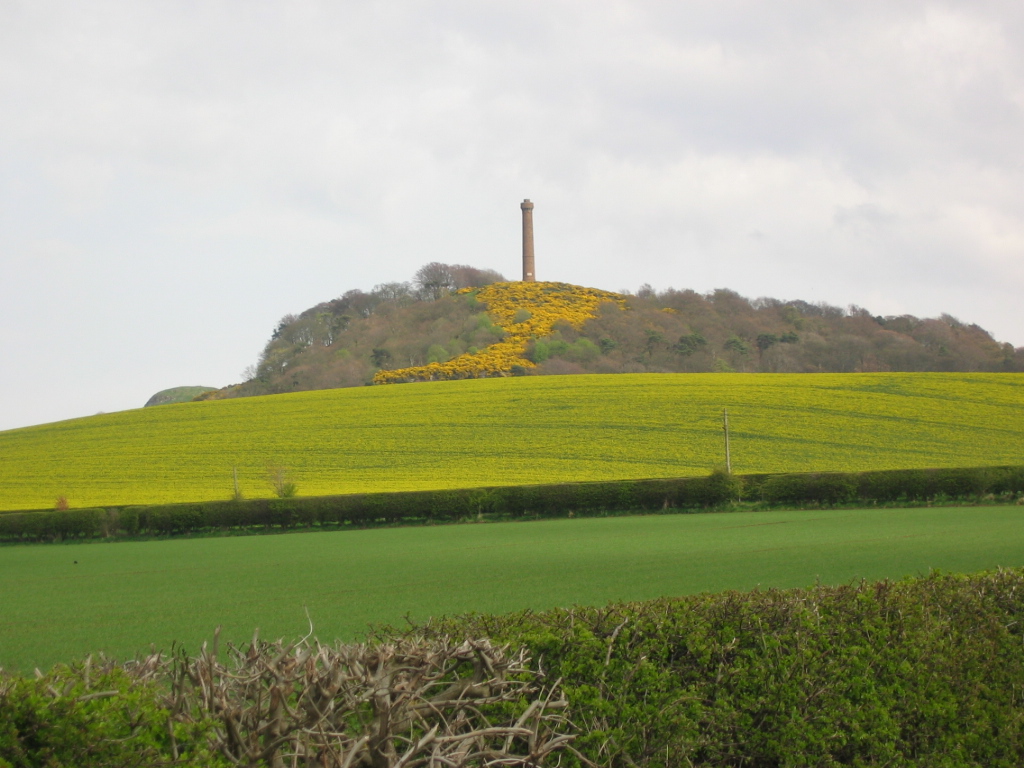
Hopetoun Monument on:
[Wikipedia]
[Google]
[Amazon]
The Hopetoun Monument is a
 The viewing platform at the top is reached by 132 steps of a dark, narrow, spiral staircase, and offers views of the
monument
A monument is a type of structure that was explicitly created to commemorate a person or event, or which has become relevant to a social group as a part of their remembrance of historic times or cultural heritage, due to its artistic, hist ...
in the Garleton Hills
The Garleton Hills, in East Lothian, Scotland, are a range of igneous hills, to the north of Haddington.
Geography
Although Skid Hill, the highest point of the range, is only , the hills are conspicuous throughout the county. The western spu ...
, near Camptoun, East Lothian
East Lothian (; sco, East Lowden; gd, Lodainn an Ear) is one of the 32 council areas of Scotland, as well as a historic county, registration county and lieutenancy area. The county was called Haddingtonshire until 1921.
In 1975, the hi ...
, Scotland
Scotland (, ) is a country that is part of the United Kingdom. Covering the northern third of the island of Great Britain, mainland Scotland has a border with England to the southeast and is otherwise surrounded by the Atlantic Ocean to th ...
. It is tall and is situated on Byres Hill near Haddington.
History
The monument was erected in 1824 in memory ofJohn Hope, 4th Earl of Hopetoun
General John Hope, 4th Earl of Hopetoun, (17 August 1765 – 27 August 1823), known as The Honourable John Hope from 1781 to 1814 and as Lord Niddry from 1814 to 1816, was a Scottish politician and British Army officer.
Military career
Hopetoun ...
(1765–1823). The foundation stone was laid on May 3, 1824. There is an inscription on the monument which states:
The monument is often referred to as the Garleton Monument or the "Galla Monument" by locals, after Garleton Farm on Byres Hill.
Features
 The viewing platform at the top is reached by 132 steps of a dark, narrow, spiral staircase, and offers views of the
 Firth of Forth
The Firth of Forth () is the estuary, or firth, of several Scottish rivers including the River Forth. It meets the North Sea with Fife on the north coast and Lothian on the south.
Name
''Firth'' is a cognate of ''fjord'', a Norse word meanin ...
and the surrounding countryside. The monument is a category B listed building
In the United Kingdom, a listed building or listed structure is one that has been placed on one of the four statutory lists maintained by Historic England in England, Historic Environment Scotland in Scotland, in Wales, and the Northern I ...
. A path runs from a small car park at the base of the hill, winding up steeply through wooded slopes, and a corridor of gorse, before coming out onto the open hilltop. The views can be superb: The Firth of Forth and Fife; Edinburgh and the Pentland Hills to the west; and The Lammermuir Hills to the South. On a clear day, it is even possible to glimpse the Cairngorms far away to the North.
A similar monument to the 4th Earl of Hopetoun stands on Mount Hill near Cupar
Cupar ( ; gd, Cùbar) is a town, former royal burgh and parish in Fife, Scotland. It lies between Dundee and Glenrothes. According to a 2011 population estimate, Cupar had a population around 9,000, making it the ninth-largest settlement in F ...
in Fife
Fife (, ; gd, Fìobha, ; sco, Fife) is a council area, historic county, registration county and lieutenancy area of Scotland. It is situated between the Firth of Tay and the Firth of Forth, with inland boundaries with Perth and Kinross ...
, and was built in 1826.
See also
*List of places in East Lothian
''Map of places in East Lothian compiled from this list''
The List of places in East Lothian is a list for any town, village, hamlet (place), hamlet, castle, golf course, historic house, hill fort, lighthouse, nature reserve, reservoir, river, and ...
* Skid Hill
References
External links
{{commons category-inline, Hopetoun Monument, East Lothian Buildings and structures in East Lothian Monuments and memorials in Scotland Tourist attractions in East Lothian