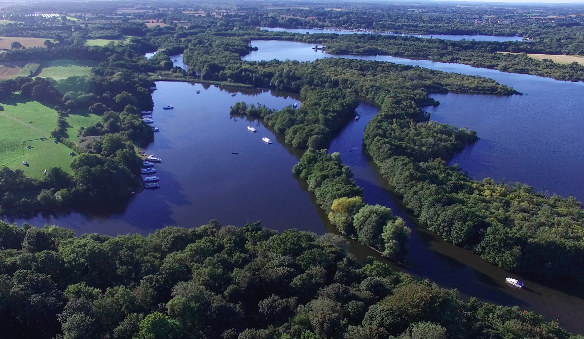
Hoveton Great Broad on:
[Wikipedia]
[Google]
[Amazon]
 Hoveton Great Broad lies within
 Hoveton Great Broad lies within
 The Broads
The Broads (known for marketing purposes as The Broads National Park) is a network of mostly navigable rivers and lakes in the English counties of Norfolk and Suffolk. Although the terms "Norfolk Broads" and "Suffolk Broads" are correctly use ...
in Norfolk
Norfolk () is a ceremonial and non-metropolitan county in East Anglia in England. It borders Lincolnshire to the north-west, Cambridgeshire to the west and south-west, and Suffolk to the south. Its northern and eastern boundaries are the No ...
, England, between Wroxham Broad
Wroxham Broad is an area of open water alongside the River Bure near the village of Wroxham in Norfolk, England within The Broads National Park. The Norfolk Broads were formed by the flooding of ancient peat workings. Wroxham Broad has an area ...
and Salhouse Broad
Salhouse Broad, one of the Norfolk Broads, is situated on the River Bure in The Broads in Norfolk, England
Norfolk () is a ceremonial and non-metropolitan county in East Anglia in England. It borders Lincolnshire to the north-west, Cambridge ...
.
The broad is connected to the River Bure
The River Bure is a river in the county of Norfolk, England, most of it in the Broads.Ordnance Survey (2005). ''OS Explorer Map OL40 - The Broads''. . The Bure rises near Melton Constable, upstream of Aylsham, which was the original head of ...
, but not open to boat traffic. Hoveton Great Broad is part of an ancient navigation that has been deliberately allowed to become closed off to any public access since well before the last War. Recent changes in the official Ordnance Survey tide line mean that it is now tidal water and therefore closed illegally. A nature trail was laid out in 1968 - the first in the region. It is accessible only by boat. Mooring is allowed on the north bank of the Bure, opposite Salhouse Broad
Salhouse Broad, one of the Norfolk Broads, is situated on the River Bure in The Broads in Norfolk, England
Norfolk () is a ceremonial and non-metropolitan county in East Anglia in England. It borders Lincolnshire to the north-west, Cambridge ...
.
Natural England
Natural England is a non-departmental public body in the United Kingdom sponsored by the Department for Environment, Food and Rural Affairs. It is responsible for ensuring that England's natural environment, including its land, flora and fauna, ...
has established a Nature trail
An educational trail (or sometimes educational path), nature trail or nature walk is a specially developed hiking trail or footpath that runs through the countryside, along which there are marked stations or stops next to points of natural, techn ...
. From the boardwalk, one can see the broad with its adjoining fen
A fen is a type of peat-accumulating wetland fed by mineral-rich Groundwater, ground or surface water. It is one of the main types of wetlands along with marshes, swamps, and bogs. Bogs and fens, both peat-forming ecosystems, are also known as ...
s and alder
Alders are trees comprising the genus ''Alnus'' in the birch family Betulaceae. The genus comprises about 35 species of monoecious trees and shrubs, a few reaching a large size, distributed throughout the north temperate zone with a few sp ...
carr.
Norfolk Broads
{{Norfolk-geo-stub