High marsh on:
[Wikipedia]
[Google]
[Amazon]


 High marsh is a
https://www.fws.gov/wetlands/documents/Wetlands-Losses-in-the-United-States-1780s-to-1980s.pdf
Thomas Dahl reports in ''Wetlands'' that from 1780 to 1980 there was a “53-percent loss from the original etlandacreage total." Further, United States wetlands experienced a net loss of approximately 60,000 acres per year spanning from 1998 to 2004. This increased to 80,000 acres per year between 2004 and 2009.
https://fws.gov/northeast/saltmarsh-sparrow/PDF/20200821-Current-Conditions-Report_SALS-Final.pdf This high marsh loss is evident throughout the United States.
Overall, the high marsh is particularly vulnerable to the impacts of climate change and anthropogenic actions, as follows.


 High marsh is a
 tidal marsh
A tidal marsh (also known as a type of "tidal wetland") is a marsh found along rivers, coasts and estuaries which floods and drains by the tidal movement of the adjacent estuary, sea or ocean. Tidal marshes are commonly zoned into lower marshes ( ...
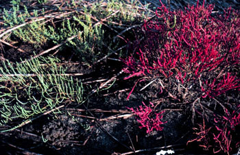
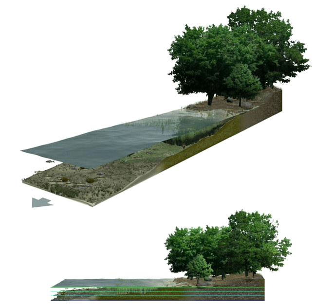
zone located above the Mean Highwater Mark (MHW) which, in contrast to the low marsh zone, is inundated infrequently during periods of extreme high tide and storm surge associated with coastal storms. This zone is impacted by spring tides, which is a bi-monthly lunar occurrence where the high marsh experiences higher inundation levels. The high marsh is the intermittent zone between the low marsh and the uplands, an entirely terrestrial area rarely flooded during events of extreme tidal action caused by severe coastal storms. The high marsh is distinguished from the low marsh by its sandy soil and higher elevation. The elevation of the high marsh allows this zone to be covered by the high tide for no more than an hour a day. With the soil exposed to air for long periods of time, evaporation occurs, leading to high salinity levels, up to four times that of sea water. Areas of extremely high salinity prohibit plant growth altogether. These barren sandy areas are known as "salt pans". Some cordgrass
''Spartina'' is a taxon of plants in the grass family, frequently found in coastal salt marshes. Its species are commonly known as cordgrass or cord-grass, and are native to the coasts of the Atlantic Ocean in western and southern Europe, north ...
plants do survive here, but are stunted and do not reach their full size.
The high marsh depends on regular tidal activity and inundation to deposit sediments. Sediment deposition facilitates mineral and organic matter buildup and sediment accretion. The minerals and organic matter promote vegetation growth and the sediment accretion promotes heightened elevation growth.Tiner, R.W. 2013. Tidal wetlands primer: an introduction to their ecology, natural history, status, and conservation. University of Massachusetts Press, Amherst and Boston. 508 pp.
The high marsh is also important to many habitat specialists such as the Saltmarsh Sparrow, Black Rail, American Black Duck
The American black duck (''Anas rubripes'') is a large dabbling duck in the family Anatidae. It was described by William Brewster in 1902. It is the heaviest species in the genus ''Anas'', weighing on average and measuring in length with an ...
, saltmarsh spike-grass, and salt-hay. These specialists rely on the high marsh ecosystem to provide for their biological needs to ensure stable productivity and abundance. Among these biological needs are foraging, mating, nesting, incubation, and brooding.
The Clean Water Act of 1972
The Clean Water Act (CWA) is the primary federal law in the United States governing water pollution. Its objective is to restore and maintain the chemical, physical, and biological integrity of the nation's waters; recognizing the responsibiliti ...
was the first act to protect these ecosystems but, due to the absence of protection, many wetlands were converted into farmland and residential land.
Marsh Prevalence Worldwide
Saltmarshes are found in at least 99 countries, as mapped by scientists Mcowen et al. in 2017.Mcowen, Chris; Weatherdon, Lauren; Bochove, Jan-Willem; Sullivan, Emma; Blyth, Simon; Zockler, Christoph; Stanwell-Smith, Damon; Kingston, Naomi; Martin, Corinne (21 March 2017). "A global map of saltmarshes". ''Biodiversity Data Journal''. 5 (5): e11764. doi:10.3897/bdj.5.e11764.ISSN
An International Standard Serial Number (ISSN) is an eight-digit serial number used to uniquely identify a serial publication, such as a magazine. The ISSN is especially helpful in distinguishing between serials with the same title. ISSNs ...
1314-2828. PMC5515097. PMID
PubMed is a free search engine accessing primarily the MEDLINE database of references and abstracts on life sciences and biomedical topics. The United States National Library of Medicine (NLM) at the National Institutes of Health maintain the ...
28765720. Similarly, in 43 countries/territories there are 5,495,089 mapped hectares of saltmarsh. The coterminous United States has many estimates for original wetland content, spanning from 211 to 217 million acres total.Dahl, Thomas E. (1990). "Wetlands Loss Since the Revolution" (PDF). ''National Wetlands Newsletter''. Alaska has the highest amount of wetlands, with an estimated 165 million acres originally. The U.S. Department of Interior
The United States Department of the Interior (DOI) is one of the executive departments of the U.S. federal government headquartered at the Main Interior Building, located at 1849 C Street NW in Washington, D.C. It is responsible for the man ...
and the U.S. Fish and Wildlife Service
The United States Fish and Wildlife Service (USFWS or FWS) is an agency within the United States Department of the Interior dedicated to the management of fish, wildlife, and natural habitats. The mission of the agency is "working with othe ...
estimate that colonial united states had approximately 392 million acres, with 221 million in the 48 states, 170 million acres in Alaska, and 59,000 acres in Hawaii.Dahl, T.E. 1990.Wetland losses in the United States 1780's to 1980’s. U.S. Department of the Interior, Fish and Wildlife Service. Washington. D.C. 13pp. High Marsh Loss Cause
The high marsh is one of the most threatened features of wetlands. On average, the United States' coastal areas support high per capita communities. Due to this, these areas face the pressure of development andoverdevelopment
In international economics, overdevelopment refers to a way of seeing global inequality and pollution that focuses on the negative consequences of excessive consumption. It exists as the mutually constitutive counterpart to the more commonly known ...
.
The United States Fish and Wildlife Service
The United States Fish and Wildlife Service (USFWS or FWS) is an agency within the United States Department of the Interior dedicated to the management of fish, wildlife, and natural habitats. The mission of the agency is "working with othe ...
(FWS) summarizes data from the Cape Cod National Seashore
The Cape Cod National Seashore (CCNS), created on August 7, 1961, by President John F. Kennedy, encompasses on Cape Cod, in Massachusetts. It includes ponds, woods and beachfront of the Atlantic coastal pine barrens ecoregion. The CCNS includ ...
(CCNS) and states that “there has been a documented shift in the high marsh to low marsh boundary by 100 m (328 ft) upslope between 1984 and 2000 in the ‘Gut’ at Wellfleet, and a loss of 46 percent of the high marsh between 1947 and 2005."U.S. Fish and Wildlife Service. 2020. Report on the current conditions for the saltmarsh sparrow. U.S. Fish and Wildlife Service, Northeast Region, Charlestown, RI. 106 pp. Nutrient Overload and Contamination
This coastal development near marshes may increase thenitrogen
Nitrogen is the chemical element with the symbol N and atomic number 7. Nitrogen is a nonmetal and the lightest member of group 15 of the periodic table, often called the pnictogens. It is a common element in the universe, estimated at se ...
and phosphorus
Phosphorus is a chemical element with the symbol P and atomic number 15. Elemental phosphorus exists in two major forms, white phosphorus and red phosphorus, but because it is highly reactive, phosphorus is never found as a free element on Ear ...
concentration leached into waterways, particularly from sewage treatment and systems. Further, due to farmlands, lawns, and golf courses, nitrogen concentrations may also be increased. When the high marsh plants are exposed to a higher concentration of nitrogen and phosphorus, the underground biomass decreases and the aboveground increases, making the ecosystem susceptible to widening and erosion
Erosion is the action of surface processes (such as water flow or wind) that removes soil, rock, or dissolved material from one location on the Earth's crust, and then transports it to another location where it is deposited. Erosion is dis ...
. These higher nutrient concentrations may also lead to eutrophication
Eutrophication is the process by which an entire body of water, or parts of it, becomes progressively enriched with minerals and nutrients, particularly nitrogen and phosphorus. It has also been defined as "nutrient-induced increase in phytopla ...
and fish kills
The term fish kill, known also as fish die-off, refers to a localized die-off of fish populations which may also be associated with more generalized mortality of aquatic life.University of Florida. Gainesville, FL (2005) ''Plant Management in Fl ...
.Deegan, L.A., J.L. Bowen, D. Drake, J.W. Fleeger, C.T. Friedrichs, K.A. Galvan, J.E. Hobbie, C. Hopkinson, D.S. Johnson, J.M. Johnson, L.E. LeMay, E. Miller, B.J. Peterson, C. Picard, S. Sheldon, M. Sutherland, J. Vallino and R.S. Warren. 2007. Susceptibility of salt marshes to nutrient enrichment and predator removal. Ecological Applications 17(5) Supplement: Nutrient Enrichment and Estuarine Eutrophication S42–S63.
Infrastructure
Certain tidal restricting infrastructure—such as roadways,dikes
Dyke (UK) or dike (US) may refer to:
General uses
* Dyke (slang), a slang word meaning "lesbian"
* Dike (geology), a subvertical sheet-like intrusion of magma or sediment
* Dike (mythology), ''Dikē'', the Greek goddess of moral justice
* Dikes ...
, and floodgates
Floodgates, also called stop gates, are adjustable gates used to control water flow in flood barriers, reservoir, river, stream, or levee systems. They may be designed to set spillway crest heights in dams, to adjust flow rates in sluices and ...
—disrupt the natural tidal flow. These restrictions prevent the sediment accretion and nutrient deposition that the high marsh relies on for elevation growth and vegetation health.
References
See also
* Salt Pannes and Pools *LowMarsh
A marsh is a wetland that is dominated by herbaceous rather than woody plant species.Keddy, P.A. 2010. Wetland Ecology: Principles and Conservation (2nd edition). Cambridge University Press, Cambridge, UK. 497 p Marshes can often be found a ...
{{Wetlands
Salt marshes
Coastal geography