Gyles' Quay on:
[Wikipedia]
[Google]
[Amazon]
 Gyles' Quay is an isolated stretch of
 Gyles' Quay is an isolated stretch of
 beach
A beach is a landform alongside a body of water which consists of loose particles. The particles composing a beach are typically made from rock, such as sand, gravel, shingle, pebbles, etc., or biological sources, such as mollusc sh ...
located 1 km south of the R173/ R175 road on the Cooley Peninsula
The Cooley Peninsula (, older ''Cúalṅge'') is a hilly peninsula in the north of County Louth on the east coast of Ireland; the peninsula includes the small town of Carlingford, the port of Greenore and the village of Omeath.
Geography
The ...
in the north of County Louth in Ireland
Ireland ( ; ga, Éire ; Ulster Scots dialect, Ulster-Scots: ) is an island in the Atlantic Ocean, North Atlantic Ocean, in Northwestern Europe, north-western Europe. It is separated from Great Britain to its east by the North Channel (Grea ...
. It was named after Ross Gyles who built a wood structure there in 1780. It was later rebuilt in stone in 1824 and survives to this day.
The long isolated beach with accessible hinterland made it very attractive to smugglers who used the beach for importing wine and tobacco. In 1823 the authorities constructed a coastguard watch station to limit the illegal imports. Today tourists are drawn to the area for the long beach expanse and the caravan park located overlooking the area.
Transport
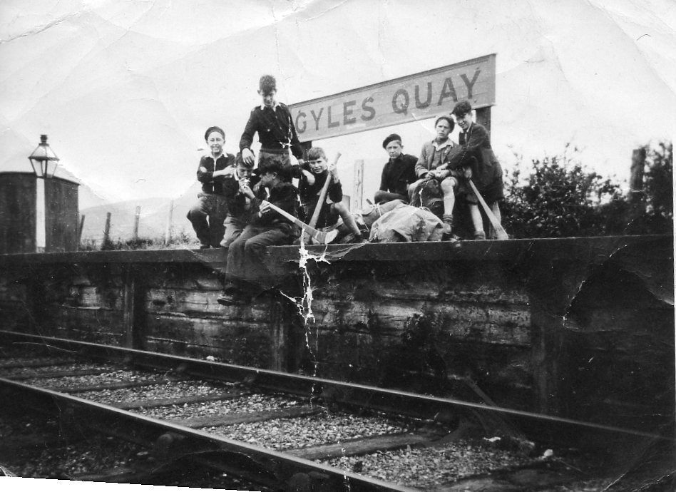
Gyles Quay Halt railway station opened on 7 July 1935 and finally closed on 1 January 1952.References
Beaches of County Louth 1780 establishments in Ireland Tourist attractions in County Louth Wharves {{louth-geo-stub