Guinea Highlands on:
[Wikipedia]
[Google]
[Amazon]
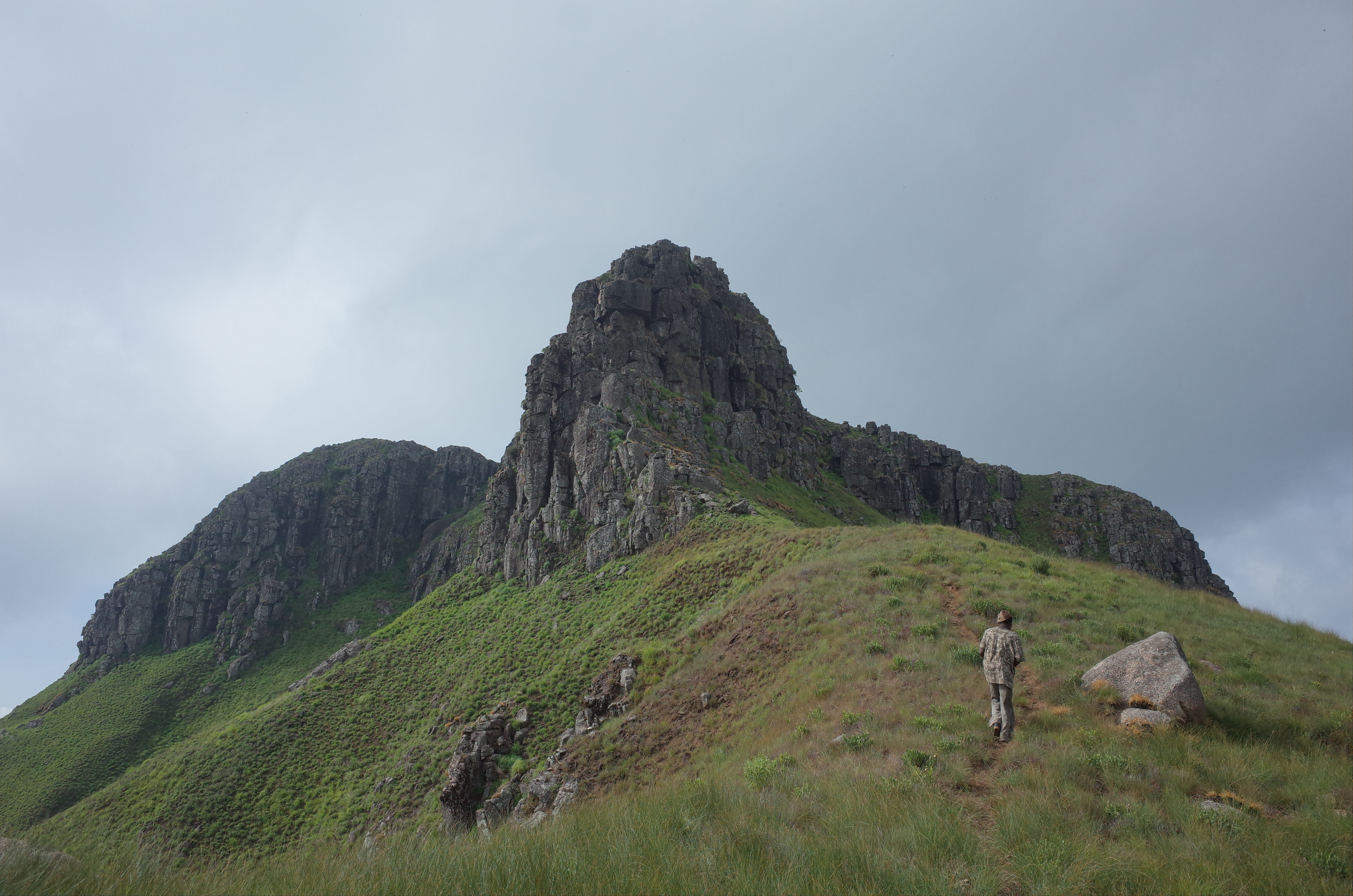
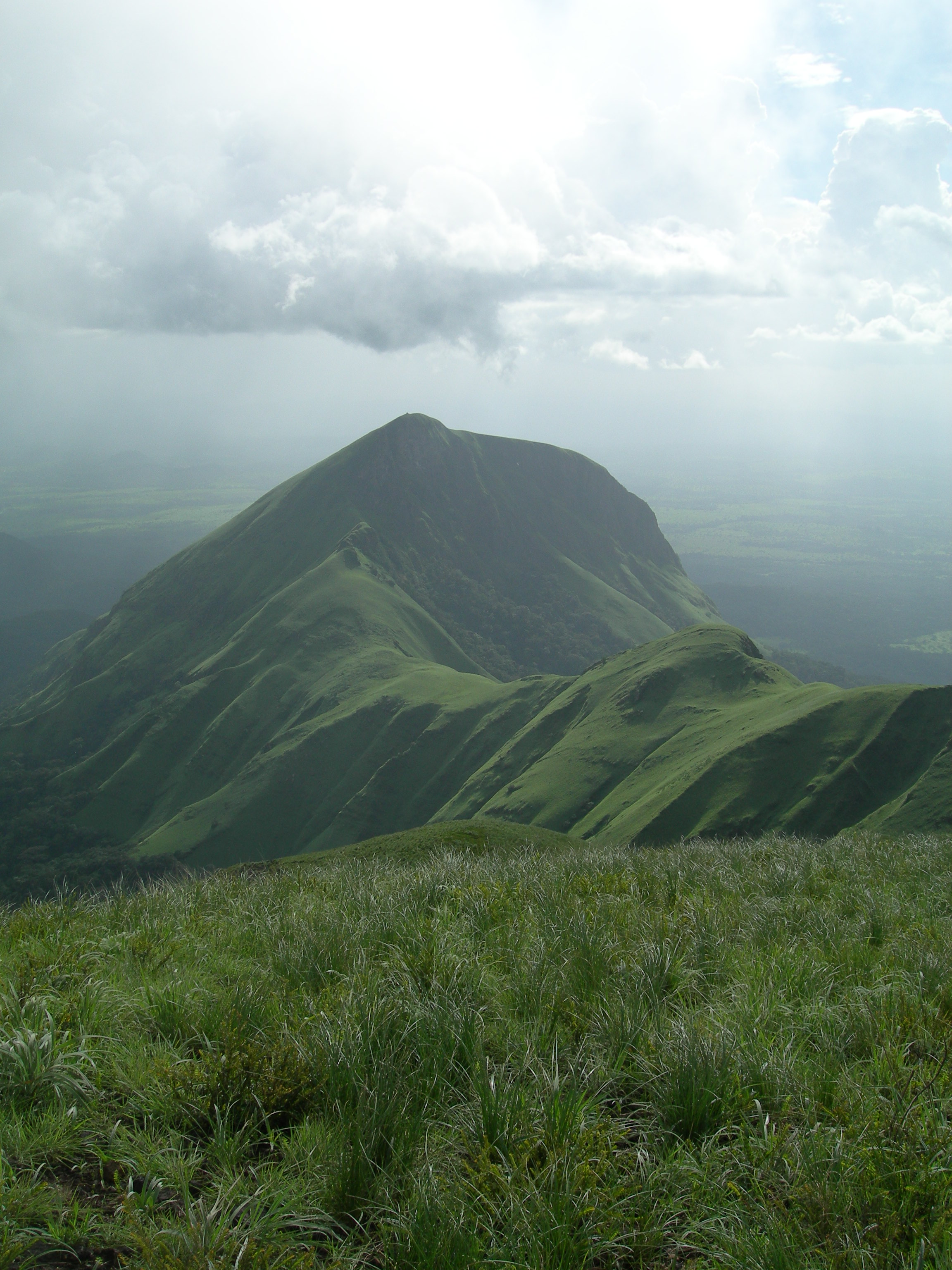
The Guinea Highlands is a densely forested mountainous plateau extending from central Guinea through northern
 In Guinea they are known as ''Dorsale Guinéenne''. The highest peak in the region is Mount Bintumani in Sierra Leone, at 1,945 metres (6,381 ft). Other peaks include Sankan Biriwa () in Sierra Leone and
 Geologically the composition of the sediments in the highlands are the same as in
 The Guinea Highlands form the transition between the
Encyclopædia Britannica
Retrieved on June 18, 2008 The region is mainly inhabited by the Guerze ( Kpelle) and Mano (Manon) peoples.

 * Mount Bintumani (Loma Mansa), Sierra Leone, 1945 meters (6381 feet)
* Sankan Biriwa, Sierra Leone, 1,850 metres (6,070 ft)
*
Sierra Leone
Sierra Leone,)]. officially the Republic of Sierra Leone, is a country on the southwest coast of West Africa. It is bordered by Liberia to the southeast and Guinea surrounds the northern half of the nation. Covering a total area of , Sierr ...
and Liberia to western Ivory Coast. The highlands include a number of mountains, ranges and plateaus, including the Fouta Djallon
Fouta Djallon ( ff, 𞤊𞤵𞥅𞤼𞤢 𞤔𞤢𞤤𞤮𞥅, Fuuta Jaloo; ar, فوتا جالون) is a highland region in the center of Guinea, roughly corresponding with Middle Guinea, in West Africa.
Etymology
The Fulani people call the ...
highlands in central Guinea, the Loma Mountains in Sierra Leone, the Simandou and Kourandou massifs in southeastern Guinea, the Nimba Range at the border of Guinea, Liberia, and Ivory Coast, and the Monts du Toura The Monts du Toura, also known as the Toura Mountains, are a range of mountains rising to 1300 metres in elevation, extending westward across Côte d’Ivoire from the Sassandra River to the border with Liberia and Guinea. Mont Nimba, at the weste ...
in western Ivory Coast.
Geography
 In Guinea they are known as ''Dorsale Guinéenne''. The highest peak in the region is Mount Bintumani in Sierra Leone, at 1,945 metres (6,381 ft). Other peaks include Sankan Biriwa () in Sierra Leone and
 Mount Richard-Molard
Mount Richard-Molard, also known as Mount Nimba, is a mountain along the border of Ivory Coast and Guinea in West Africa. The highest peak for both countries and the Nimba Range is at . The mountain is a part of the Guinea Highlands, which straddl ...
(Mount Nimba) () on the border of Guinea and Ivory Coast. The highlands mostly lie between above sea level.
The Guinea Highlands are the source of many of West Africa's rivers, including the Niger River
The Niger River ( ; ) is the main river of West Africa, extending about . Its drainage basin is in area. Its source is in the Guinea Highlands in south-eastern Guinea near the Sierra Leone border. It runs in a crescent shape through ...
, West Africa's longest river, the Senegal
Senegal,; Wolof: ''Senegaal''; Pulaar: 𞤅𞤫𞤲𞤫𞤺𞤢𞥄𞤤𞤭 (Senegaali); Arabic: السنغال ''As-Sinighal'') officially the Republic of Senegal,; Wolof: ''Réewum Senegaal''; Pulaar : 𞤈𞤫𞤲𞤣𞤢𞥄𞤲𞤣𞤭 ...
and Gambia rivers, and the rivers of Sierra Leone
Sierra Leone,)]. officially the Republic of Sierra Leone, is a country on the southwest coast of West Africa. It is bordered by Liberia to the southeast and Guinea surrounds the northern half of the nation. Covering a total area of , Sierr ...
, Liberia, Maritime Guinea
Maritime Guinea (), also known as Lower Guinea, is one of the four natural regions of Guinea. It is located in the west of the country, between the Atlantic Ocean and the Fouta Djallon plateau. Conakry, Guinea's capital and largest city, is located ...
, and western Ivory Coast.
Geology
 Geologically the composition of the sediments in the highlands are the same as in
 Upper Guinea Upper Guinea is a geographical term used in several contexts:
# Upper Guinea (french: Haute-Guinée) is one of the four geographic regions of the Republic of Guinea, being east of Futa Jalon, north of Forest Guinea, and bordering Mali. The popula ...
and include granite
Granite () is a coarse-grained ( phaneritic) intrusive igneous rock composed mostly of quartz, alkali feldspar, and plagioclase. It forms from magma with a high content of silica and alkali metal oxides that slowly cools and solidifies under ...
s, schist
Schist ( ) is a medium-grained metamorphic rock showing pronounced schistosity. This means that the rock is composed of mineral grains easily seen with a low-power hand lens, oriented in such a way that the rock is easily split into thin flakes ...
s, and quartzite
Quartzite is a hard, non- foliated metamorphic rock which was originally pure quartz sandstone.Essentials of Geology, 3rd Edition, Stephen Marshak, p 182 Sandstone is converted into quartzite through heating and pressure usually related to tec ...
s.
Ecology
 The Guinea Highlands form the transition between the
 Western Guinean lowland forests
The Western Guinean lowland forests ecoregion (WWF #AT0130) is a tropical moist broadleaf forest ecoregion of West Africa. It is centered on Liberia, with portions in surrounding countries. It is the westernmost tropical rainforest in Africa, an ...
, moist tropical rainforests that lie to the south between the Guinea Highlands and the Atlantic Ocean, and the Guinean forest-savanna mosaic
Guinea ( ),, fuf, 𞤘𞤭𞤲𞤫, italic=no, Gine, wo, Gine, nqo, ߖߌ߬ߣߍ߫, bm, Gine officially the Republic of Guinea (french: République de Guinée), is a coastal country in West Africa. It borders the Atlantic Ocean to the we ...
to the north.
The Guinean montane forests
The Guinean montane forests are a tropical moist broadleaf forest ecoregion of West Africa.
The ecoregion occupies the portions of the Guinea Highlands lying above 600 meters elevation, extending across portions of Guinea, Sierra Leone, Lib ...
ecoregion covers the portion of the highlands above 600 meters elevation. It includes montane forests, grasslands, and savannas, with a distinct flora and fauna from the surrounding lowlands.
People
Yomou is the chief market town for the densely forested region of the Guinea Highlands. Main commodities sold in the town includerice
Rice is the seed of the grass species '' Oryza sativa'' (Asian rice) or less commonly ''Oryza glaberrima'' (African rice). The name wild rice is usually used for species of the genera '' Zizania'' and '' Porteresia'', both wild and domesticat ...
, cassava
''Manihot esculenta'', commonly called cassava (), manioc, or yuca (among numerous regional names), is a woody shrub of the spurge family, Euphorbiaceae, native to South America. Although a perennial plant, cassava is extensively cultivated ...
, coffee
Coffee is a drink prepared from roasted coffee beans. Darkly colored, bitter, and slightly acidic, coffee has a stimulating effect on humans, primarily due to its caffeine content. It is the most popular hot drink in the world.
Seeds of ...
, palm oil and kernels
Kernel may refer to:
Computing
* Kernel (operating system), the central component of most operating systems
* Kernel (image processing), a matrix used for image convolution
* Compute kernel, in GPGPU programming
* Kernel method, in machine learnin ...
.Retrieved on June 18, 2008 The region is mainly inhabited by the Guerze ( Kpelle) and Mano (Manon) peoples.
Peaks

 * Mount Bintumani (Loma Mansa), Sierra Leone, 1945 meters (6381 feet)
* Sankan Biriwa, Sierra Leone, 1,850 metres (6,070 ft)
*
 Mount Richard-Molard
Mount Richard-Molard, also known as Mount Nimba, is a mountain along the border of Ivory Coast and Guinea in West Africa. The highest peak for both countries and the Nimba Range is at . The mountain is a part of the Guinea Highlands, which straddl ...
, also known as Mount Nimba, Ivory Coast and Guinea, 1752 meters (5748 feet)
* Grand Rochers, Guinea, 1694 meters (5558 feet)
* Mont Sempéré, Guinea, 1682 meters (5518 feet)
* Mont Tô, Guinea, 1675 meters (5495 feet)
* Mont Piérré Richaud, Guinea, 1670 meters (5479 feet)
* Pic de Fon, Guinea, 1658 meters (5440 feet)
* Mont LeClerc, Guinea, 1577 meters (5174 feet)
* Pic de Tibé, Guinea, 1504 meters (4934 feet)
* Mount Wuteve
Mount Wuteve is a mountain located in Liberia, whose summit is the highest point in Liberia. It is located in the Guinea Highlands range, whose parent range is the West Africa Mountains. Data from the Shuttle Radar Topography Mission
T ...
, Liberia, 1420 meters (4659 feet)
* Pic de Tétini, Guinea 1257 meters
* Kourandou Massif, Guinea, 1236 meters
* Béro Massif, Guinea, 1210 meters
References
{{WikidataCoord, display=t Mountains of Guinea Mountains of Liberia Mountains of Sierra Leone Mountains of Ivory Coast Highlands