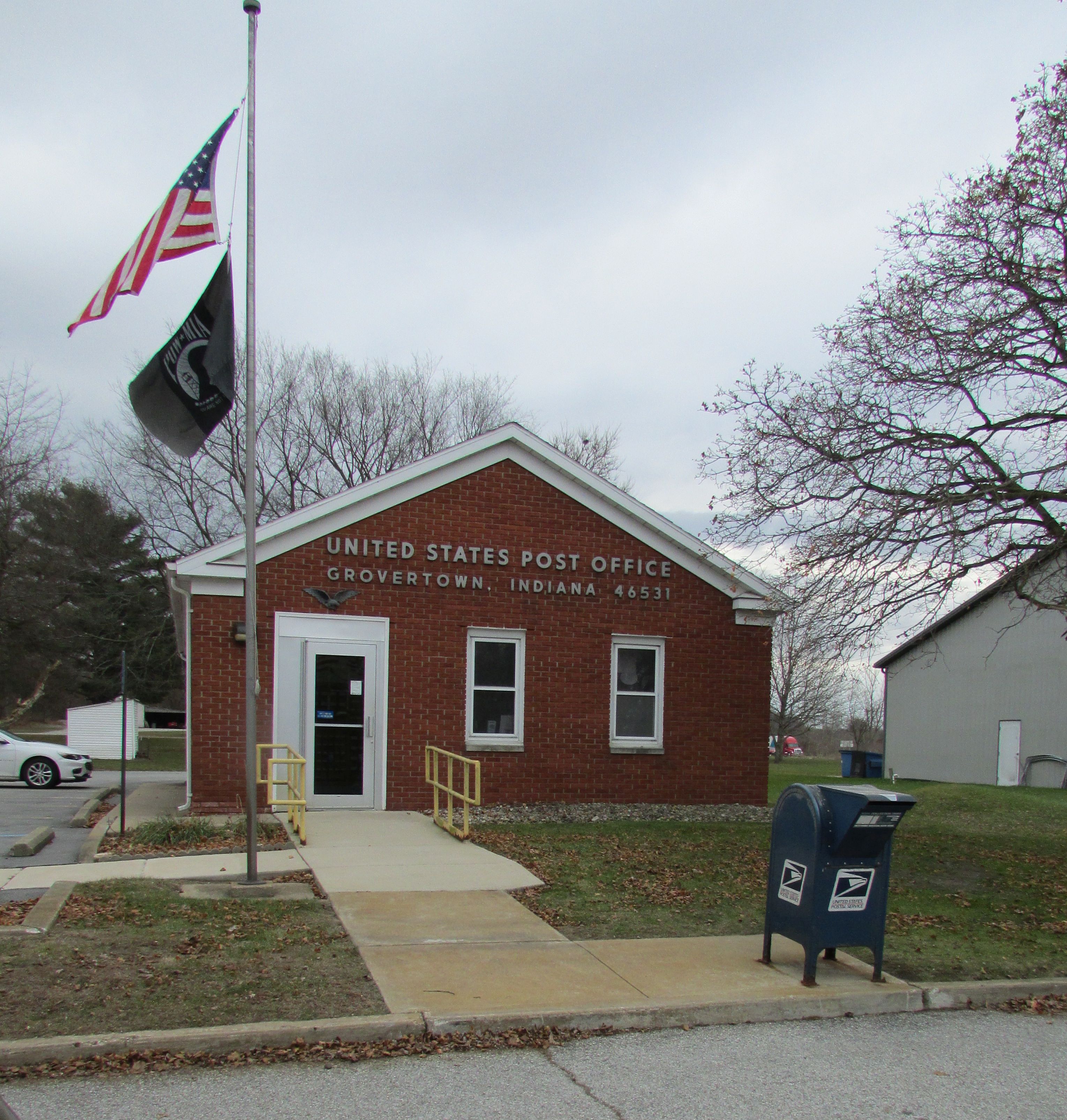
Grovertown, Indiana on:
[Wikipedia]
[Google]
[Amazon]
 Grovertown (also Grover Town or Grovestown) is an
Geographic Names Information System Feature Detail Report
 Grovertown (also Grover Town or Grovestown) is an
 unincorporated community
An unincorporated area is a region that is not governed by a local municipal corporation. Widespread unincorporated communities and areas are a distinguishing feature of the United States and Canada. Most other countries of the world either have ...
in southeastern Oregon Township, Starke County, in the U.S. state
In the United States, a state is a constituent political entity, of which there are 50. Bound together in a political union, each state holds governmental jurisdiction over a separate and defined geographic territory where it shares its sover ...
of Indiana
Indiana () is a U.S. state in the Midwestern United States. It is the 38th-largest by area and the 17th-most populous of the 50 States. Its capital and largest city is Indianapolis. Indiana was admitted to the United States as the 19th s ...
.
History
Although Grovertown is unincorporated, it has apost office
A post office is a public facility and a retailer that provides mail services, such as accepting letters and parcels, providing post office boxes, and selling postage stamps, packaging, and stationery. Post offices may offer additional serv ...
, with the ZIP code of 46531. The post office has been in operation since 1859. Grovertown was laid out in the year 1858. The Pittsburg, Ft. Wayne & Chicago Railroad runs through the village, which contains some two hundred inhabitants.
Geography
Grovertown lies along State Road 23 northeast of the city of Knox, thecounty seat
A county seat is an administrative center, seat of government, or capital city of a county or civil parish. The term is in use in Canada, China, Hungary, Romania, Taiwan, and the United States. The equivalent term shire town is used in the US st ...
of Starke County. Its elevation is 725 feet (221 m), and it is located at (41.3750434, -86.5047339).Geographic Names Information System
The Geographic Names Information System (GNIS) is a database of name and locative information about more than two million physical and cultural features throughout the United States and its territories, Antarctica, and the associated states of ...
, 1979-02-14. Accessed 2008-06-01.
References
Unincorporated communities in Starke County, Indiana Unincorporated communities in Indiana {{StarkeCountyIN-geo-stub