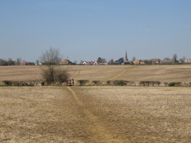
Grafton Way (footpath) on:
[Wikipedia]
[Google]
[Amazon]
 The Grafton Way is a (also measured at ) footpath in
 The Grafton Way is a (also measured at ) footpath in
 Northamptonshire
Northamptonshire (; abbreviated Northants.) is a county in the East Midlands of England. In 2015, it had a population of 723,000. The county is administered by
two unitary authorities: North Northamptonshire and West Northamptonshire. It is ...
, England. It runs south east from Greens Norton
Greens Norton is a village and civil parish in West Northamptonshire, England, just over north-west of Towcester. At the 2011 census the parish, including Caswell and Duncote, had a population of 1,526, a slight decrease since the 2001 census ...
to Cosgrove (or Wolverton
Wolverton is a constituent town of Milton Keynes, England. It is located at the northern edge of Milton Keynes, beside the West Coast Main Line, the Grand Union Canal and the river Great Ouse. It is the administrative seat of Wolverton and Gre ...
), where it meets the Knightley Way. It is named after the Dukes of Grafton
Duke of Grafton is a title in the Peerage of England. It was created in 1675 by Charles II of England for Henry FitzRoy, his second illegitimate son by the Duchess of Cleveland. The most notable duke of Grafton was Augustus FitzRoy, 3rd Duke ...
, major land-owners in the area in the 18th and 19th centuries.
It is recognised by the Long Distance Walkers Association
The Long Distance Walkers Association (LDWA) is a British not for profit, volunteer-led association whose aim is "to further the common interests of those who enjoy long distance walking". The LDWA is an association of people with the common inte ...
and is marked on Ordnance Survey
, nativename_a =
, nativename_r =
, logo = Ordnance Survey 2015 Logo.svg
, logo_width = 240px
, logo_caption =
, seal =
, seal_width =
, seal_caption =
, picture =
, picture_width =
, picture_caption =
, formed =
, preceding1 =
, di ...
maps.
The walk starts in the centre of Greens Norton, and heads south east, skirting the south-west edge of Towcester
Towcester ( ) is an affluent market town in Northamptonshire, England. It currently lies in West Northamptonshire but was the former administrative headquarters of the South Northamptonshire district council.
Towcester is one of the oldest ...
. It passes through the hamlet of Pury End
Pury End is a hamlet of approximately 100 houses in the civil parish of Paulerspury, near Towcester in West Northamptonshire, England. The Grafton Way footpath crosses through the village and runs down Carey's Road. The population of the parish ...
near Paulerspury
Paulerspury is a civil parish and small village in West Northamptonshire, England. It is approximately south of Towcester and north of Milton Keynes along the A5 road (which follows the course of the Roman Road of Watling Street). The paris ...
, and crosses the A5 road
A5 Road may refer to:
;Africa
*A5 highway (Nigeria), a road connecting Lagos and Ibadan
* A5 road (Zimbabwe), a road connecting Harare and Francistown
;Americas
* Quebec Autoroute 5, a road in Quebec, Canada
* County Route A5 (California) or Bowm ...
(the ancient Watling Street
Watling Street is a historic route in England that crosses the River Thames at London and which was used in Classical Antiquity, Late Antiquity, and throughout the Middle Ages. It was used by the ancient Britons and paved as one of the main R ...
) before passing the south-west of Yardley Gobion
Yardley Gobion ( ) is a village in the south of the English county of Northamptonshire off a by-pass of the A508 Northampton to Milton Keynes road.
The village's name means 'rod wood/clearing', where they were made or acquired. Henry Gubyun h ...
and the deserted village of Furtho
Furtho is a deserted medieval village and former parish in West Northamptonshire, England. It is now part of Potterspury civil parish.
The origin of the village's name is uncertain: 'before the hill-spur' or 'ford hill-spur' are conjectured.
...
to reach Cosgrove on the Grand Union Canal
The Grand Union Canal in England is part of the British canal system. It is the principal navigable waterway between London and the Midlands. Starting in London, one arm runs to Leicester and another ends in Birmingham, with the latter st ...
. Some descriptions of the walk stop here, others continue along the canal tow-path to Old Wolverton
Wolverton is a constituent town of Milton Keynes, England. It is located at the northern edge of Milton Keynes, beside the West Coast Main Line, the Grand Union Canal and the river Great Ouse. It is the administrative seat of Wolverton and G ...
on the outskirts of Milton Keynes
Milton Keynes ( ) is a city and the largest settlement in Buckinghamshire, England, about north-west of London. At the 2021 Census, the population of its urban area was over . The River Great Ouse forms its northern boundary; a tributary ...
. Leaflet with detailed map and route profile
References
Footpaths in Northamptonshire {{Northamptonshire-geo-stub