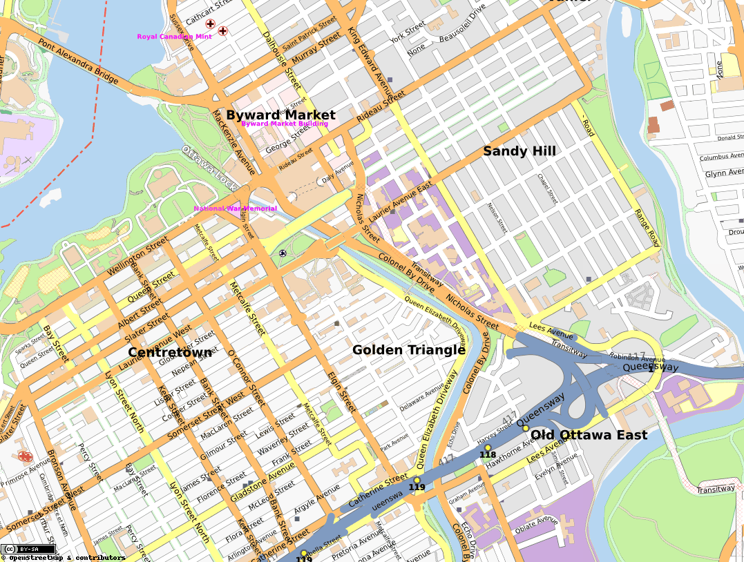
Golden Triangle, Ottawa on:
[Wikipedia]
[Google]
[Amazon]
 The Golden Triangle is a sub-neighbourhood of Centretown in
 The Golden Triangle is a sub-neighbourhood of Centretown in
 Somerset Ward
Somerset (Ward 14) is a city ward in the city of Ottawa, Ontario, Canada. It covers the neighbourhoods of Downtown Ottawa, Centretown, Lebreton Flats and most of Centretown West. It is Ottawa's smallest and most dense ward. It is represented on Ot ...
in central Ottawa, Ontario, Canada
Canada is a country in North America. Its ten provinces and three territories extend from the Atlantic Ocean to the Pacific Ocean and northward into the Arctic Ocean, covering over , making it the world's second-largest country by tot ...
. It borders Elgin Street, at its west, and the Rideau Canal
The Rideau Canal, also known unofficially as the Rideau Waterway, connects Canada's capital city of Ottawa, Ontario, to Lake Ontario and the Saint Lawrence River at Kingston. It is 202 kilometres long. The name ''Rideau'', French for "curtain", ...
, at its east. The Ottawa City Hall is to its north and the Elgin Street Police Station to its south. According to the 2016 Canada Census
The 2016 Canadian census was an enumeration of Canadian residents, which counted a population of 35,151,728, a change from its 2011 population of 33,476,688. The census, conducted by Statistics Canada, was Canada's seventh quinquennial census. ...
, the total population for this area was 5,778.Population calculated by combining Census Tract 0049.00 with Dissemination Block 35060338048 and Dissemination Areas 35060334, 35061716, 35061718, and 35060325
It is dominated by large single-family homes although many have since been subdivided, but it contains some condominiums and small apartment buildings.
Its main western thoroughfare, Elgin Street (nicknamed " Sens Mile"), is home to boutiques and galleries, and it is surrounded by restaurants, cafes, bars, and nightclubs. Its eastern thoroughfare, Queen Elizabeth Driveway
Queen Elizabeth Driveway is a scenic parkway in Ottawa, Canada, that runs along the western edge of the Rideau Canal. It runs from Laurier Avenue (Ottawa), Laurier Avenue in the north to Dow's Lake where it turns into Prince of Wales Drive (Ottawa ...
, runs along the western edge of the Rideau Canal. Along the entire length of Queen Elizabeth Driveway is a multi-use trail
A trail, also known as a path or track, is an unpaved lane or small road usually passing through a natural area. In the United Kingdom and the Republic of Ireland, a path or footpath is the preferred term for a pedestrian or hiking trail. Th ...
, which is part of the Capital Pathway
The Capital Pathway, also known informally as the Bike Path, is a recreational pathway interlinking many parks, waterways and sites in Ottawa, Ontario and Gatineau, Quebec. Most of the pathway is paved, and allows an almost continuous route ...
system.
A series of explosions in the sewers caused property damage throughout the area on May 29, 1929.

See also
* Corktown, a series of shanties along this section of the Rideau Canal that existed when the Canal was being built *List of neighbourhoods in Ottawa
This is a list of neighbourhoods and outlying communities within the City of Ottawa, Ontario, Canada. In 2001, the old city of Ottawa was amalgamated with the suburbs of Nepean, Kanata, Gloucester, Rockcliffe Park, Vanier and Cumberland, and the ...
References
Neighbourhoods in Ottawa Shopping districts and streets in Canada {{ottawa-stub