Gerlovo Beach on:
[Wikipedia]
[Google]
[Amazon]

 Gerlovo Beach ( bg, Герловски бряг, Gerlovski bryag, ) is a beach extending 2 km on the northwest coast of
 Management Plan for Antarctic Specially Protected Area No. 149 Cape Shirreff and San Telmo Island.
Measure 2 (2005), Annex H, ATCM XXVIII Final Report. Stockholm, 2005 The area was visited by early 19th century
Cape Shirreff, ASPA No. 149: Breeding wildlife sites and human features.
Punta Arenas: Instituto Antártico Chileno (INACH), 2004 * L.L. Ivanov et al. Antarctica: Livingston Island and Greenwich Island, South Shetland Islands. Scale 1:100000 topographic map. Sofia: Antarctic Place-names Commission of Bulgaria, 2005 * L. Ivanov. Antarctica: Livingston Island and Smith Island. Scale 1:100000 topographic map. Manfred Wörner Foundation, 2017.
Gerlovo Beach.
SCAR
Bulgarian Antarctic Gazetteer.
basic data
in English)
Gerlovo Beach.
Adjusted Copernix satellite image Beaches of Livingston Island Bulgaria and the Antarctic {{LivingstonIsland-geo-stub
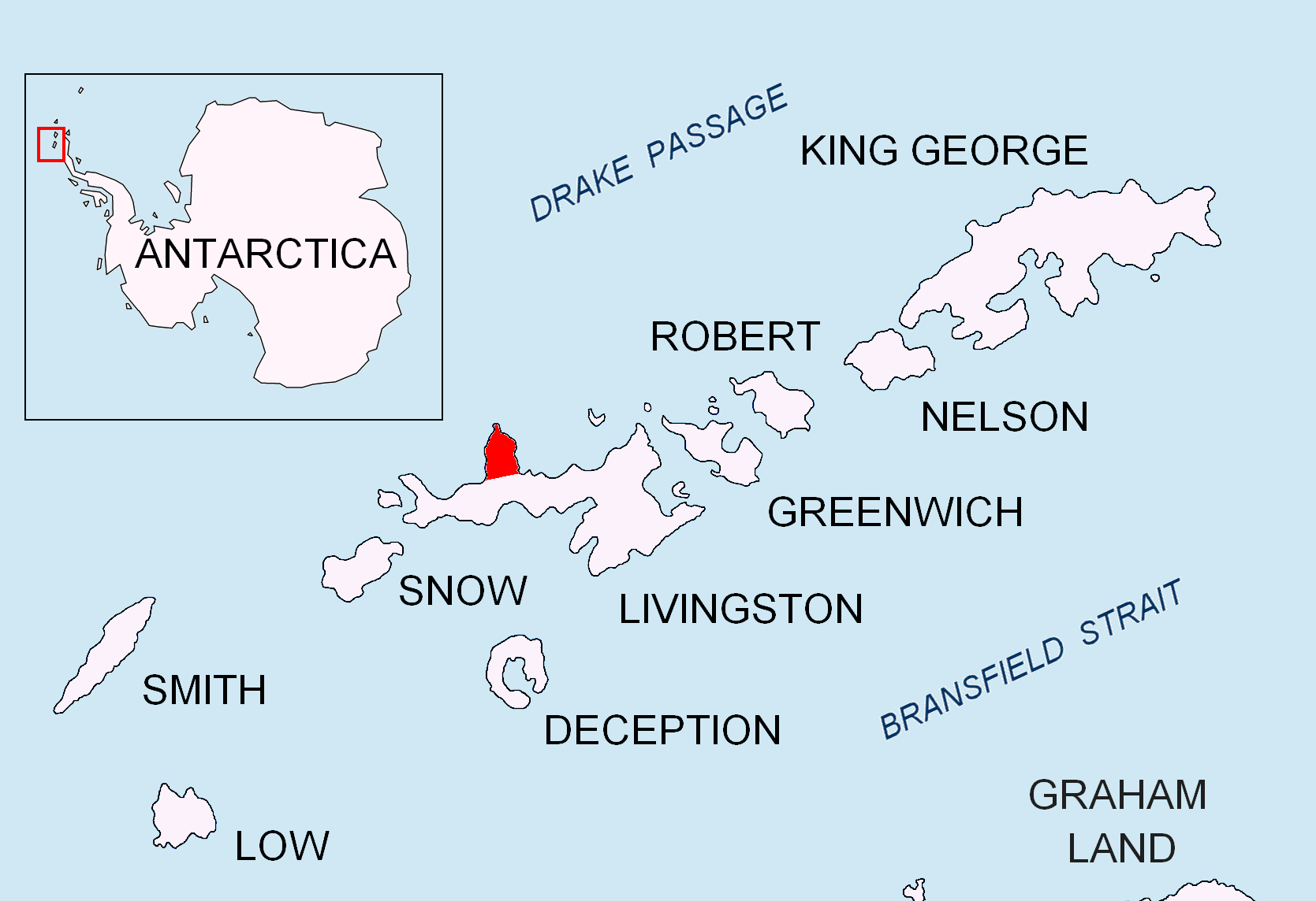
 Gerlovo Beach ( bg, Герловски бряг, Gerlovski bryag, ) is a beach extending 2 km on the northwest coast of
 Ioannes Paulus II Peninsula
Ioannes Paulus II Peninsula ( bg, Полуостров Йоан Павел II, Poluostrov Yoan Pavel II, ) is an ice-covered peninsula on the north coast of Livingston Island in the South Shetland Islands, Antarctica that is bounded by Hero Bay t ...
on Livingston Island in the South Shetland Islands, Antarctica. It stretches both south and northeast of Mercury Bluff, facing San Telmo Island
San Telmo Island (a.k.a. Telmo Island) is an island forming the west side of Shirreff Cove on the north-west coast of Ioannes Paulus II Peninsula, Livingston Island in the South Shetland Islands of Antarctica. It has a surface area of .L.L. Iv ...
to the north by west, and featuring Belomortsi Point in its northern part. Snow-free in summer, with area ca. . The beach is part of Antarctic Specially Protected Area An Antarctic Specially Protected Area (ASPA) is an area on the continent of Antarctica, or on nearby islands, which is protected by scientists and several different international bodies. The protected areas were established in 1961 under the Antarct ...
''ASPA 149 Cape Shirreff and San Telmo Island''.Measure 2 (2005), Annex H, ATCM XXVIII Final Report. Stockholm, 2005 The area was visited by early 19th century
sealers Sealer may refer either to a person or ship engaged in seal hunting, or to a sealant; associated terms include:
Seal hunting
* Sealer Hill, South Shetland Islands, Antarctica
* Sealers' Oven, bread oven of mud and stone built by sealers around 180 ...
.
The beach is named after the Gerlovo
Gerlovo or Gerilovo ( bg, Герлово or Герилово), is a small geographic and ethnographic region in Northern Bulgaria, a hilly fertile valley in the northeastern Balkan Mountains, south of the Ludogorie region. It lies between the Li ...
region in northeastern Bulgaria.
Location
Gerlovo Beach is centred at . British mapping in 1822 and 1968, Spanish in 1991 and Bulgarian in 2009 and 2017.Maps
Cape Shirreff, ASPA No. 149: Breeding wildlife sites and human features.
Punta Arenas: Instituto Antártico Chileno (INACH), 2004 * L.L. Ivanov et al. Antarctica: Livingston Island and Greenwich Island, South Shetland Islands. Scale 1:100000 topographic map. Sofia: Antarctic Place-names Commission of Bulgaria, 2005 * L. Ivanov. Antarctica: Livingston Island and Smith Island. Scale 1:100000 topographic map. Manfred Wörner Foundation, 2017.
Notes
References
Gerlovo Beach.
SCAR
Composite Gazetteer of Antarctica
The Composite Gazetteer of Antarctica (CGA) of the Scientific Committee on Antarctic Research (SCAR) is the authoritative international gazetteer containing all Antarctic toponyms published in national gazetteers, plus basic information about th ...
.
Bulgarian Antarctic Gazetteer.
Antarctic Place-names Commission
The Antarctic Place-names Commission was established by the Bulgarian Antarctic Institute in 1994, and since 2001 has been a body affiliated with the Ministry of Foreign Affairs of Bulgaria.
The Commission approves Bulgarian place names in ...
. (details in Bulgarianbasic data
in English)
External links
Gerlovo Beach.
Adjusted Copernix satellite image Beaches of Livingston Island Bulgaria and the Antarctic {{LivingstonIsland-geo-stub