Fox's Gap on:
[Wikipedia]
[Google]
[Amazon]
Fox's Gap, also known as Fox Gap, is a
 The area is listed on the
wind gap
A wind gap (or air gap) is a gap through which a waterway once flowed that is now dry as a result of stream capture. A water gap is a similar feature, but one in which a waterway still flows. Water gaps and wind gaps often provide routes which ...
in the South Mountain Range of the Blue Ridge Mountains
The Blue Ridge Mountains are a Physiographic regions of the world, physiographic province of the larger Appalachian Mountains range. The mountain range is located in the Eastern United States, and extends 550 miles southwest from southern Pennsy ...
, located in Frederick County and Washington County, Maryland
Maryland ( ) is a U.S. state, state in the Mid-Atlantic (United States), Mid-Atlantic region of the United States. It shares borders with Virginia, West Virginia, and the District of Columbia to its south and west; Pennsylvania to its north; ...
. The gap is traversed by Reno Monument Road. The Appalachian Trail
The Appalachian Trail (also called the A.T.), is a hiking trail in the Eastern United States, extending almost between Springer Mountain in Georgia and Mount Katahdin in Maine, and passing through 14 states.Gailey, Chris (2006)"Appalachian ...
also crosses the gap along the ridgeline.
Geography
The gap is about below the ridge line to the north, below the ridge line to the south and about above the surrounding lowlands. To the east of the gap lies the Middletown Valley and to the west theHagerstown Valley Hagerstown Valley is located in Maryland in the United States. It is part of the Great Appalachian Valley, which continues northward as Cumberland Valley in Pennsylvania, and southward as Shenandoah Valley in West Virginia and Virginia.
Hagerstown ...
. Turner's Gap is to the north, while Lambs Knoll
Lambs Knoll is a peak of South Mountain on the border of Washington County and Frederick County in the state of Maryland. The peak is the second tallest on South Mountain in Maryland behind Quirauk Mountain.
Geography
The peak is located t ...
is immediately to the south.
History
The area was settled in early 1751 by the John and Christiana Fox family and their son Frederick, German immigrants fromHesse
Hesse (, , ) or Hessia (, ; german: Hessen ), officially the State of Hessen (german: links=no, Land Hessen), is a state in Germany. Its capital city is Wiesbaden, and the largest urban area is Frankfurt. Two other major historic cities are Da ...
. Frederick assembled adjoining lands which eventually extended to Turner's Gap. The area is first mentioned as "Foxes Gap" in a September 10, 1792 letter. Frederick Fox moved to Ohio in the early 1800s after the death of his wife. Fox's gap was in use by Euromerican colonists for decades before anyone settled there on the slopes of the mountain or gave it a lasting name though. This was the original, early route of what would be known as The Great Philadelphia Wagon Road. John MacGruder's 1732 patent along Catoctin Creek is described as “''about 1/2 mile above the wagon road that goes from Connestoga to Opeckon''” indicating the road being well established by that early date. The main migration wagon road would eventually be relocated to the center of the valley, but the Middletown to Sharpsburg route would remain in use as a local road over essentially the same road beds from the 1730s until present. General Braddock, George Washington, and Dunbar's Regiment went through Fox's Gap during May 1755 in the Braddock Expedition and their attempt to capture Fort Duquesne.
The Daniel Wise family bought a portion of the property in 1858 for $46.96, clearing fields and building a log cabin. The Wise House was demolished in 1919. On September 14, 1862 the area was the scene some of the heaviest engagements of the Battle of South Mountain
The Battle of South Mountain—known in several early Southern accounts as the Battle of Boonsboro Gap—was fought on September 14, 1862, as part of the Maryland campaign of the American Civil War. Three pitched battles were fought for posse ...
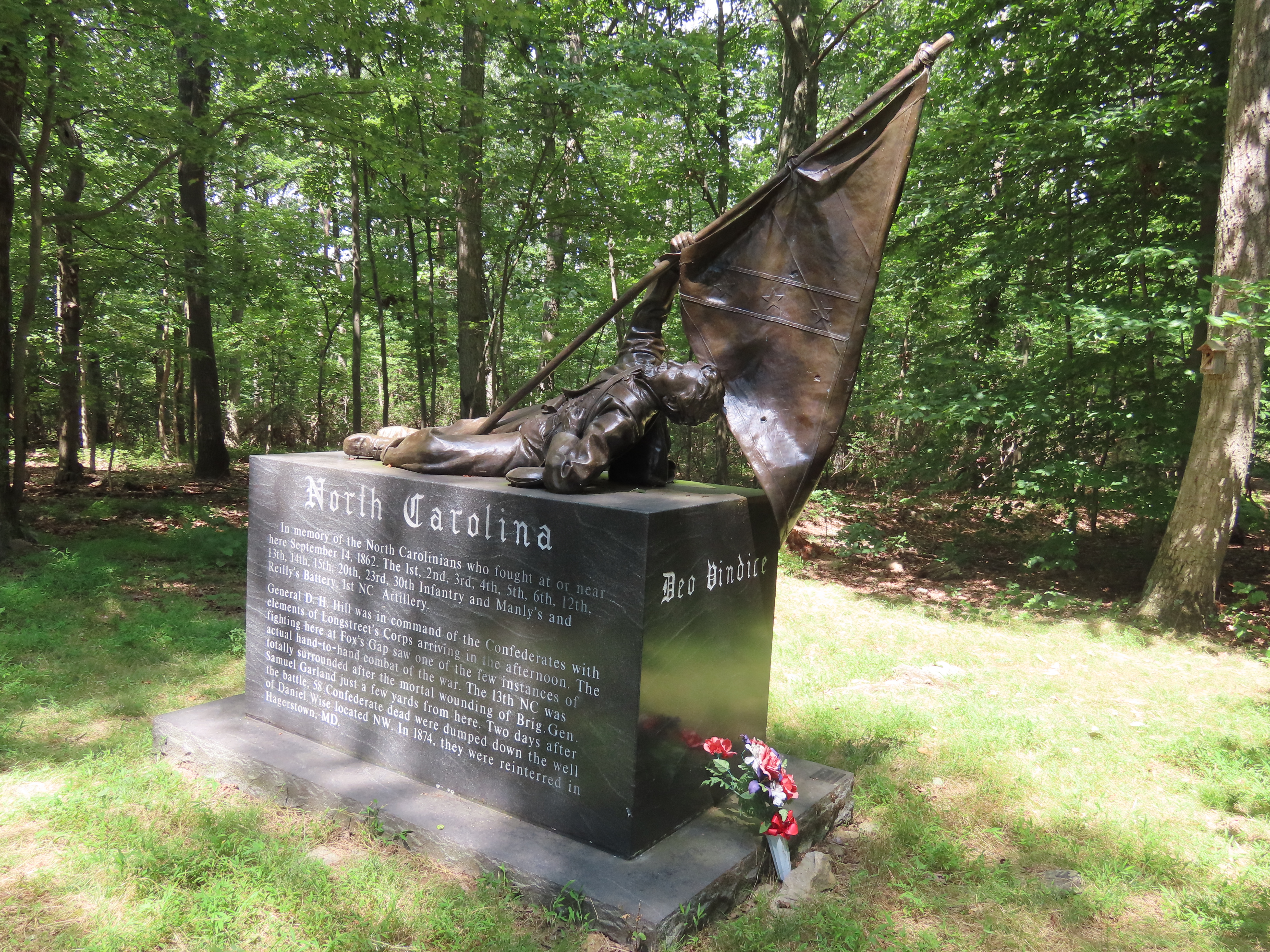
. (See ''Hood's Defeat Near Fox's Gap September 14, 1862'', by Curtis L. Older, available on Kindle and Apple Books.) Older, Curtis L., ''Hood's Defeat Near Fox's Gap September 14, 1862, Kindle and Apple Books, ISBN 978-0-9960067-5-0''. The Reno Monument erected in 1889 by fellow soldiers at the top of Fox's Gap along Reno Monument Road commemorates the death of Union general Jesse L. Reno. Another monument has been erected nearby in the 1990s, which commemorates also the death of Confederate Brig. General Samuel Garland, Jr. and about a half-mile south is a bronze sculpture on a granite stone base dedicated in 2003 to remember the North Carolina troops that held the line here.  The area is listed on the
 National Register of Historic Places
The National Register of Historic Places (NRHP) is the United States federal government's official list of districts, sites, buildings, structures and objects deemed worthy of preservation for their historical significance or "great artist ...
as part of the Turner's and Fox's Gaps Historic District.
References
{{authority control Valleys of Maryland Wind gaps of the United States South Mountain Range (Maryland−Pennsylvania) Landforms of Frederick County, Maryland Landforms of Washington County, Maryland Appalachian Trail Journey Through Hallowed Ground National Heritage Area