Forest Creek, Queensland on:
[Wikipedia]
[Google]
[Amazon]
Forest Creek is a
 The
The
locality
Locality may refer to:
* Locality (association), an association of community regeneration organizations in England
* Locality (linguistics)
* Locality (settlement)
* Suburbs and localities (Australia), in which a locality is a geographic subdivis ...
in the Shire of Douglas
The Shire of Douglas is a Local government in Australia, local government area in Far North Queensland, Far North Queensland. It is located on the coast north of the city of Cairns, Queensland, Cairns. The shire, administered from the town of Mo ...
, Queensland
)
, nickname = Sunshine State
, image_map = Queensland in Australia.svg
, map_caption = Location of Queensland in Australia
, subdivision_type = Country
, subdivision_name = Australia
, established_title = Before federation
, established_ ...
, Australia. In the , Forest Creek had a population of 136 people.
Geography
 The
The Daintree River
The Daintree River is a river that rises in the Daintree Rainforest near Cape Tribulation in Far North Queensland, Australia. The river is located about northwest of Cairns in the UNESCO World Heritagelisted Wet Tropics of Queensland. The area ...
forms the southern boundary of the locality. The watercourse Forest Creek flows through the locality, becoming a tributary of the Daintree River ().
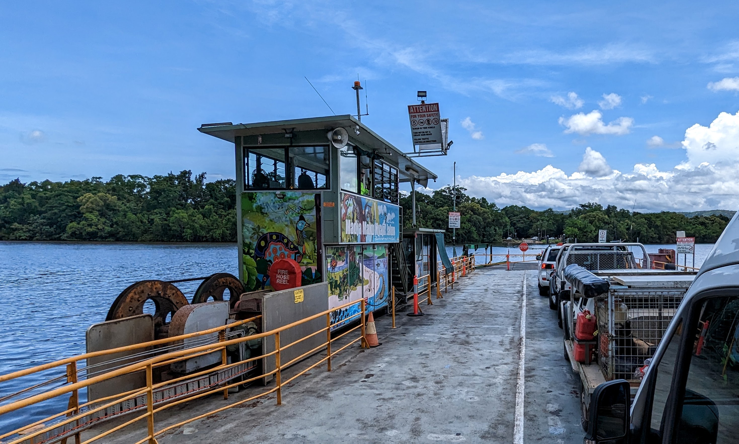
The Daintree River Ferry
The Daintree River Ferry is a cable ferry across the Daintree River in Queensland, Australia. The ferry is situated some north of Port Douglas, and gives access to the northern section of the Daintree National Park and to Cape Tribulation. T ...
carries vehicles from Cape Tribulation Road in Lower Daintree across the Daintree River
The Daintree River is a river that rises in the Daintree Rainforest near Cape Tribulation in Far North Queensland, Australia. The river is located about northwest of Cairns in the UNESCO World Heritagelisted Wet Tropics of Queensland. The area ...
to Cape Tribulation Road in Forest Creek ().
The locality contains two section of the Daintree National Park
The Daintree rainforest is a national park in Far North Queensland, Australia, northwest of Brisbane and northwest of Cairns. It was founded in 1981 and is part of the Wet Tropics of Queensland. In 1988 it became a World Heritage Site. The par ...
in the south-east of the locality and in the east.
Virgil Island island in the Daintree River in the south of the locality (). It is separated from the mainland by the narrow Brandy and Water Creek ().
Apart from the protected areas, the eastern part of the locality are predominantly used for rural residential
A hobby farm (also called a lifestyle block in New Zealand, or acreage living or rural residential in Australia) is a smallholding or small farm that is maintained without expectation of being a primary source of income. Some are held merely to ...
purposes, while the western part of the locality are predominantly used for grazing
In agriculture, grazing is a method of animal husbandry whereby domestic livestock are allowed outdoors to roam around and consume wild vegetations in order to convert the otherwise indigestible (by human gut) cellulose within grass and other ...
on native vegetation.
History
The locality was named on 17 March 1984; it takes its name from the creek. In the , Forest Creek had a population of 103 people. In the , Forest Creek had a population of 136 people.Education
There are no schools in Forest Creek. The nearest government primary schools are Alexandra Bay State School in Diwan to the north-east and Daintree State School in neighbouring Daintree to the south-west (the latter requiring a ferry crossing). The nearest government secondary school is Mossman State High School in Mossman to the south (requiring a ferry crossing).References
{{Shire of Douglas Shire of Douglas Localities in Queensland