Elslack on:
[Wikipedia]
[Google]
[Amazon]
 Elslack is a village and
 Elslack is a village and
 civil parish
In England, a civil parish is a type of administrative parish used for local government. It is a territorial designation which is the lowest tier of local government below districts and counties, or their combined form, the unitary authority ...
in the Craven district of North Yorkshire
North Yorkshire is the largest ceremonial counties of England, ceremonial county (lieutenancy area) in England, covering an area of . Around 40% of the county is covered by National parks of the United Kingdom, national parks, including most of ...
, England, close to the border with Lancashire
Lancashire ( , ; abbreviated Lancs) is the name of a historic county, ceremonial county, and non-metropolitan county in North West England. The boundaries of these three areas differ significantly.
The non-metropolitan county of Lancashi ...
and 4 miles west of Skipton
Skipton (also known as Skipton-in-Craven) is a market town and civil parish in the Craven district of North Yorkshire, England. Historically in the East Division of Staincliffe Wapentake in the West Riding of Yorkshire, it is on the River Air ...
. Thornton in Craven
Thornton-in-Craven is a village and civil parish in the Craven district of North Yorkshire, England. It is approx from the border with Lancashire and north of Earby. Barnoldswick is nearby. The Pennine Way passes through the village, as doe ...
is nearby. The Tempest Arms is a large pub in the village, sited by the A56, which is popular with locals from the surrounding area. Elslack Moor, above the village, is crossed by the Pennine Way
The Pennine Way is a National Trail in England, with a small section in Scotland. The trail stretches for from Edale, in the northern Derbyshire Peak District, north through the Yorkshire Dales and Northumberland National Park and ends at Kir ...
, though this does not visit the village itself.
History
A Roman fort lies at about north-west of Elslack. The fort may have been named Olenacum, or Ριγοδουνον, according to the analysis of Ptolemy's coordinates by Kleineberg et al. It guarded a Roman road linking two other forts:Bremetennacum
Bremetennacum, or Bremetennacum Veteranorum, was a Roman fort on the site of the present day village of Ribchester in Lancashire, England (). (Misspellings in ancient geographical texts include ''Bremetonnacum'', ''Bremetenracum'' or ''Bresneten ...
at Ribchester
Ribchester is a village and civil parish within the Ribble Valley district of Lancashire, England. It lies on the banks of the River Ribble, northwest of Blackburn and east of Preston.
The village has a long history with evidence of Bronze ...
and another at Ilkley
Ilkley is a spa town and civil parish in the City of Bradford in West Yorkshire, in Northern England. Historically part of the West Riding of Yorkshire, Ilkley civil parish includes the adjacent village of Ben Rhydding and is a ward within the ...
. This road has been traced by archaeologists running north-east up Ribblesdale
Ribblesdale is one of the Yorkshire Dales in England. It is the dale or upper valley of the River Ribble in North Yorkshire. Towns and villages in Ribblesdale (downstream, from north to south) include Selside, Horton-in-Ribblesdale, Stainfo ...
about east of Clitheroe
Clitheroe () is a town and civil parish in the Borough of Ribble Valley, Lancashire, England; it is located north-west of Manchester. It is near the Forest of Bowland and is often used as a base for tourists visiting the area. In 2018, the Cl ...
. Then at it turns eastwards passing Barnoldswick
Barnoldswick (pronounced ) is a market town and civil parish in the Borough of Pendle, Lancashire, England. It is within the boundaries of the historic West Riding of Yorkshire, Barnoldswick and the surrounding areas of West Craven have been a ...
, Elslack and Skipton
Skipton (also known as Skipton-in-Craven) is a market town and civil parish in the Craven district of North Yorkshire, England. Historically in the East Division of Staincliffe Wapentake in the West Riding of Yorkshire, it is on the River Air ...
.
Elslack is mentioned in the 1086 ''Domesday Book
Domesday Book () – the Middle English spelling of "Doomsday Book" – is a manuscript record of the "Great Survey" of much of England and parts of Wales completed in 1086 by order of King William I, known as William the Conqueror. The manusc ...
'' as ''Eleslac''.
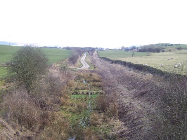
Elslack had its own railway station
Rail transport (also known as train transport) is a means of transport that transfers passengers and goods on wheeled vehicles running on rails, which are incorporated in tracks. In contrast to road transport, where the vehicles run on a pre ...
, but this was closed in 1952. The line passing through it suffered the same fate in 1970. The station site is now privately owned.
The Tempest Arms was named "Pub of the Year" in the 2011 ''Good Pub Guide
''The Good Pub Guide'' is a long-running critical publication which lists and rates public houses (pubs) in the United Kingdom.Villages in North Yorkshire
Civil parishes in North Yorkshire
{{craven-geo-stub