Elan Village on:
[Wikipedia]
[Google]
[Amazon]
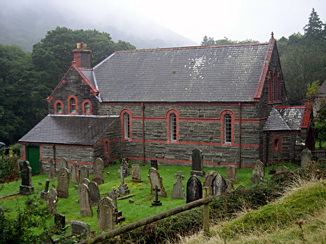
 Elan Village ( cy, Pentre Elan) is a small purpose-built community in
 Elan Village ( cy, Pentre Elan) is a small purpose-built community in
 Powys
Powys (; ) is a county and preserved county in Wales. It is named after the Kingdom of Powys which was a Welsh successor state, petty kingdom and principality that emerged during the Middle Ages following the end of Roman rule in Britain.
Geog ...
, Wales. It was designed by architect Herbert Tudor Buckland
Herbert Tudor Buckland (20 November 1869 – 1951) was a British architect, best known for his seminal Arts and Crafts houses (several of which, including his own at Edgbaston, Birmingham, are Grade I listed), the Elan Valley model village, e ...
as part of Birmingham Corporation's scheme to construct a series of water supply reservoir
A reservoir (; from French ''réservoir'' ) is an enlarged lake behind a dam. Such a dam may be either artificial, built to store fresh water or it may be a natural formation.
Reservoirs can be created in a number of ways, including contro ...
s in the Elan Valley
The Elan Valley ( cy, Cwm Elan) is a river valley situated to the west of Rhayader, in Powys, Wales, sometimes known as the "Welsh Lake District". It covers of lake and countryside.
The valley contains the Elan Valley Reservoirs and Elan Villa ...
between 1892 and 1904. It housed workers and their families responsible for maintaining the scheme's dams and the filtration systems. Elan Village is the only purpose-built Arts and Crafts " Model Village" in Wales.
It is served by the B4518 road
The B4518 road is a road in Powys, central Wales, with a total length of . It begins at in Rhayader near the junction of the A470 road and the A44 road and leads eventually to the A470 again at Llanbrynmair at
. En route going north from Rhaya ...
which runs three miles southwestwards from Rhayader
Rhayader (; cy, Rhaeadr Gwy; ) is a market town and community in Powys, Wales, within the historic county of Radnorshire. The town is from the source of the River Wye on Plynlimon, the highest point of the Cambrian Mountains, and is locate ...
to end at the village, though continuing as a minor road to Caban-coch Reservoir. The road continues over the Elenydd
Elenydd () is an upland area of Mid Wales, extending across parts of northern and eastern Ceredigion and Powys between Aberystwyth and Rhayader. Elenydd is also a name given to the medieval commote of Cwmwd Deuddwr which covered approximately ...
to Cwmystwyth
Cwmystwyth (also Cwm Ystwyth, ; en, "valley of the River Ystwyth") is a village in Ceredigion, Wales near Devil's Bridge, and Pont-rhyd-y-groes.
The Ordnance Survey calculates Cwmystwyth to be the centre point of Wales (; ).
History
Dis ...
and a cul-de-sac branch runs to the dam of Claerwen Reservoir
The Claerwen reservoir and dam in Powys, Wales, were the last additions to the Elan Valley Reservoirs system built to provide water for the increasing water demand of the city of Birmingham and the West Midlands. The dam is built mainly of concre ...
.Ordnance Survey 1:25,000 scale Explorer map sheet no 200 ''Llandrindod Wells & Elan Valley'' It is in the community
A community is a social unit (a group of living things) with commonality such as place, norms, religion, values, customs, or identity. Communities may share a sense of place situated in a given geographical area (e.g. a country, village, ...
of Rhayader
Rhayader (; cy, Rhaeadr Gwy; ) is a market town and community in Powys, Wales, within the historic county of Radnorshire. The town is from the source of the River Wye on Plynlimon, the highest point of the Cambrian Mountains, and is locate ...
.
References
{{authority control Villages in Powys Planned communities in Wales Populated places established in 1892 Rhayader