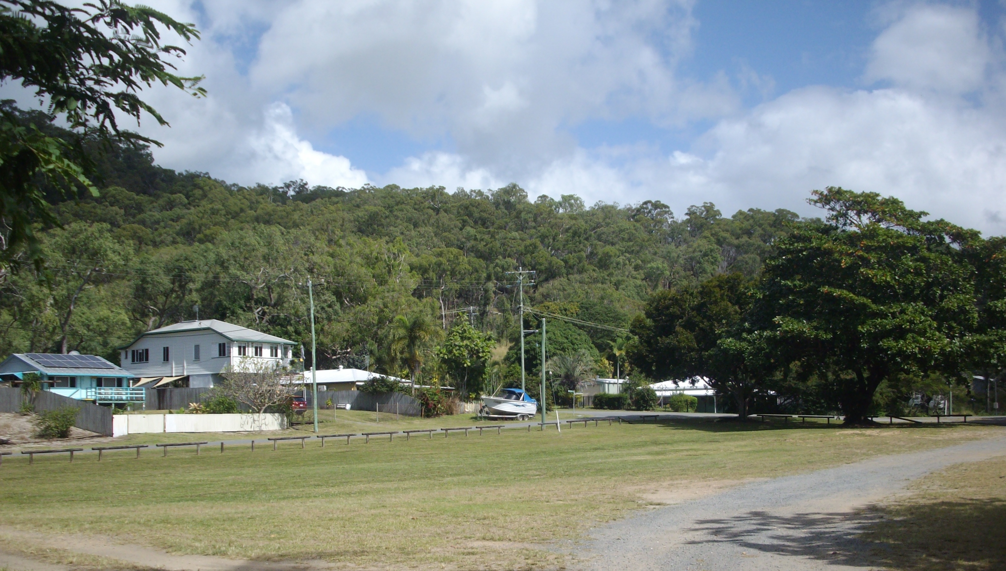
East Trinity, Queensland on:
[Wikipedia]
[Google]
[Amazon]
East Trinity is a coastal

 The locality of East Trinity has the locality of Glen Boughton enclosed within it.
The northern boundary of East Trinity is the
locality
Locality may refer to:
* Locality (association), an association of community regeneration organizations in England
* Locality (linguistics)
* Locality (settlement)
* Suburbs and localities (Australia), in which a locality is a geographic subdivis ...
in the Cairns Region
The Cairns Region is a local government area in Far North Queensland, Queensland, Australia, centred on the regional city of Cairns. It was established in 2008 by the amalgamation of the City of Cairns and the Shires of Douglas and Mulgrave. ...
, Queensland
)
, nickname = Sunshine State
, image_map = Queensland in Australia.svg
, map_caption = Location of Queensland in Australia
, subdivision_type = Country
, subdivision_name = Australia
, established_title = Before federation
, established_ ...
, Australia. It was formerly known as Trinity East. In the , East Trinity had a population of 212 people.
The town of Giangurra is on the northern coast of the locality ().
Geography

 The locality of East Trinity has the locality of Glen Boughton enclosed within it.
The northern boundary of East Trinity is the
 Coral Sea
The Coral Sea () is a marginal sea of the South Pacific off the northeast coast of Australia, and classified as an interim Australian bioregion. The Coral Sea extends down the Australian northeast coast. Most of it is protected by the Fre ...
. The western boundary is Trinity Inlet
The Trinity Inlet is an oceanic inlet which serves as the port for the city of Cairns, Queensland, Australia. The city centre is on the western bank where the inlet meets the Coral Sea.
Location and features
The Trinity Inlet is located in the ...
. The south-western boundary is Pine Creek. The eastern boundary is the Murray Prior Range.
Parts of the land, water and environment in and around East Trinity have been subject to acid sulfate soil
Acid sulfate soils are naturally occurring soils, sediments or organic substrates (e.g. peat) that are formed under waterlogged conditions. These soils contain iron sulfide minerals (predominantly as the mineral pyrite) and/or their oxidation produ ...
oxidisation. Acid sulfate soil remediation has been implemented to fix the impacts of soil oxidisation to the land, water and environment in East Trinity.
Mountains
East Trinity has the following mountains, all of which are in the Murray Prior Range along the locality's eastern boundary (from north to south): * Mount Yarrabah () *Mount Murray Prior () *Mount Gorton () *May Peak ()Bays and headlands
Offshore are a number of bays and headlands (from west to east): * Trinity Bay, to the west of False Cape, named afterTrinity Sunday
Trinity Sunday is the first Sunday after Pentecost in the Western Christianity, Western Christian liturgical year, liturgical calendar, and the Sunday of Pentecost in Eastern Christianity. Trinity Sunday celebrates the Christian doctrine of the ...
(10 June 1770) by Lieutenant James Cook
James Cook (7 November 1728 Old Style date: 27 October – 14 February 1779) was a British explorer, navigator, cartographer, and captain in the British Royal Navy, famous for his three voyages between 1768 and 1779 in the Pacific Ocean an ...
on the HM Bark Endeavour, including side bays (from west to east):
** Trinity Inlet
The Trinity Inlet is an oceanic inlet which serves as the port for the city of Cairns, Queensland, Australia. The city centre is on the western bank where the inlet meets the Coral Sea.
Location and features
The Trinity Inlet is located in the ...
(),
**Stafford Point ()
** Rolling Bay ()
**Bessie Point ()
** Sturt Cove ()
**Lyons Point ()
** Brown Bay ()
** Sunny Bay ()
**False Cape ()
*Mission Bay to the east of False Cape ()
History
East Trinity is situated in the Yidinji traditional Aboriginal country. Prior to 2002, the locality was known as Trinity East. In the , East Trinity had a population of 111 people. In the , East Trinity had a population of 212 people. In 2020, there have been proposals for a satellite city urban development, the construction of a bridge/tunnel linking Cairns City to East Trinity, and eco-tourism proposals.Heritage listings
East Trinity has the following heritage listings: * Bessie Point, off Pine Creek-Yarrabah Road: Hydrographic Survey Bench Mark * Yarrabah Road: False Cape BatteryEducation
There are no schools in East Trinity. The nearest government primary schools are Yarrabah State School in neighbouringYarrabah
Yarrabah (traditionally ''Yagaljida'' in the Yidin language spoken by the indigenous Yidinji people is a coastal town and Suburbs and localities (Australia), locality in the Aboriginal Shire of Yarrabah, Queensland, Australia. In the , the local ...
to the north-east and Gordonvale State School in Gordonvale
Gordonvale is a rural sugar-growing town and Suburbs and localities (Australia), locality situated on the southern side of Cairns, Queensland, Cairns in the Cairns Region, Queensland, Australia. In the , the locality of Gordonvale had a populati ...
to the south. The nearest government secondary schools are Yarrabah State School (to Year 10 only) and Gordonvale State High School in Gordonvale.References
External links
{{Cairns Region Suburbs of Cairns Localities in Queensland Coastline of Queensland