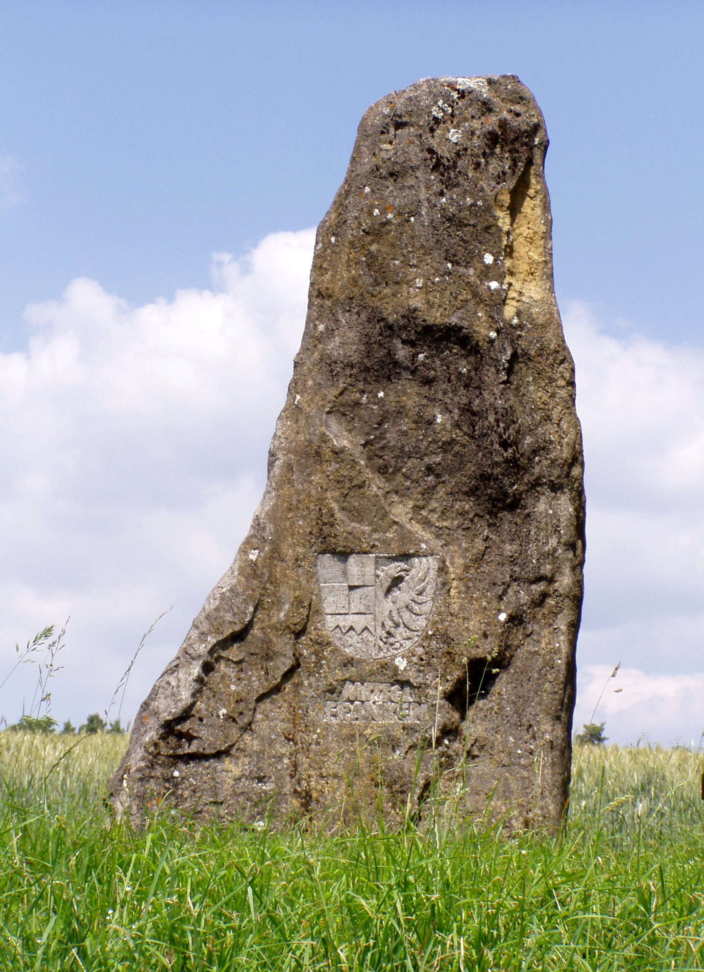
Dreifrankenstein on:
[Wikipedia]
[Google]
[Amazon]
 The Dreifrankenstein (
 The Old Dreifrankenstein (''Alter Dreifrankenstein'') erected in 1892, is a 135 cm high column made of
 The New Dreifrankenstein (''Neuer Dreifrankenstein''), laid in 1979, is a 280 cm high
 Bayerische Vermessungsverwaltung
/ref>
 The Dreifrankenstein (
German
German(s) may refer to:
* Germany (of or related to)
** Germania (historical use)
* Germans, citizens of Germany, people of German ancestry, or native speakers of the German language
** For citizens of Germany, see also German nationality law
**Ge ...
for ''Three Franconias Stone'') is a boundary stone
A boundary marker, border marker, boundary stone, or border stone is a robust physical marker that identifies the start of a land boundary or the change in a boundary, especially a change in direction of a boundary. There are several other t ...
that marks the tripoint
A tripoint, trijunction, triple point, or tri-border area is a geographical point at which the boundaries of three countries or subnational entities meet. There are 175 international tripoints as of 2020. Nearly half are situated in rivers, l ...
where the three Franconian provinces of Upper, Middle and Lower Franconia
Lower Franconia (german: Unterfranken) is one of seven districts of Bavaria, Germany. The districts of Lower, Middle and Upper Franconia make up the region of Franconia.
History
After the founding of the Kingdom of Bavaria the state was totally ...
meet in southern Germany. As part of the regional reforms in 1972 the boundary marker was moved around 7 kilometres as the crow flies
__NOTOC__
The expression ''as the crow flies'' is an idiom for the most direct path between two points, rather similar to "in a beeline". This meaning is attested from the early 19th century, and appeared in Charles Dickens's 1838 novel ''Oliver ...
to the southeast. Today both points are marked by stones that are referred to as the Old and New Dreifrankenstein.
Old Dreifrankenstein
sandstone
Sandstone is a clastic sedimentary rock composed mainly of sand-sized (0.0625 to 2 mm) silicate grains. Sandstones comprise about 20–25% of all sedimentary rocks.
Most sandstone is composed of quartz or feldspar (both silicates ...
. It is located in woodland
A woodland () is, in the broad sense, land covered with trees, or in a narrow sense, synonymous with wood (or in the U.S., the ''plurale tantum'' woods), a low-density forest forming open habitats with plenty of sunlight and limited shade (se ...
on the territory of Sandhügel, several hundred metres west of Kleinbirkach (in the borough of the market town of Ebrach) and east of Ebersbrunn (Markt Geiselwind
Geiselwind is a market town in Lower Franconia (Bavaria) in the district of Kitzingen in Germany. It has a population of around 2,300.
Geography Location
Geiselwind is today in the region of Lower Franconia (Würzburg). Until administrative refor ...
, Lower Franconia) near the source region of the Reiche Ebrach stream. Its GPS
The Global Positioning System (GPS), originally Navstar GPS, is a satellite-based radionavigation system owned by the United States government and operated by the United States Space Force. It is one of the global navigation satellite sy ...
coordinates are .
New Dreifrankenstein
glacial erratic
A glacial erratic is glacially deposited rock differing from the type of rock native to the area in which it rests. Erratics, which take their name from the Latin word ' ("to wander"), are carried by glacial ice, often over distances of hundre ...
made of muschelkalk
The Muschelkalk (German for "shell-bearing limestone"; french: calcaire coquillier) is a sequence of sedimentary rock, sedimentary rock strata (a lithostratigraphy, lithostratigraphic unit) in the geology of central and western Europe. It has a Mid ...
, in which the coats of arms of the three Franconian provinces
A province is almost always an administrative division within a country or state. The term derives from the ancient Roman '' provincia'', which was the major territorial and administrative unit of the Roman Empire's territorial possessions ou ...
have been carved. It is located on an eminence in the Steigerwald
The Steigerwald is a hill region up to in the Bavarian-Franconian part of the South German Scarplands between Würzburg and Nuremberg. It is part of the Keuper Uplands, and within it, it is continued to the north-northeast and right of the river ...
forest, southwest of Heuchelheim (in the borough of Schlüsselfeld
Schlüsselfeld is a town on the southwestern edge of the Upper Franconian district (Landkreis) of Bamberg
Geography
Schlüsselfeld lies 24 km southwest of Bamberg in the Steigerwald (forest) in the valley of the Reiche Ebrach, 299 m abo ...
, Upper Franconia), northwest of Freihaslach (Markt Burghaslach
Burghaslach is a municipality and a market town in the district of Neustadt (Aisch)-Bad Windsheim in Franconia in Bavaria, Germany.
Geography
Neighbouring municipalities to Burghaslach are Geiselwind, Schlüsselfeld, Vestenbergsgreuth, Mar ...
, Middle Franconia) and east of Sixtenberg (Markt Geiselwind, Lower Franconia). Its GPS coordinates are .
On the Dreifrankenstein is a geodetic reference point whose coordinates are ./ref>
References