Donegal, Pennsylvania on:
[Wikipedia]
[Google]
[Amazon]
:''There are also three Donegal Townships in Pennsylvania.''
 Donegal is a borough in Westmoreland County,

 Donegal is a borough in Westmoreland County,
 Pennsylvania
Pennsylvania (; ( Pennsylvania Dutch: )), officially the Commonwealth of Pennsylvania, is a state spanning the Mid-Atlantic, Northeastern, Appalachian, and Great Lakes regions of the United States. It borders Delaware to its southeast, ...
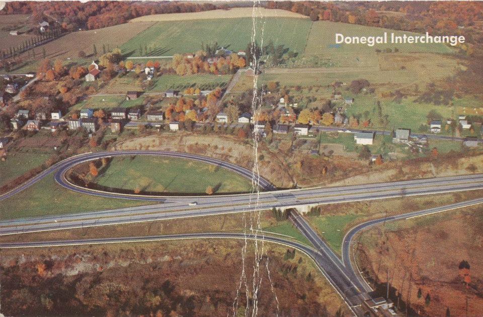
, United States. It is a distinct municipality from the adjacent Donegal Township. The population was 103 at the 2020 census. Donegal is best known as an exit on the Pennsylvania Turnpike
The Pennsylvania Turnpike (Penna Turnpike or PA Turnpike) is a toll highway operated by the Pennsylvania Turnpike Commission (PTC) in the U.S. state of Pennsylvania. A controlled-access highway, it runs for across the state. The turnpike's we ...
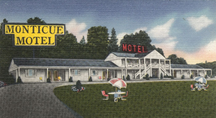
with restaurants, gas stations, and two hotels for travelers.
It was named after the town and county of Donegal Donegal may refer to:
County Donegal, Ireland
* County Donegal, a county in the Republic of Ireland, part of the province of Ulster
* Donegal (town), a town in County Donegal in Ulster, Ireland
* Donegal Bay, an inlet in the northwest of Ireland b ...
in Ireland
Ireland ( ; ga, Éire ; Ulster Scots dialect, Ulster-Scots: ) is an island in the Atlantic Ocean, North Atlantic Ocean, in Northwestern Europe, north-western Europe. It is separated from Great Britain to its east by the North Channel (Grea ...
.
Geography
Donegal is located at (40.111789, -79.381931). According to theUnited States Census Bureau
The United States Census Bureau (USCB), officially the Bureau of the Census, is a principal agency of the U.S. Federal Statistical System, responsible for producing data about the American people and economy. The Census Bureau is part of the ...
, the borough has a total area of , all of it land.
Climate
Demographics
As of thecensus
A census is the procedure of systematically acquiring, recording and calculating information about the members of a given population. This term is used mostly in connection with national population and housing censuses; other common censuses incl ...
of 2000, there were 165 people, 72 households, and 47 families residing in the borough. The population density
Population density (in agriculture: standing stock or plant density) is a measurement of population per unit land area. It is mostly applied to humans, but sometimes to other living organisms too. It is a key geographical term.Matt RosenberPopul ...
was 519.1 people per square mile (199.1/km2). There were 79 housing units at an average density of 248.5 per square mile (95.3/km2). The racial makeup of the borough was 98.79% White
White is the lightest color and is achromatic (having no hue). It is the color of objects such as snow, chalk, and milk, and is the opposite of black. White objects fully reflect and scatter all the visible wavelengths of light. White on ...
, and 1.21% from two or more races.
There were 72 households, out of which 26.4% had children under the age of 18 living with them, 54.2% were married couples
Marriage, also called matrimony or wedlock, is a culturally and often legally recognized union between people called spouses. It establishes rights and obligations between them, as well as between them and their children, and between t ...
living together, 9.7% had a female householder with no husband present, and 34.7% were non-families. 29.2% of all households were made up of individuals, and 9.7% had someone living alone who was 65 years of age or older. The average household size was 2.29 and the average family size was 2.83.
In the borough the population was spread out, with 21.8% under the age of 18, 10.3% from 18 to 24, 24.8% from 25 to 44, 27.3% from 45 to 64, and 15.8% who were 65 years of age or older. The median age was 41 years. For every 100 females, there were 81.3 males. For every 100 females age 18 and over, there were 81.7 males.
The median income for a household in the borough was $23,875, and the median income for a family was $25,417. Males had a median income of $32,000 versus $13,958 for females. The per capita income
Per capita income (PCI) or total income measures the average income earned per person in a given area (city, region, country, etc.) in a specified year. It is calculated by dividing the area's total income by its total population.
Per capita i ...
for the borough was $12,656. About 21.1% of families and 20.0% of the population were below the poverty line
The poverty threshold, poverty limit, poverty line or breadline is the minimum level of income deemed adequate in a particular country. The poverty line is usually calculated by estimating the total cost of one year's worth of necessities for t ...
, including 18.9% of those under the age of eighteen and 17.1% of those 65 or over.
Education
Donegal has an elementary school for its children and for the children of several other area communities. As part of the Mount Pleasant Area School District, older students attend Mount Pleasant Area Junior/Senior High School.Attractions
Donegal Township is home to a busy turnpike exchange that sees thousands of people every year. Most travelers are on their way to one of the many local attractions. Two of the main attractions are the 7 Springs Ski Resort and Hidden Valley Ski Resort. These resorts provide a steady winter income for many local businesses. There are also severalFrank Lloyd Wright
Frank Lloyd Wright (June 8, 1867 – April 9, 1959) was an American architect, designer, writer, and educator. He designed more than 1,000 structures over a creative period of 70 years. Wright played a key role in the architectural movements o ...
-designed homes within driving distance that can be toured, such as The Duncan House, Kentuck Knob
Kentuck Knob, also known as the Hagan House, is a house designed by the American architect Frank Lloyd Wright in rural Stewart Township near the village of Chalk Hill, Fayette County, Pennsylvania, USA, southeast of Pittsburgh. It was designat ...
, and Fallingwater
Fallingwater is a house designed by the architect Frank Lloyd Wright in 1935 in the Laurel Highlands of southwest Pennsylvania, about southeast of Pittsburgh in the United States. It is built partly over a waterfall on Bear Run in the Mill R ...
. Fallingwater is located near Ohiopyle State Park, which offers a range of opportunities for outdoor recreation.

References