Doi Saket District on:
[Wikipedia]
[Google]
[Amazon]
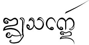
 Doi Saket ( th, ดอยสะเก็ด, ; nod,
  ) is a district (''
amphoe.com
Doi Saket {{ChiangMai-geo-stub
 ) is a district (''
amphoe
An amphoe (sometimes also ''amphur'', th, อำเภอ, )—usually translated as "district"—is the second level administrative subdivision of Thailand. Groups of ''amphoe'' or districts make up the provinces, and are analogous to countie ...
'') in the eastern part of Chiang Mai province
Chiang Mai ( th, เชียงใหม่, ; nod, , ) is the largest Province (''changwat'') of Thailand. It lies in upper northern Thailand and has a population of 1.78 million people. It is bordered by Chiang Rai to the northeast, Lam ...
in northern Thailand
Thailand ( ), historically known as Siam () and officially the Kingdom of Thailand, is a country in Southeast Asia, located at the centre of the Indochinese Peninsula, spanning , with a population of almost 70 million. The country is bo ...
. The district is predominantly a rural farming area, containing a mixture of rice fields on the valley floor to orchard and other farming on the hillsides. The village is known for its murals inside Wat Doi Saket.
History
The district was established in 1902.Geography
Neighboring districts are (from the south clockwise) Mae On, San Kamphaeng, San Sai, Mae Taeng, Phrao of Chiang Mai province, Wiang Pa Pao of Chiang Rai province and Mueang Pan ofLampang province
Lampang ( th, ลำปาง, ; Northern Thai: ) is one of Thailand's seventy-six provinces (''changwat''), lies in upper northern Thailand. The old name of Lampang was ''Khelang Nakhon''.
Geography
Lampang is in the broad river valley of the ...
.
The district is named after 1,816 m high Doi Saket (ดอยสะเก็ด), a mountain of the Khun Tan Range
The Khun Tan Range ( th, ทิวเขาขุนตาน or, erroneously, ทิวเขาขุนตาล) is a mountain range that occupies a central position in Northern Thailand. Most of the range is located in Chiang Mai, west ...
on the east side of the district.
Administration
The district is divided into 14 sub-districts (''tambon
''Tambon'' ( th, ตำบล, ) is a local governmental unit in Thailand. Below district (''amphoe'') and province (''changwat''), they form the third administrative subdivision level. there were 7,255 tambons, not including the 180 ''khwaeng'' ...
s''), which are further subdivided into 110 villages (''muban
Muban ( th, หมู่บ้าน; , ) is the lowest administrative sub-division of Thailand. Usually translated as 'village' and sometimes as 'hamlet', they are a subdivision of a tambon (subdistrict). , there were 74,944 administrative mu ...
s''). Doi Saket is a township (''thesaban tambon
Thesaban ( th, เทศบาล, , ) are the municipalities of Thailand. There are three levels of municipalities: city, town, and sub-district. Bangkok and Pattaya are special municipal entities not included in the ''thesaban'' system.
The mu ...
''), which covers parts of ''tambon'' Choeng Doi and Luang Nuea. There are a further 13 tambon administrative organizations (TAO).
External links
amphoe.com
Doi Saket {{ChiangMai-geo-stub