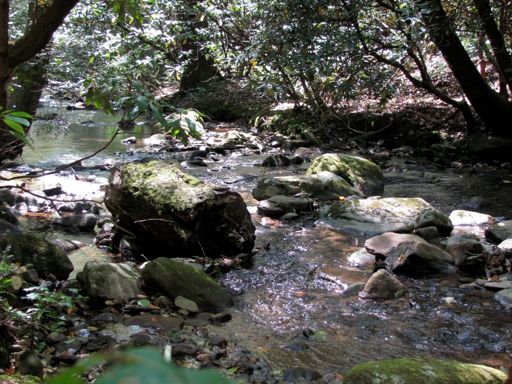
Dicks Creek (Chestatee River) on:
[Wikipedia]
[Google]
[Amazon]
 Dicks Creek is a stream in
 Frogtown Creek rises east of Dicks Creek and Blood Mountain Creek, and to the southeast of Blood Mountain, and parallels Dicks Creek to the west, while running alongside
Georgia
Georgia most commonly refers to:
* Georgia (country), a country in the Caucasus region of Eurasia
* Georgia (U.S. state), a state in the Southeast United States
Georgia may also refer to:
Places
Historical states and entities
* Related to the ...
, and is a tributary of the Chestatee River The Chestatee River (variant spellings Chestatie, Chestetee, Chostatee, Chosteta, Chestotee; none in modern use) is a file geodatabase (GDB) at ftp://rockyftp.cr.usgs.gov/vdelivery/Datasets/Staged/Hydro/FileGDB101/ river in the Appalachian Mountain ...
. The creek is approximately long. file geodatabase (GDB) at ftp://rockyftp.cr.usgs.gov/vdelivery/Datasets/Staged/Hydro/FileGDB101/
Course
Dicks Creek rises in the Blood Mountain Wilderness, just southwest ofBlood Mountain
Blood Mountain is the highest peak on the Georgia section of the Appalachian Trail and the sixth-tallest mountain in Georgia, with an elevation of .Brown (1996), p.93 It is located on the border of Lumpkin County with Union County and is withi ...
, in the confines of the Chattahoochee-Oconee National Forest in Lumpkin County
Lumpkin County is a county located in the north central portion of the U.S. state of Georgia. As of the 2020 census, the population was 33,488. Its county seat is Dahlonega.
History
This area was settled by the Cherokee, who also occupied a ...
in Georgia
Georgia most commonly refers to:
* Georgia (country), a country in the Caucasus region of Eurasia
* Georgia (U.S. state), a state in the Southeast United States
Georgia may also refer to:
Places
Historical states and entities
* Related to the ...
. The creek heads in a southerly direction away from Blood Mountain for approximately 2.3 miles, and picks up Lance Creek from the west, just before its confluence with Blood Mountain Creek, which has paralleled Dicks Creek from the foot of Blood Mountain on the east. Dicks Creek picks up Miller Creek from the west after another 0.8 miles, then turns to the southeast and picks up Waters Creek, also from the west, before heading east for 2.8 miles and meeting Frogtown Creek, where the Chestatee River The Chestatee River (variant spellings Chestatie, Chestetee, Chostatee, Chosteta, Chestotee; none in modern use) is a file geodatabase (GDB) at ftp://rockyftp.cr.usgs.gov/vdelivery/Datasets/Staged/Hydro/FileGDB101/ river in the Appalachian Mountain ...
begins at the confluence
In geography, a confluence (also: ''conflux'') occurs where two or more flowing bodies of water join to form a single channel. A confluence can occur in several configurations: at the point where a tributary joins a larger river (main stem); o ...
of the two creeks very close to the intersection of State Route 9 and U.S. Route 129
U.S. Route 129 (US 129) is an auxiliary route of US 29, which it intersects in Athens, Georgia. US 129 currently runs for from an intersection with US 19/ US 27 ALT/ US 98 in Chiefland, Florida, to an interchang ...
at Turners Corner. A portion of Dicks Creek is on the Appalachian Trail
The Appalachian Trail (also called the A.T.), is a hiking trail in the Eastern United States, extending almost between Springer Mountain in Georgia and Mount Katahdin in Maine, and passing through 14 states.Gailey, Chris (2006)"Appalachian Tr ...
.
 Frogtown Creek rises east of Dicks Creek and Blood Mountain Creek, and to the southeast of Blood Mountain, and parallels Dicks Creek to the west, while running alongside
 U.S. Route 19
U.S. Route 19 (US 19) is a north–south U.S. Highway in the Eastern United States. Despite encroaching Interstate Highways, the route has remained a long-haul road, connecting the Gulf of Mexico with Lake Erie.
The highway's southern ...
to the east, before its confluence with Dicks Creek. Frogtown Creek features DeSoto Falls in the Desoto Falls Scenic Area.
Sub-watershed details
The creekwatershed
Watershed is a hydrological term, which has been adopted in other fields in a more or less figurative sense. It may refer to:
Hydrology
* Drainage divide, the line that separates neighbouring drainage basins
* Drainage basin, called a "watershe ...
and associated waters is designated by the United States Geological Survey
The United States Geological Survey (USGS), formerly simply known as the Geological Survey, is a scientific agency of the United States government. The scientists of the USGS study the landscape of the United States, its natural resources, ...
as sub-watershed
Watershed is a hydrological term, which has been adopted in other fields in a more or less figurative sense. It may refer to:
Hydrology
* Drainage divide, the line that separates neighbouring drainage basins
* Drainage basin, called a "watershe ...
HUC 031300010501, is named the Dicks Creek sub-watershed, and drains an area of approximately 32 square miles east of Suches, and north of the Chestatee River.
See also
* Water Resource Region *South Atlantic-Gulf Water Resource Region
South is one of the cardinal directions or Points of the compass, compass points. The direction is the opposite of north and is perpendicular to both east and west.
Etymology
The word ''south'' comes from Old English ''sūþ'', from earlier Pro ...
*Apalachicola basin
The ACF River Basin is the drainage basin, or watershed, of the Apalachicola River, Chattahoochee River, and Flint River, in the Southeastern United States.
This area is alternatively known as simply the Apalachicola Basin and is listed by t ...
References
{{authority control Dicks Creek (Chestatee River) Rivers of Lumpkin County, Georgia