Cambridge Gulf on:
[Wikipedia]
[Google]
[Amazon]


 Cambridge Gulf is a
Kununurra Historical Society Inc.
Archive, Library, Museum & Research for history and images of Cambridge Gulf. Gulfs of Australia Ord River Kimberley coastline of Western Australia Estuaries of Western Australia


 Cambridge Gulf is a
 gulf
A gulf is a large inlet from the ocean into the landmass, typically with a narrower opening than a bay, but that is not observable in all geographic areas so named. The term gulf was traditionally used for large highly-indented navigable bodie ...
on the north coast of the Kimberley region of Western Australia
Western Australia (commonly abbreviated as WA) is a state of Australia occupying the western percent of the land area of Australia excluding external territories. It is bounded by the Indian Ocean to the north and west, the Southern Ocean to th ...
.
Many rivers flow into the gulf, including the Ord River
The Ord River is a river in the Kimberley region of Western Australia. The river's catchment covers .
The lower Ord River and the conjunction with Cambridge Gulf create the most northern estuarine environment in Western Australia.
The Ord ...
, Pentecost River
Pentecost River is a river in the Kimberley region of Western Australia.
The Pentecost rises in the Durack Range and flows north through El Questro Station where it joins the Chamberlain River, then continues north crossing the Gibb River Ro ...
, Durack River
Durack River is a river in the Kimberley region of Western Australia.
The river rises below the Durack Range then flows north, discharging into the west arm of Cambridge Gulf.
There are 14 tributaries of the Durack, including Chapman River, ...
, King River and the Forrest River
The Forrest River is a river in the Kimberley region of Western Australia.
The river rises just east of Pseudomys Hill in the Drysdale River National Park and flows in an easterly direction until discharging into the western arm of the Cambri ...
, making the environment an estuarine
An estuary is a partially enclosed coastal body of brackish water with one or more rivers or streams flowing into it, and with a free connection to the open sea. Estuaries form a transition zone between river environments and maritime environment ...
one.
The gulf experiences two large tidal flow
Tidal is the adjectival form of tide.
Tidal may also refer to:
* ''Tidal'' (album), a 1996 album by Fiona Apple
* Tidal (king), a king involved in the Battle of the Vale of Siddim
* TidalCycles, a live coding environment for music
* Tidal (servic ...
s each day between .
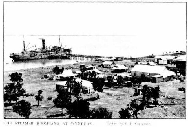
The town of Wyndham, the area's principal port, lies on its eastern bank at the lower part of the gulf and is approximately by road west-north-west of Kununurra. Cambridge Gulf is a gulf within a gulf, being at the southern extremity of the Joseph Bonaparte Gulf
Joseph Bonaparte Gulf is a large body of water off the coast of the Northern Territory and Western Australia and part of the Timor Sea. It was named after Joseph Bonaparte, brother of Napoleon and King of Naples (1806-1808) and then Spain (1808 ...
, in the Timor Sea
The Timor Sea ( id, Laut Timor, pt, Mar de Timor, tet, Tasi Mane or ) is a relatively shallow sea bounded to the north by the island of Timor, to the east by the Arafura Sea, and to the south by Australia.
The sea contains a number of reefs, ...
.
The entrance of the Gulf is defined by Cape Domett
Cape Domett is at the eastern side of the mouth of the Cambridge Gulf in the Kimberley region of Western Australia.
It is opposite Cape Dussejour, which lies to the north west of Cape Domett, with Lacrosse Island
Lacrosse Island is an islan ...
on the eastern shore, Lacrosse Island
Lacrosse Island is an island in the Cambridge Gulf in the Kimberley region of Western Australia, located between Cape Domett on the eastern shore and Cape Dussejour on the western. The island is in the local government area of the Shire of Wyn ...
in the middle, and the Cape Dussejour
Cape Dussejour is located at the western side of the entrance to the Cambridge Gulf in the Kimberley region of Western Australia.
The Cape to the south east, on the eastern side of the mouth, is Cape Domett, with Lacrosse Island located between ...
on the western shore, with King Shoals and Medusa Banks out in Joseph Bonaparte Gulf beyond Lacrosse Island.
The conjunction between the gulf and the lower regions of the Ord River (the eastern arm), and the Durack and Pentecost Rivers (the western arm) are the main areas that have estuarine features.
Description
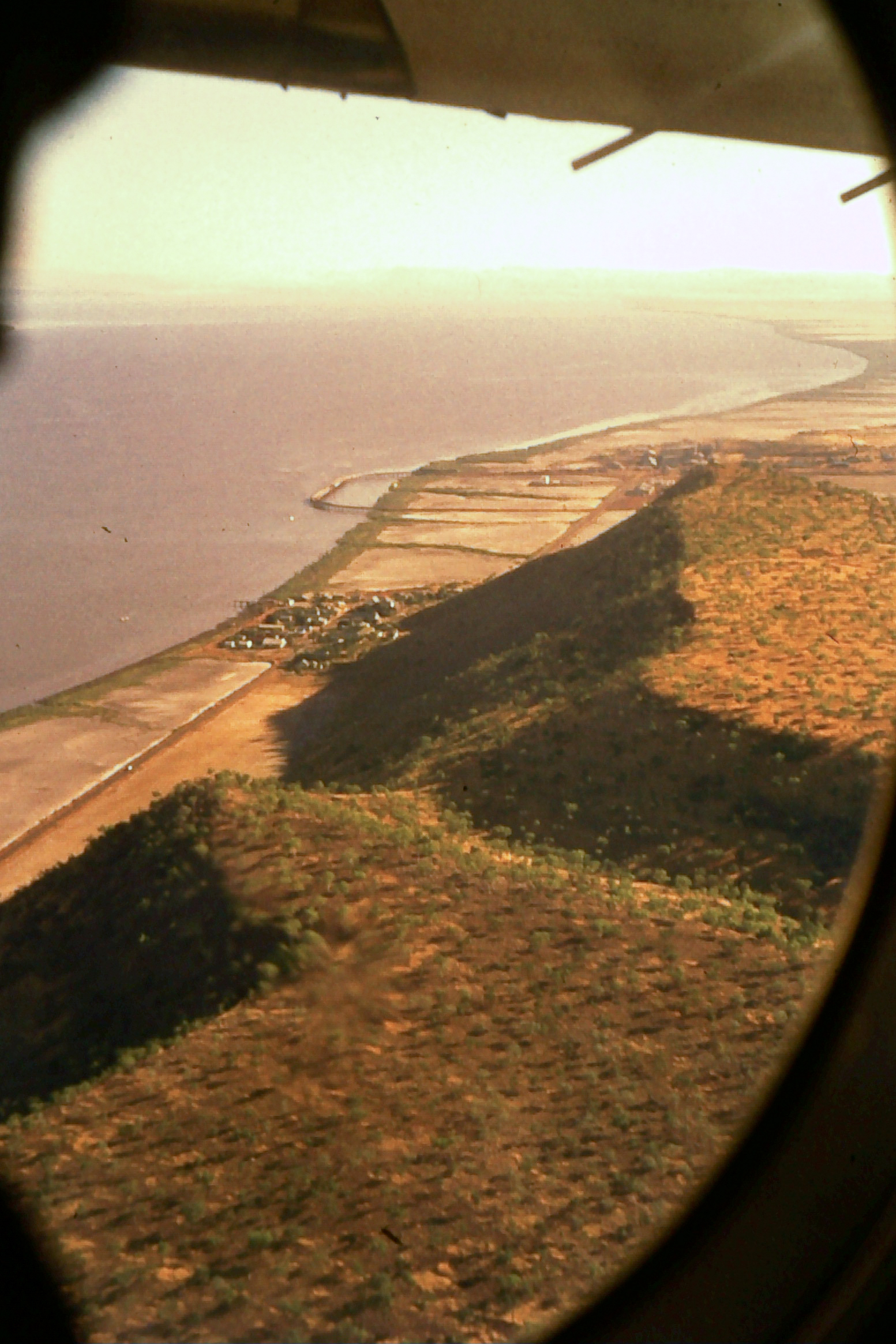
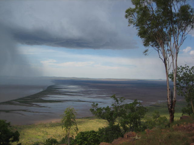
The western shore of the gulf is backed by highsandstone
Sandstone is a clastic sedimentary rock composed mainly of sand-sized (0.0625 to 2 mm) silicate grains. Sandstones comprise about 20–25% of all sedimentary rocks.
Most sandstone is composed of quartz or feldspar (both silicates) ...
hills that are to in height and with fringing colonies of mangroves
A mangrove is a shrub or tree that grows in coastal saline or brackish water. The term is also used for tropical coastal vegetation consisting of such species. Mangroves are taxonomically diverse, as a result of convergent evolution in several ...
and mudflats when the tide is low. Dense mangrove stands fringe the marshy area on the eastern shore of the gulf. Adolphus Island
Adolphus Island is an uninhabited island located in the Kimberley region of Western Australia. It is situated in Cambridge Gulf approximately north of Wyndham and covers an area of about . The island has a maximum height of approximately .
T ...
splits the southern end of the sound with a navigatable channel being found on the western arm.
History
Thetraditional owners
Native title is the designation given to the common law doctrine of Aboriginal title in Australia, which is the recognition by Australian law that Indigenous Australians (both Aboriginal Australian and Torres Strait Islander people) have rights ...
of the area are the Jeidji
The Yeidji, also spelt Yiiji and other variants, commonly known as Gwini/ Kwini, are an Aboriginal Australian people of the Kimberley area of Western Australia, who also self-identify as Balanggarra.
Name
In contemporary accounts, the Yeidji ...
people.
On 17 September 1819 Philip Parker King
Rear Admiral Phillip Parker King, FRS, RN (13 December 1791 – 26 February 1856) was an early explorer of the Australian and Patagonian coasts.
Early life and education
King was born on Norfolk Island, to Philip Gidley King and Anna J ...
on the survey cutter , who was mapping the entire north Australian coastline, landed at Lacrosse Island, from where he noticed a "deep opening" to the south.
Lacrosse Island is situated in the entrance of a deep opening trending to the South-South-West towards some steep rugged hills.This "deep opening" described came to be known as the Cambridge Gulf in the days that followed. On 18 September 1819 King's journal states.
At last quarter ebb we got underweigh and proceeded to examine the opening by steering South-South-West towards the deepest part; at twenty-three miles from Lacrosse Island the gulf is divided by Adolphus Island into two arms; one of which trended to the South-South-East and the other to the South-South-West. As the western arm appeared to be of most importance we entered it and, with a strong flood tide, proceeded with great rapidity; as sunset approached we began to look for an anchorage, but found much difficulty on account of the strength of the tides, the great depth of water, and, as I at first thought, the unfavourable quality of the bottom: at last the anchor was dropped close to the south-west shore of Adolphus Island in the entrance of another arm which appeared to trend to the south-east under Mount Connexion.It would seem from the description that the "arm" mentioned in the last sentence, was the
Ord River
The Ord River is a river in the Kimberley region of Western Australia. The river's catchment covers .
The lower Ord River and the conjunction with Cambridge Gulf create the most northern estuarine environment in Western Australia.
The Ord ...
, which was not named for another 60 years. ''Mermaid'' spent many days during which King sighted, mapped and named the Cambridge Gulf, which was named after the Duke of Cambridge
Duke of Cambridge, one of several current royal dukedoms in the United Kingdom , is a hereditary title of specific rank of nobility in the British royal family. The title (named after the city of Cambridge in England) is heritable by male de ...
. However, having first spotted the "deep opening" of the gulf on 17 September 1819, then spending 12 days within it, King did not name the gulf in his journal until 29 September 1819 when he was leaving it. Adolphus Island too was named after him.
Alexander Forrest
Alexander Forrest Order of St Michael and St George, CMG (22 September 1849 – 20 June 1901) was an explorer and surveying, surveyor of Western Australia, and later also a member of parliament.
As a government surveyor, Forrest explored many ...
was the next European to explore the area in 1879. However, the closest he got was to the junction of the Ord River
The Ord River is a river in the Kimberley region of Western Australia. The river's catchment covers .
The lower Ord River and the conjunction with Cambridge Gulf create the most northern estuarine environment in Western Australia.
The Ord ...
and the Negri River, near the WA/NT Border, both of these rivers being named by him. On 2 August 1879 Forrest records in his journal the following.
No-one can regret more than I do, that I am unable to follow this magnificent stream to its mouth, which I have no doubt will be found in Cambridge Gulf – the whole of its waters in that case being in Western Australian territory. I have named this river the Ord, after his excellency the Governor of Western Australia who has taken so great an interest in this expedition.By late 1884 some of the first settlers had begun to arrive in the Kimberley, travelling overland. By early 1885 people were arriving at the Cambridge Gulf to move inland in search for gold around
Halls Creek
Halls is a plural of the word hall.
Halls may also refer to:
People
* Walter Halls (1871–1953), British trade unionist and politician
* Ethel May Halls (1882–1967), American actress
* Julian Halls (born 1967), British field hockey player
* ...
, before the port was named as Wyndham in 1886. During the 1886 gold rush up to sixteen vessels would be moored in the gulf waiting to dock.
References
Further reading
* Durack, Mary,(1932) ''An outline of north Australian history from Cambridge Gulf to the Victoria River, 1818–1887''. Journal and Proceedings (Western Australian Historical Society), Vol. 2, pt. 12 (1932), p. 1–11 {{coord, 14, 54, S, 128, 14, E, display=title, region:AU_source:GNS-enwiki, name=Cambridge GulfExternal links
Kununurra Historical Society Inc.
Archive, Library, Museum & Research for history and images of Cambridge Gulf. Gulfs of Australia Ord River Kimberley coastline of Western Australia Estuaries of Western Australia