Cultural Property Of Great Importance on:
[Wikipedia]
[Google]
[Amazon]
Immovable Cultural Heritage of Great Importance ( sr, Непокретна културна добра од великог значаја / ''Nepokretna kulturna dobra od velikog značaja'') are those objects of Immovable
PKIC 2
, , Grocka Bazaar
,
PKIC 3
, , Old Downtown of
PKIC 6
, ,
,
PKIC 8
, , Grčki šor (Greek Street) ,
PKIC 9
, , Lukarevina Field ,
PKIC 12
, , Old downtown of
PKIC 15
, , Urban Ensembles of
PKIC 19
, , Village
PKIC 20
, , Part of the
PKIC 21
,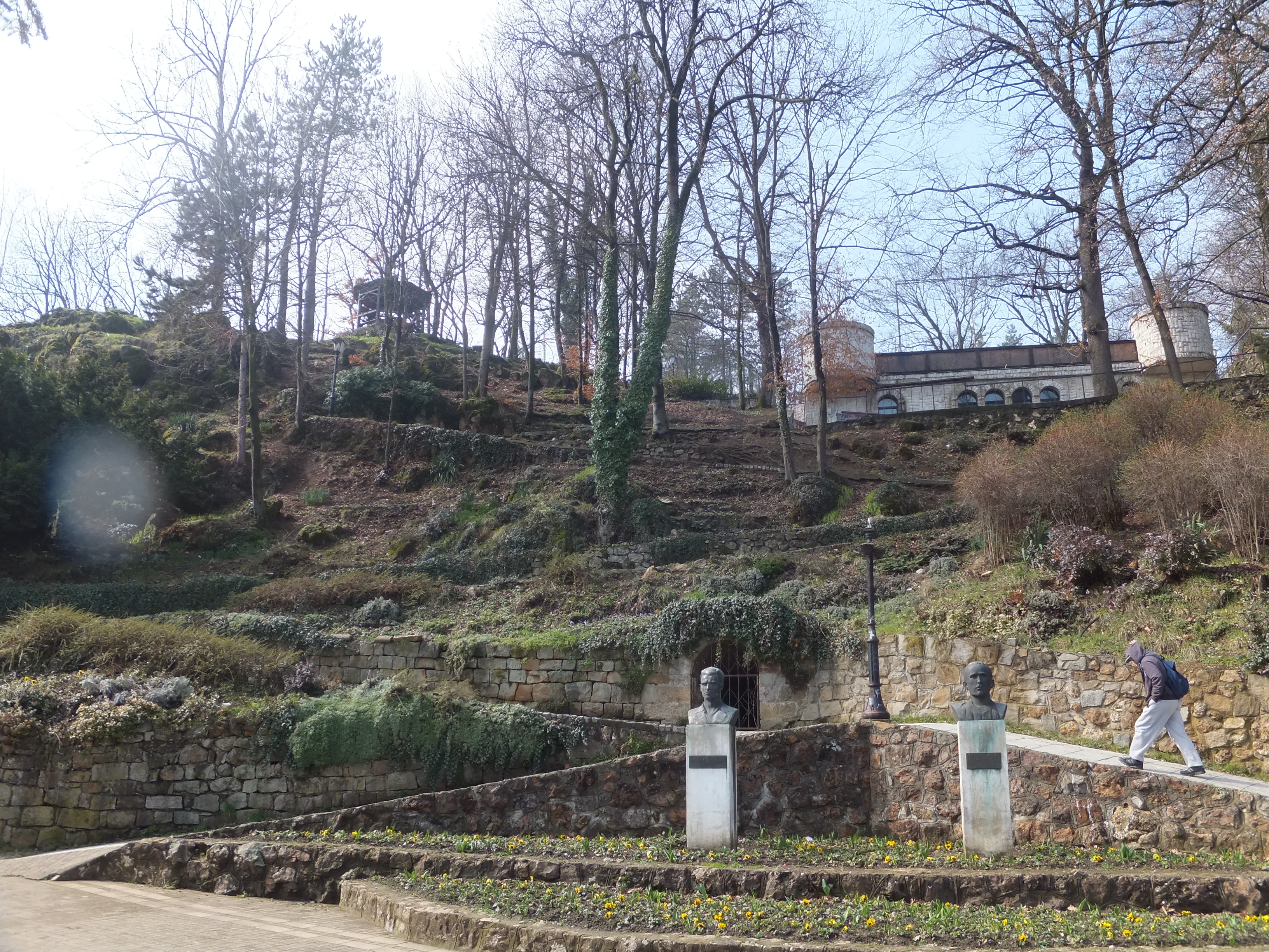 , Čajka's Hill
,
PKIC 27
, , Part of Bistrica Village
, Petrovac
, Bistrica
, 4 June 1986
, 5 December 1987
,
, -
PKIC 33
, , Baba Zlatina Street Complex ,
PKIC 41
, , Petrovaradin Upper and Lower Fortress with
PKIC 42
, , " Jodna banja" ("Iodine Spa") complex
,
PKIC 43
,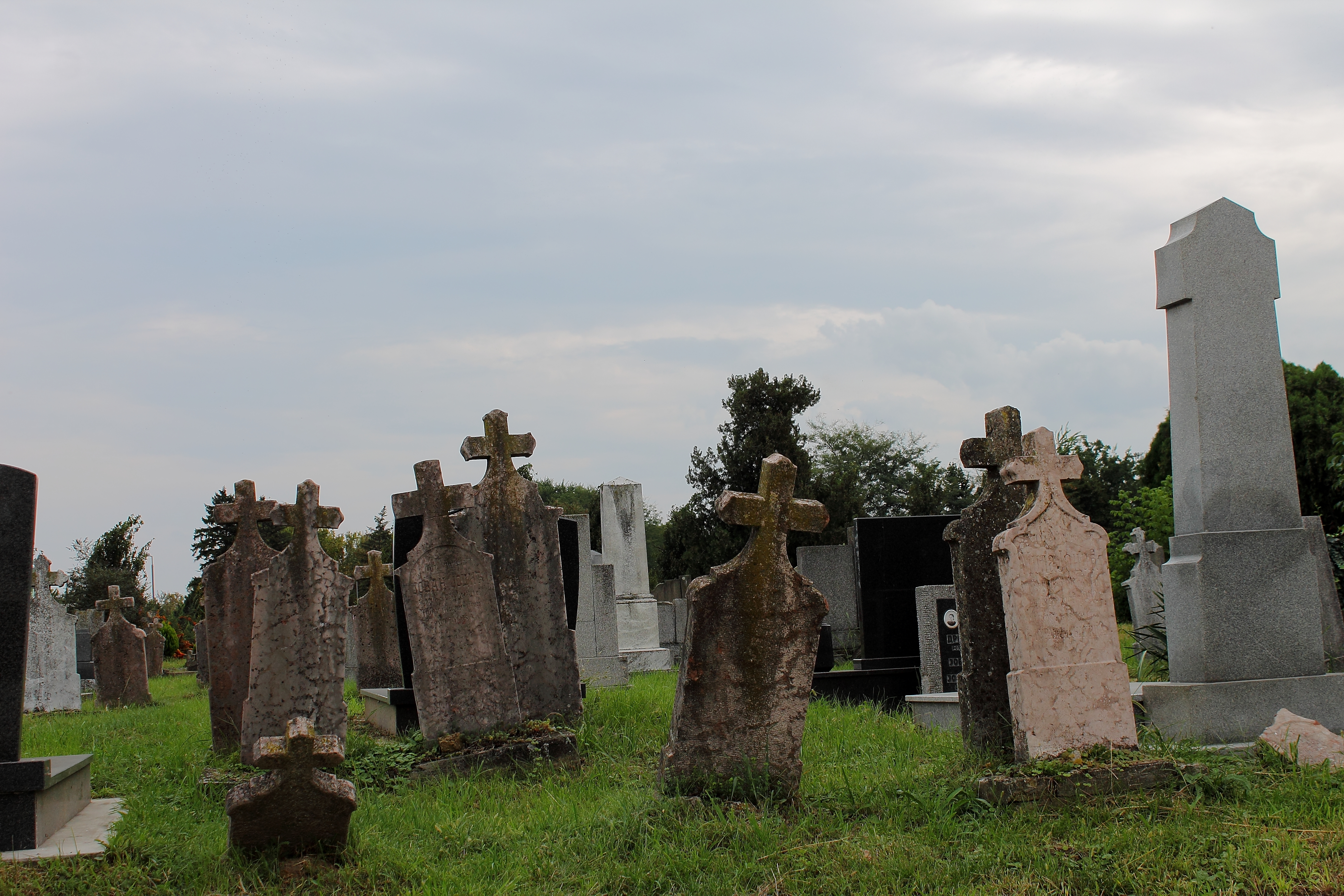 , Old Cemeteries of
PKIC 44
, , Marcibanji-Karačonji Castle and Park
,
PKIC 45
, ,
,
PKIC 46
, , Memorial Cemetery of the Fighters in the People's Liberation War
,
PKIC 48
, , Old Downtown of
PKIC 50
, , Old Downtown of
PKIC 51
, , Old Downtown of
PKIC 53
,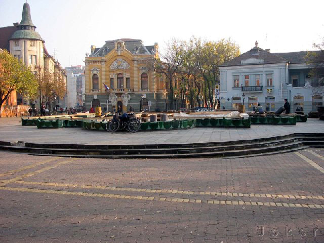 , Town Ensemble of
PKIC 54
, , Ethno-Park in
PKIC 55
,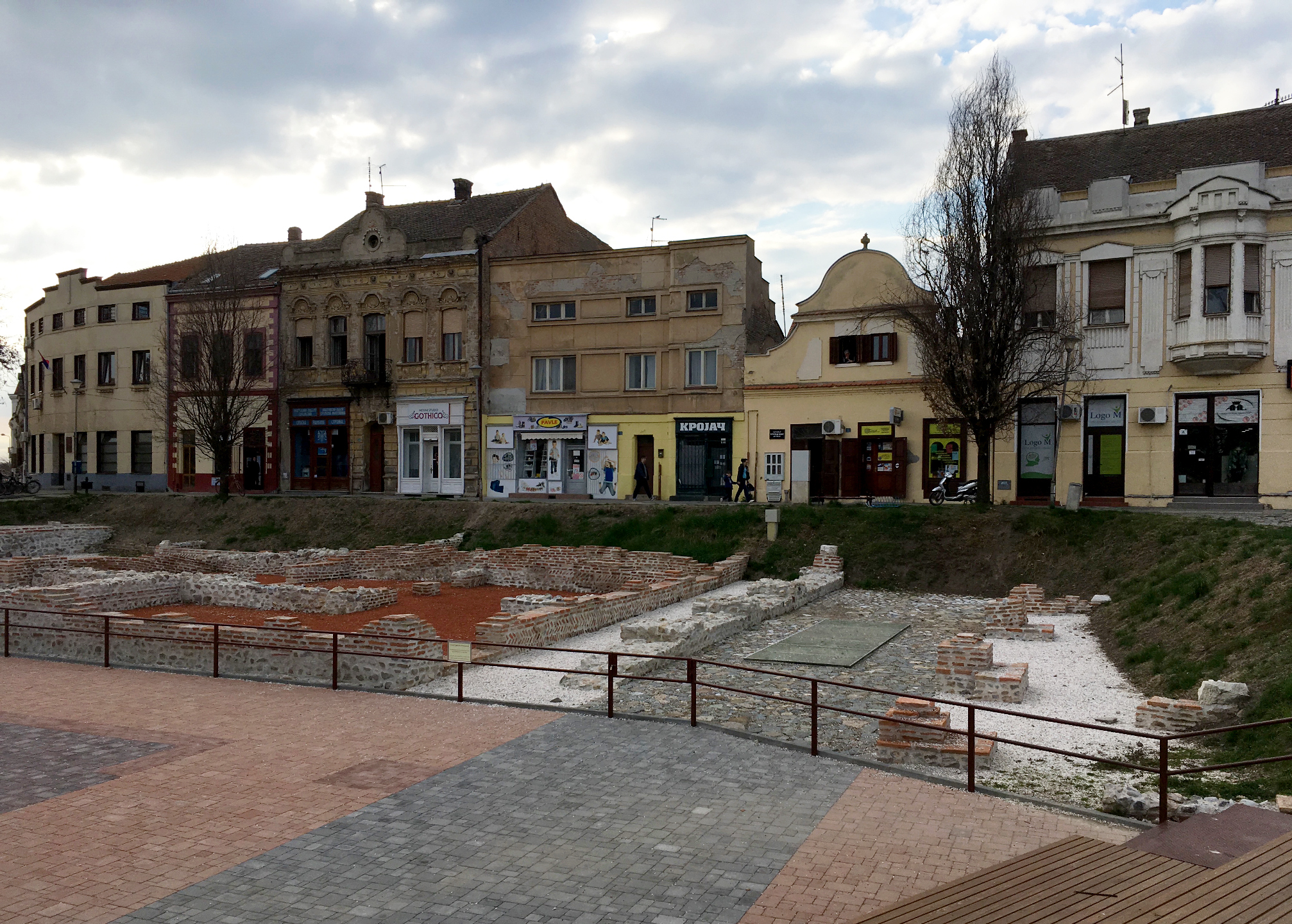 , Žitna pijaca Square (Bratstva i jedinstva)
,
PKIC 56
,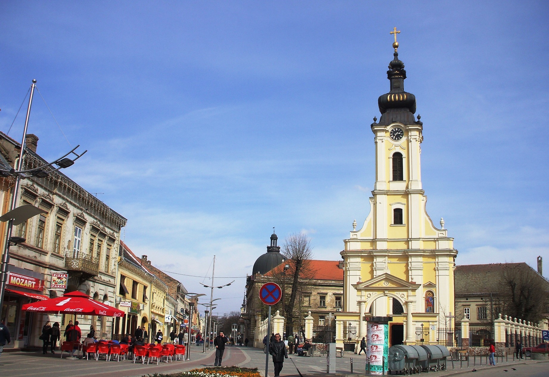 , Svetog Stefana Square (Narodnih Heroja)
,
PKIC 57
, , Town Ensemble of Irig
, Irig
, Irig
, 19 February 1974
, 28 October 1991
,
, -
PKIC 58
, , Old Downtown of
PKIC 60
, , Old Downtown of
cultural heritage
Cultural heritage is the heritage of tangible and intangible heritage assets of a group or society that is inherited from past generations. Not all heritages of past generations are "heritage"; rather, heritage is a product of selection by soci ...
that enjoy the second-highest level of state protection in the Republic of Serbia
Serbia (, ; Serbian: , , ), officially the Republic of Serbia ( Serbian: , , ), is a landlocked country in Southeastern and Central Europe, situated at the crossroads of the Pannonian Basin and the Balkans. It shares land borders with Hung ...
, behind the Immovable Cultural Heritage of Exceptional Importance. Immovable Cultural Heritage is classified as being of Great Importance upon decision by the National Assembly of Serbia
The National Assembly ( sr-cyr, Народна скупштина, Narodna skupština, ) is the unicameral legislature of Serbia. The assembly is composed of 250 deputies who are proportionally elected to four-year terms by secret ballot. The as ...
. They are inscribed in the ''Central Register of Immovable cultural property'' maintained by the Institute for the Protection of Cultural Monuments of Serbia
An institute is an organisational body created for a certain purpose. They are often research organisations (research institutes) created to do research on specific topics, or can also be a professional body.
In some countries, institutes can ...
. Objects of Immovable cultural heritage have to fulfill one or more of those criteria defined in the ''Law on Cultural Heritage'' of 1994 in order to be categorized as being "of great importance":
# importance for a certain area or time-span;
# evidence of social or natural development, or the socio-economic and cultural-historic development conditions during a certain time-span;
#evidence about important historic events or persons from the national history.
According to the Law, there are four classes of Immovable Cultural Heritage: Cultural Monuments, Archaeological Sites, Historic Landmarks and Spatial Cultural-Historical Units. Objects in each of those classes can be categorized as being "of great importance" by the National Assembly.
List of Cultural Heritage of Great Importance
There are currently 2592 objects of immovable cultural heritage inscribed in the ''Central Register'', 582 of which are categorized as being "of great importance" (512 cultural monuments, 25 archaeological sites, 17 historic landmarks and 28 spatial cultural-historical units).Cultural monuments of Great Importance
Archaeological Sites of Great Importance
Historic Landmarks of Great Importance
Spatial Cultural-Historical Units of Great Importance
{, class="wikitable sortable" style="text-align:center" !Number in the Central Register ! style="background:#FFDEAD;" , Picture ! style="background:#FFDEAD;" , Name ! style="background:#FFDEAD;" , City/Municipality ! style="background:#FFDEAD;" , Location address ! style="background:#FFDEAD;" , designated cultural heritage !Great importance since ! style="background:#FFDEAD;" , Comment , -PKIC 2
,
 , Grocka Bazaar
,
 Belgrade
Belgrade ( , ;, ; Names of European cities in different languages: B, names in other languages) is the Capital city, capital and List of cities in Serbia, largest city in Serbia. It is located at the confluence of the Sava and Danube rivers a ...
/ Grocka
Grocka ( sr-cyr, Гроцка, ) or Grocka na Dunavu ( sr-cyr, Гроцка на Дунаву, ) is a municipality of the city of Belgrade. According to the 2011 census results, the municipality has 83,906 inhabitants.
Location and geography
The ...
, Grocka
Grocka ( sr-cyr, Гроцка, ) or Grocka na Dunavu ( sr-cyr, Гроцка на Дунаву, ) is a municipality of the city of Belgrade. According to the 2011 census results, the municipality has 83,906 inhabitants.
Location and geography
The ...
Bulevar oslobođenja St.
, 12 May 1966
, 7 April 1979
,
, -PKIC 3
,
 , Old Downtown of
 Zemun
Zemun ( sr-cyrl, Земун, ; hu, Zimony) is a municipality in the city of Belgrade. Zemun was a separate town that was absorbed into Belgrade in 1934. It lies on the right bank of the Danube river, upstream from downtown Belgrade. The developme ...
, Belgrade
Belgrade ( , ;, ; Names of European cities in different languages: B, names in other languages) is the Capital city, capital and List of cities in Serbia, largest city in Serbia. It is located at the confluence of the Sava and Danube rivers a ...
/ Zemun
Zemun ( sr-cyrl, Земун, ; hu, Zimony) is a municipality in the city of Belgrade. Zemun was a separate town that was absorbed into Belgrade in 1934. It lies on the right bank of the Danube river, upstream from downtown Belgrade. The developme ...
, Zemun
Zemun ( sr-cyrl, Земун, ; hu, Zimony) is a municipality in the city of Belgrade. Zemun was a separate town that was absorbed into Belgrade in 1934. It lies on the right bank of the Danube river, upstream from downtown Belgrade. The developme ...
, 1 November 1966
, 7 April 1979
,
, -PKIC 6
,
Kosančićev venac
Kosančićev Venac ( sr-Cyrl, Косанчићев Венац) is an List of Belgrade neighborhoods, urban neighborhood of Belgrade, the capital of Serbia. It is located in Belgrade's municipality of Stari Grad, Belgrade, Stari Grad. It has been d ...
, Belgrade
Belgrade ( , ;, ; Names of European cities in different languages: B, names in other languages) is the Capital city, capital and List of cities in Serbia, largest city in Serbia. It is located at the confluence of the Sava and Danube rivers a ...
/ Stari Grad
, Beograd
, 24 May 1971
, 7 April 1979
, From Savski Bridge to the corner of the streets Karađorđeva and Pariska, Pariska St., Gračanička St., Ivan-Brgova St., Pop Lukina St., to Savski most
, -PKIC 8
, , Grčki šor (Greek Street) ,
Kruševac
Kruševac ( sr-cyr, Крушевац, , tr, Alacahisar or Kruşevca) is a city and the administrative center of the Rasina District in central Serbia. It is located in the valley of West Morava, on Rasina river. According to the 2011 census, t ...
, Kruševac
Kruševac ( sr-cyr, Крушевац, , tr, Alacahisar or Kruşevca) is a city and the administrative center of the Rasina District in central Serbia. It is located in the valley of West Morava, on Rasina river. According to the 2011 census, t ...
Vuka Karadžića St.
, 5 July 1967
, 7 April 1979
,
, -PKIC 9
, , Lukarevina Field ,
Aleksandrovac
Aleksandrovac ( sr-cyr, Александровац) is a town and municipality located in the Rasina District of central Serbia. As of 2011, the town has a population of 6,476 inhabitants, while the municipality has 26,522 inhabitants.
History
Fr ...
, Drenča
Drenča ( sr-cyrl, Дренча) is a village in the municipality of Aleksandrovac, Serbia
Serbia (, ; Serbian language, Serbian: , , ), officially the Republic of Serbia (Serbian language, Serbian: , , ), is a landlocked country in Southe ...
, 22 October 1982
, 21 July 1983
,
, -PKIC 12
, , Old downtown of
Negotin
Negotin ( sr-cyrl, Неготин, ; ro, Negotin) is a town and municipality located in the Bor District of the eastern Serbia. It is situated near the borders between Serbia, Romania and Bulgaria. It is the judicial center of the Bor District. ...
, Negotin
Negotin ( sr-cyrl, Неготин, ; ro, Negotin) is a town and municipality located in the Bor District of the eastern Serbia. It is situated near the borders between Serbia, Romania and Bulgaria. It is the judicial center of the Bor District. ...
, Negotin
Negotin ( sr-cyrl, Неготин, ; ro, Negotin) is a town and municipality located in the Bor District of the eastern Serbia. It is situated near the borders between Serbia, Romania and Bulgaria. It is the judicial center of the Bor District. ...
, 3 July 1980
, 21 July 1983
,
, -PKIC 15
,
Kragujevac
Kragujevac ( sr-Cyrl, Крагујевац, ) is the fourth largest city in Serbia and the administrative centre of the Šumadija District. It is the historical centre of the geographical region of Šumadija in central Serbia, and is situated on ...
, Kragujevac
Kragujevac ( sr-Cyrl, Крагујевац, ) is the fourth largest city in Serbia and the administrative centre of the Šumadija District. It is the historical centre of the geographical region of Šumadija in central Serbia, and is situated on ...
, Kragujevac
Kragujevac ( sr-Cyrl, Крагујевац, ) is the fourth largest city in Serbia and the administrative centre of the Šumadija District. It is the historical centre of the geographical region of Šumadija in central Serbia, and is situated on ...
, 16 June 1970
, 7 April 1979
,
, -PKIC 19
,
 , Village
 Godovik
Godovik is a village in the municipality of Požega, western Serbia
Serbia (, ; Serbian: , , ), officially the Republic of Serbia (Serbian: , , ), is a landlocked country in Southeastern and Central Europe, situated at the crossroads of t ...
Narrow Area
, Požega
, Godovik
Godovik is a village in the municipality of Požega, western Serbia
Serbia (, ; Serbian: , , ), officially the Republic of Serbia (Serbian: , , ), is a landlocked country in Southeastern and Central Europe, situated at the crossroads of t ...
, 28 April 1981
, 21 July 1983
,
, -PKIC 20
,
 , Part of the
 Ivanjica
)
, motto =
, image_map =
, map_caption =
, pushpin_map_caption = Location within Serbia##Location within Europe
, pushpin_relief = 1
, pushpin_map = Serbia#Europe
, coo ...
Town Center
, Ivanjica
)
, motto =
, image_map =
, map_caption =
, pushpin_map_caption = Location within Serbia##Location within Europe
, pushpin_relief = 1
, pushpin_map = Serbia#Europe
, coo ...
, Ivanjica
)
, motto =
, image_map =
, map_caption =
, pushpin_map_caption = Location within Serbia##Location within Europe
, pushpin_relief = 1
, pushpin_map = Serbia#Europe
, coo ...
, 8 July 1983
, 5 December 1987
,
, -PKIC 21
,
 , Čajka's Hill
,
 Vrnjačka Banja
Vrnjačka Banja ( sr-cyr, Врњачка Бања) is a town and municipality located in the Raška District of central Serbia. The population of the town is 10,065 inhabitants, while the population of the municipality is 27,527 inhabitants.
Vrnja ...
, Vrnjačka Banja
Vrnjačka Banja ( sr-cyr, Врњачка Бања) is a town and municipality located in the Raška District of central Serbia. The population of the town is 10,065 inhabitants, while the population of the municipality is 27,527 inhabitants.
Vrnja ...
, 30 May 1985
, 5 December 1987
,
, -PKIC 27
,
 , Part of Bistrica Village
, Petrovac
, Bistrica
, 4 June 1986
, 5 December 1987
,
, -
, Part of Bistrica Village
, Petrovac
, Bistrica
, 4 June 1986
, 5 December 1987
,
, -PKIC 33
, , Baba Zlatina Street Complex ,
Vranje
Vranje ( sr-Cyrl, Врање, ) is a city in Southern Serbia and the administrative center of the Pčinja District. The municipality of Vranje has a population of 83,524 and its urban area has 60,485 inhabitants.
Vranje is the economical, polit ...
, Vranje
Vranje ( sr-Cyrl, Врање, ) is a city in Southern Serbia and the administrative center of the Pčinja District. The municipality of Vranje has a population of 83,524 and its urban area has 60,485 inhabitants.
Vranje is the economical, polit ...
Baba Zlatina St.
, 30 June 1986
, 5 December 1987
,
, -PKIC 41
, , Petrovaradin Upper and Lower Fortress with
Suburb
A suburb (more broadly suburban area) is an area within a metropolitan area, which may include commercial and mixed-use, that is primarily a residential area. A suburb can exist either as part of a larger city/urban area or as a separate ...
, Novi Sad
Novi Sad ( sr-Cyrl, Нови Сад, ; hu, Újvidék, ; german: Neusatz; see below for other names) is the second largest city in Serbia and the capital of the autonomous province of Vojvodina. It is located in the southern portion of the Pan ...
/ Petrovaradin
Petrovaradin ( sr-cyr, Петроварадин, ) is a historic town in the Serbian province of Vojvodina, now a part of the city of Novi Sad. As of 2011, the urban area has 14,810 inhabitants. Lying on the right bank of the Danube, across from t ...
, Petrovaradin
Petrovaradin ( sr-cyr, Петроварадин, ) is a historic town in the Serbian province of Vojvodina, now a part of the city of Novi Sad. As of 2011, the urban area has 14,810 inhabitants. Lying on the right bank of the Danube, across from t ...
, 19 February 1946
, 28 October 1991
,
, -PKIC 42
,
 , " Jodna banja" ("Iodine Spa") complex
,
 Novi Sad
Novi Sad ( sr-Cyrl, Нови Сад, ; hu, Újvidék, ; german: Neusatz; see below for other names) is the second largest city in Serbia and the capital of the autonomous province of Vojvodina. It is located in the southern portion of the Pan ...
, Novi Sad
Novi Sad ( sr-Cyrl, Нови Сад, ; hu, Újvidék, ; german: Neusatz; see below for other names) is the second largest city in Serbia and the capital of the autonomous province of Vojvodina. It is located in the southern portion of the Pan ...
Bulevar revolucije St. no. 14
, 30 July 1986
, 28 October 1991
,
, -PKIC 43
,
Novi Sad
Novi Sad ( sr-Cyrl, Нови Сад, ; hu, Újvidék, ; german: Neusatz; see below for other names) is the second largest city in Serbia and the capital of the autonomous province of Vojvodina. It is located in the southern portion of the Pan ...
, Novi Sad
Novi Sad ( sr-Cyrl, Нови Сад, ; hu, Újvidék, ; german: Neusatz; see below for other names) is the second largest city in Serbia and the capital of the autonomous province of Vojvodina. It is located in the southern portion of the Pan ...
, Novi Sad
Novi Sad ( sr-Cyrl, Нови Сад, ; hu, Újvidék, ; german: Neusatz; see below for other names) is the second largest city in Serbia and the capital of the autonomous province of Vojvodina. It is located in the southern portion of the Pan ...
, 7 November 1973
, 28 October 1991
, Includes: Uspensko, Almaško (pictured), Jewish and Catholic cemeteries in Novi Sad.
, -PKIC 44
,
Novi Sad
Novi Sad ( sr-Cyrl, Нови Сад, ; hu, Újvidék, ; german: Neusatz; see below for other names) is the second largest city in Serbia and the capital of the autonomous province of Vojvodina. It is located in the southern portion of the Pan ...
/ Petrovaradin
Petrovaradin ( sr-cyr, Петроварадин, ) is a historic town in the Serbian province of Vojvodina, now a part of the city of Novi Sad. As of 2011, the urban area has 14,810 inhabitants. Lying on the right bank of the Danube, across from t ...
, Sremska Kamenica
Sremska Kamenica (Serbian Cyrillic: ''Сремска Каменица'', ) is a town and urban neighborhood of Novi Sad, in Serbia.
Name
In Serbian, the town is known as ''Sremska Kamenica'' (Сремска Каменица), in Croatian ...
Dvor St. no. 1
, 22 February 1974
, 28 October 1991
,
, -PKIC 45
,
 ,
, Synagogue
A synagogue, ', 'house of assembly', or ', "house of prayer"; Yiddish: ''shul'', Ladino: or ' (from synagogue); or ', "community". sometimes referred to as shul, and interchangeably used with the word temple, is a Jewish house of worshi ...
, Jewish School and Jewish Municipal Authorities Building
, Novi Sad
Novi Sad ( sr-Cyrl, Нови Сад, ; hu, Újvidék, ; german: Neusatz; see below for other names) is the second largest city in Serbia and the capital of the autonomous province of Vojvodina. It is located in the southern portion of the Pan ...
, Novi Sad
Novi Sad ( sr-Cyrl, Нови Сад, ; hu, Újvidék, ; german: Neusatz; see below for other names) is the second largest city in Serbia and the capital of the autonomous province of Vojvodina. It is located in the southern portion of the Pan ...
Jevrejska St. no. 9-11
, 16 May 1983
, 28 October 1991
,
, -PKIC 46
,
 , Memorial Cemetery of the Fighters in the People's Liberation War
,
 Novi Sad
Novi Sad ( sr-Cyrl, Нови Сад, ; hu, Újvidék, ; german: Neusatz; see below for other names) is the second largest city in Serbia and the capital of the autonomous province of Vojvodina. It is located in the southern portion of the Pan ...
, Novi Sad
Novi Sad ( sr-Cyrl, Нови Сад, ; hu, Újvidék, ; german: Neusatz; see below for other names) is the second largest city in Serbia and the capital of the autonomous province of Vojvodina. It is located in the southern portion of the Pan ...
, 28 January 1985
, 28 October 1991
,
, -PKIC 48
, , Old Downtown of
Zrenjanin
Zrenjanin ( sr-Cyrl, Зрењанин, ; hu, Nagybecskerek; ro, Becicherecu Mare; sk, Zreňanin; german: Großbetschkerek) is a List of cities in Serbia, city and the administrative center of the Central Banat District in the autonomous pro ...
, Zrenjanin
Zrenjanin ( sr-Cyrl, Зрењанин, ; hu, Nagybecskerek; ro, Becicherecu Mare; sk, Zreňanin; german: Großbetschkerek) is a List of cities in Serbia, city and the administrative center of the Central Banat District in the autonomous pro ...
, Zrenjanin
Zrenjanin ( sr-Cyrl, Зрењанин, ; hu, Nagybecskerek; ro, Becicherecu Mare; sk, Zreňanin; german: Großbetschkerek) is a List of cities in Serbia, city and the administrative center of the Central Banat District in the autonomous pro ...
, 15 October 1968
, 28 October 1991
,
, -PKIC 50
,
 , Old Downtown of
 Banatsko Novo Selo
Banatsko Novo Selo ( sr-cyr, Банатско Ново Село ) is a village located in the municipality of Pančevo, South Banat District, Vojvodina, Serbia. The village has a Serb ethnic majority and its population numbering 7,089 people ( 2 ...
, Pančevo
Pančevo (Serbian Cyrillic: Панчево, ; german: Pantschowa; hu, Pancsova; ro, Panciova; sk, Pánčevo) is a city and the administrative center of the South Banat District in the autonomous province of Vojvodina, Serbia. It is located on ...
, Banatsko Novo Selo
Banatsko Novo Selo ( sr-cyr, Банатско Ново Село ) is a village located in the municipality of Pančevo, South Banat District, Vojvodina, Serbia. The village has a Serb ethnic majority and its population numbering 7,089 people ( 2 ...
, 12 January 1973
, 28 October 1991
,
, -PKIC 51
,
 , Old Downtown of
 Bečej
Bečej ( sr-cyrl, Бечеј, ; hu, Óbecse, ) is a town and municipality located in the South Bačka District of the autonomous province of Vojvodina, Serbia. The town has a population of 23,895, while the municipality has 37,351 inhabitants. It ...
– Pogača Square
, Bečej
Bečej ( sr-cyrl, Бечеј, ; hu, Óbecse, ) is a town and municipality located in the South Bačka District of the autonomous province of Vojvodina, Serbia. The town has a population of 23,895, while the municipality has 37,351 inhabitants. It ...
, Bečej
Bečej ( sr-cyrl, Бечеј, ; hu, Óbecse, ) is a town and municipality located in the South Bačka District of the autonomous province of Vojvodina, Serbia. The town has a population of 23,895, while the municipality has 37,351 inhabitants. It ...
, 2 February 1976
, 28 October 1991
,
, -PKIC 53
,
 , Town Ensemble of
 Subotica
Subotica ( sr-cyrl, Суботица, ; hu, Szabadka) is a List of cities in Serbia, city and the administrative center of the North Bačka District in the autonomous province of Vojvodina, Serbia. Formerly the largest city of Vojvodina region, ...
, Subotica
Subotica ( sr-cyrl, Суботица, ; hu, Szabadka) is a List of cities in Serbia, city and the administrative center of the North Bačka District in the autonomous province of Vojvodina, Serbia. Formerly the largest city of Vojvodina region, ...
, Subotica
Subotica ( sr-cyrl, Суботица, ; hu, Szabadka) is a List of cities in Serbia, city and the administrative center of the North Bačka District in the autonomous province of Vojvodina, Serbia. Formerly the largest city of Vojvodina region, ...
, 31 December 1986
, 28 October 1991
,
, -PKIC 54
,
 , Ethno-Park in
 Kupinovo
Kupinovo () is a village located in the municipality of Pećinci, Serbia. As of 2011 census, the village has 1,866 inhabitants.
It is near the famous biodiversity area, the Obedska bara. This contains several insects and other life forms unique t ...
, Pećinci
Pećinci (, ; hu, Pecsince) is a village and municipality located in the Srem District of the autonomous province of Vojvodina, Serbia. The village has a population of 2,581 (2011), while Pećinci municipality has 19,720 inhabitants.
Name
In ...
, Kupinovo
Kupinovo () is a village located in the municipality of Pećinci, Serbia. As of 2011 census, the village has 1,866 inhabitants.
It is near the famous biodiversity area, the Obedska bara. This contains several insects and other life forms unique t ...
B. Markovića St. no. 140, 142, 138, 136, 146, 134, 148, 150, 127
, 9 February 1977
, 28 October 1991
,
, -PKIC 55
,
 , Žitna pijaca Square (Bratstva i jedinstva)
,
 Sremska Mitrovica
Sremska Mitrovica (; sr-Cyrl, Сремска Митровица, hu, Szávaszentdemeter, la, Sirmium) is a city and the administrative center of the Srem District in the autonomous province of Vojvodina, Serbia. It is situated on the left bank ...
, Sremska Mitrovica
Sremska Mitrovica (; sr-Cyrl, Сремска Митровица, hu, Szávaszentdemeter, la, Sirmium) is a city and the administrative center of the Srem District in the autonomous province of Vojvodina, Serbia. It is situated on the left bank ...
Žitna pijaca Square
, 9 April 1966
, 28 October 1991
,
, -PKIC 56
,
Sremska Mitrovica
Sremska Mitrovica (; sr-Cyrl, Сремска Митровица, hu, Szávaszentdemeter, la, Sirmium) is a city and the administrative center of the Srem District in the autonomous province of Vojvodina, Serbia. It is situated on the left bank ...
, Sremska Mitrovica
Sremska Mitrovica (; sr-Cyrl, Сремска Митровица, hu, Szávaszentdemeter, la, Sirmium) is a city and the administrative center of the Srem District in the autonomous province of Vojvodina, Serbia. It is situated on the left bank ...
Svetog Stefana Square
, 4 April 1966
, 28 October 1991
,
, -PKIC 57
,
 , Town Ensemble of Irig
, Irig
, Irig
, 19 February 1974
, 28 October 1991
,
, -
, Town Ensemble of Irig
, Irig
, Irig
, 19 February 1974
, 28 October 1991
,
, -PKIC 58
,
 , Old Downtown of
 Pančevo
Pančevo (Serbian Cyrillic: Панчево, ; german: Pantschowa; hu, Pancsova; ro, Panciova; sk, Pánčevo) is a city and the administrative center of the South Banat District in the autonomous province of Vojvodina, Serbia. It is located on ...
, Pančevo
Pančevo (Serbian Cyrillic: Панчево, ; german: Pantschowa; hu, Pancsova; ro, Panciova; sk, Pánčevo) is a city and the administrative center of the South Banat District in the autonomous province of Vojvodina, Serbia. It is located on ...
, Pančevo
Pančevo (Serbian Cyrillic: Панчево, ; german: Pantschowa; hu, Pancsova; ro, Panciova; sk, Pánčevo) is a city and the administrative center of the South Banat District in the autonomous province of Vojvodina, Serbia. It is located on ...
, 2 April 1973
, 28 October 1991
,
, -PKIC 60
,
 , Old Downtown of
 Sombor
Sombor ( sr-Cyrl, Сомбор, ; hu, Zombor; rue, Зомбор, Zombor) is a List of cities in Serbia, city and the administrative center of the West Bačka District in the autonomous province of Vojvodina, Serbia. The city has a total popula ...
"Venac"
, Sombor
Sombor ( sr-Cyrl, Сомбор, ; hu, Zombor; rue, Зомбор, Zombor) is a List of cities in Serbia, city and the administrative center of the West Bačka District in the autonomous province of Vojvodina, Serbia. The city has a total popula ...
, Sombor
Sombor ( sr-Cyrl, Сомбор, ; hu, Zombor; rue, Зомбор, Zombor) is a List of cities in Serbia, city and the administrative center of the West Bačka District in the autonomous province of Vojvodina, Serbia. The city has a total popula ...
, 19 June 1969
, 28 October 1991
,
See also
* Cultural Heritage of Serbia *List of World Heritage Sites in Serbia
The United Nations Educational, Scientific and Cultural Organization (UNESCO) designates World Heritage Sites of outstanding universal value to cultural or natural heritage which have been nominated by countries which are signatories to the UNESC ...
*List of fortifications in Serbia
This is a list of fortifications in Serbia. The list includes remains (ruins) of military constructions; fortresses (''tvrđave''), castles (''zamci''), towers (''kule''), etc. There are over 30 preserved forts in Serbia, and more than hundreds ...
*List of protected natural resources in Serbia
Protected areas cover around 5% of the territory of Serbia. The ''Law on the Protection of the Nature'' defines these categories of protected areas:
* Strict nature reserve — Area of unmodified natural features with representative ecosystems s ...
References