Crick, Northamptonshire on:
[Wikipedia]
[Google]
[Amazon]
Crick is a village in

 The Leicester Line of the
West Northamptonshire Local History website
{{authority control Villages in Northamptonshire West Northamptonshire District Civil parishes in Northamptonshire
West Northamptonshire
West Northamptonshire is a unitary authority area covering part of the ceremonial county of Northamptonshire, England, created in 2021. By far the largest settlement in West Northamptonshire is the county town of Northampton. Its other signif ...
in England
England is a country that is part of the United Kingdom. It shares land borders with Wales to its west and Scotland to its north. The Irish Sea lies northwest and the Celtic Sea to the southwest. It is separated from continental Europe b ...
. It is close to the border with Warwickshire
Warwickshire (; abbreviated Warks) is a county in the West Midlands region of England. The county town is Warwick, and the largest town is Nuneaton. The county is famous for being the birthplace of William Shakespeare at Stratford-upon-Avon an ...
, east of Rugby
Rugby may refer to:
Sport
* Rugby football in many forms:
** Rugby league: 13 players per side
*** Masters Rugby League
*** Mod league
*** Rugby league nines
*** Rugby league sevens
*** Touch (sport)
*** Wheelchair rugby league
** Rugby union: 1 ...
and northwest of Northampton. The villages of Crick and West Haddon
West or Occident is one of the four cardinal directions or points of the compass. It is the opposite direction from east and is the direction in which the Sun sets on the Earth.
Etymology
The word "west" is a Germanic word passed into some R ...
were by-passed by the A428 main road from Rugby to Northampton
Northampton () is a market town and civil parish in the East Midlands of England, on the River Nene, north-west of London and south-east of Birmingham. The county town of Northamptonshire, Northampton is one of the largest towns in England; ...
when the Daventry International Rail Freight Terminal (DIRFT) was built in 1996. The terminal is a short distance east of junction 18 of the M1 motorway
The M1 motorway connects London to Leeds, where it joins the A1(M) near Aberford, to connect to Newcastle. It was the first inter-urban motorway to be completed in the UK; the first motorway in the country was the Preston By-pass, which lat ...
, which is next to Crick. Crick's population in the 2001 census was 1,460, increasing to 1,886 at the 2011 census.
History
Crick takes its name from theBrittonic
Brittonic or Brythonic may refer to:
*Common Brittonic, or Brythonic, the Celtic language anciently spoken in Great Britain
*Brittonic languages, a branch of the Celtic languages descended from Common Brittonic
*Britons (Celtic people)
The Br ...
Celtic
Celtic, Celtics or Keltic may refer to:
Language and ethnicity
*pertaining to Celts, a collection of Indo-European peoples in Europe and Anatolia
**Celts (modern)
*Celtic languages
**Proto-Celtic language
* Celtic music
*Celtic nations
Sports Fo ...
word for “hill,” “cruc.” There are many similar examples across Wales
Wales ( cy, Cymru ) is a Countries of the United Kingdom, country that is part of the United Kingdom. It is bordered by England to the Wales–England border, east, the Irish Sea to the north and west, the Celtic Sea to the south west and the ...
, for example Crughywel, Crug Mawr
Crug Mawr is a hill in the Black Mountains in the Brecon Beacons National Park in southern Powys, Wales. Its summit at a height of 550 m (1,805 ft) is marked by a trig point. The peak sits high above the valleys of the Grwyne Fawr an ...
and Crickadarn
Erwood ( cy, Erwyd) is a village and community lying beside the River Wye, on the A470 road some 6 miles south-east of Builth Wells in Powys, Wales. The population of the community taken at the 2011 census was 429. It is in the historic county ...
. Crack's Hill () is about northeast of the village, next to the canal, and gives good views of Crick, Yelvertoft
Yelvertoft is a village and civil parish in West Northamptonshire unitary authority in the county of Northamptonshire, England. At the time of the 2001 census, the parish's population was 821 people, reducing to 764 at the 2011 Census.
Yelve ...
, West Haddon
West or Occident is one of the four cardinal directions or points of the compass. It is the opposite direction from east and is the direction in which the Sun sets on the Earth.
Etymology
The word "west" is a Germanic word passed into some R ...
and Rugby
Rugby may refer to:
Sport
* Rugby football in many forms:
** Rugby league: 13 players per side
*** Masters Rugby League
*** Mod league
*** Rugby league nines
*** Rugby league sevens
*** Touch (sport)
*** Wheelchair rugby league
** Rugby union: 1 ...
from the top. Kilsby and Crick railway station
Kilsby and Crick was a railway station on the Northampton Loop Line serving the villages of Kilsby and Crick in Northamptonshire. It was located to the eastern side of where the railway crossed the A5 road at the site now occupied by the Dav ...
was located west of the village between 1881 and 1960.
Notable buildings
The Historic England website contains details of a total of 48 listed buildings in the parish of Crick, all of which are Grade II except for St Margaret’s Church which is Grade I. Details of some of these are as follows:St Margaret’s Church, Church Street
This building was erected in a perpendicular style in the 14th and 15th centuries, incorporating some 12th-century work. It includes a nave, two aisles, north sacristy, south porch and west tower. The walls are constructed of coursed ironstone and limestone rubble, with coursed ironstone and sandstone in the tower. The roofs are of tile and lead. There is a Romanesque sandstone font, whose base consists of three crouching figures. It was restored in 1840 by RC Hussey, and thus contains a number of elements from that era.Ex-Servicemen's Club, Church Street
This property was built in a Gothic Revival style in 1847 as a school with an attached teacher’s house. The walls are of red and blue brick with ironstone dressings. The octagonal bell turret has a small spire.Vyntner's Manor, Watford Road
This house has a datestone which may read 1694. It is built of coursed squared ironwork, with a tile roof and brick and stone stacks. The bay window on the left-hand side has a datestone reading 1925, when extensions and internal remodelling took place.Facilities
Crick has aPost Office
A post office is a public facility and a retailer that provides mail services, such as accepting letters and parcels, providing post office boxes, and selling postage stamps, packaging, and stationery. Post offices may offer additional serv ...
and a Co-Op
A cooperative (also known as co-operative, co-op, or coop) is "an autonomous association of persons united voluntarily to meet their common economic, social and cultural needs and aspirations through a jointly owned and democratically-control ...
. There are three public house
A pub (short for public house) is a kind of drinking establishment which is licensed to serve alcoholic drinks for consumption on the premises. The term ''public house'' first appeared in the United Kingdom in late 17th century, and was ...
s, the 'Royal Oak', the 'Wheatsheaf' and the 'Red Lion'. The Ex-Servicemen's Club is a members-only club. Currently the nearest railway station is at Rugby
Rugby may refer to:
Sport
* Rugby football in many forms:
** Rugby league: 13 players per side
*** Masters Rugby League
*** Mod league
*** Rugby league nines
*** Rugby league sevens
*** Touch (sport)
*** Wheelchair rugby league
** Rugby union: 1 ...
, away. However the proposed Rugby Parkway will be nearer, east.
Canal

 The Leicester Line of the
 Grand Union Canal
The Grand Union Canal in England is part of the British canal system. It is the principal navigable waterway between London and the Midlands. Starting in London, one arm runs to Leicester and another ends in Birmingham, with the latter st ...
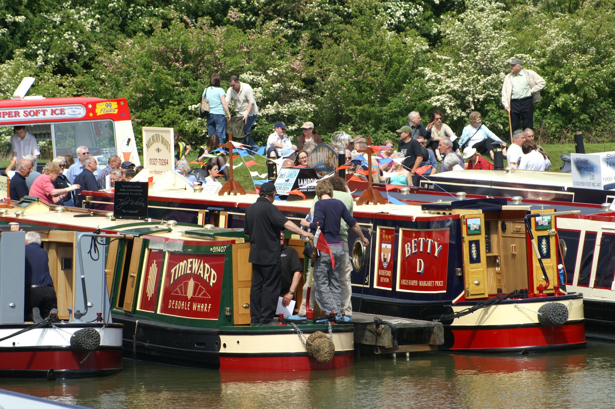
passes just east of Crick, and the village is well known for its canal marina
A marina (from Spanish , Portuguese and Italian : ''marina'', "coast" or "shore") is a dock or basin with moorings and supplies for yachts and small boats.
A marina differs from a port in that a marina does not handle large passenger ships o ...
and annual Crick Boat Show
The Crick Boat Show & Waterways Festival is an event that has been held annually at Crick Marina in Northamptonshire, England, since its inception in 2000.
Location
The show takes place every year on the Grand Union Canal at Crick Marina. This i ...
.
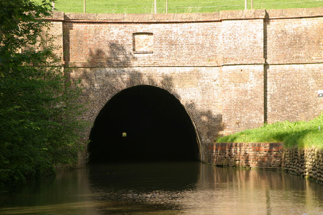
Crick canal tunnel is close to the south-east of the village and is long.
Schools Crick Primary School
ref name = "NCC
Crick Primary School at Northants County Council website
/ref> is on Main Road and most clearly visible from Bury Dyke. Details of a series of reports on the school can be found in the relevant section of the Ofsted website. There were 143 pupils on the roll at the time of the inspection in October 2011.
Secondary school children living in the village generally attend
Guilsborough School
Guilsborough Academy is a co-educational academy school in Guilsborough, Northamptonshire, England.
History
The school was founded in September 1958 as Guilsborough Secondary Modern School and was officially opened in May 1959. Many of the buil ...
in Guilsborough
Guilsborough is a village and civil parish in West Northamptonshire in England. At the time of the 2001 census, the parish's population was 882 people, reducing to 692 at the 2011 Census.
It is at the centre of an area of rural villages betwe ...
, Lawrence Sheriff School for Boys, Rugby High School for Girls
Rugby High School is a selective grammar school situated in the Bilton area of Rugby, Warwickshire, England. The school motto is “She Sets Heights In Her Heart”. It takes girls aged 11–18 and boys 16–18. To attend this school, all st ...
or Rugby School
Rugby School is a public school (English independent boarding school for pupils aged 13–18) in Rugby, Warwickshire, England.
Founded in 1567 as a free grammar school for local boys, it is one of the oldest independent schools in Britain. Up ...
.
References
External links
West Northamptonshire Local History website
{{authority control Villages in Northamptonshire West Northamptonshire District Civil parishes in Northamptonshire