County Route 130 (Rensselaer County, New York) on:
[Wikipedia]
[Google]
[Amazon]
New York State Route 154 (NY 154) was a
 NY 154 began at the intersection of US 4 (Vandenburgh Avenue) and Campbell Avenue in southern Troy. The route headed to the northeast, running alongside
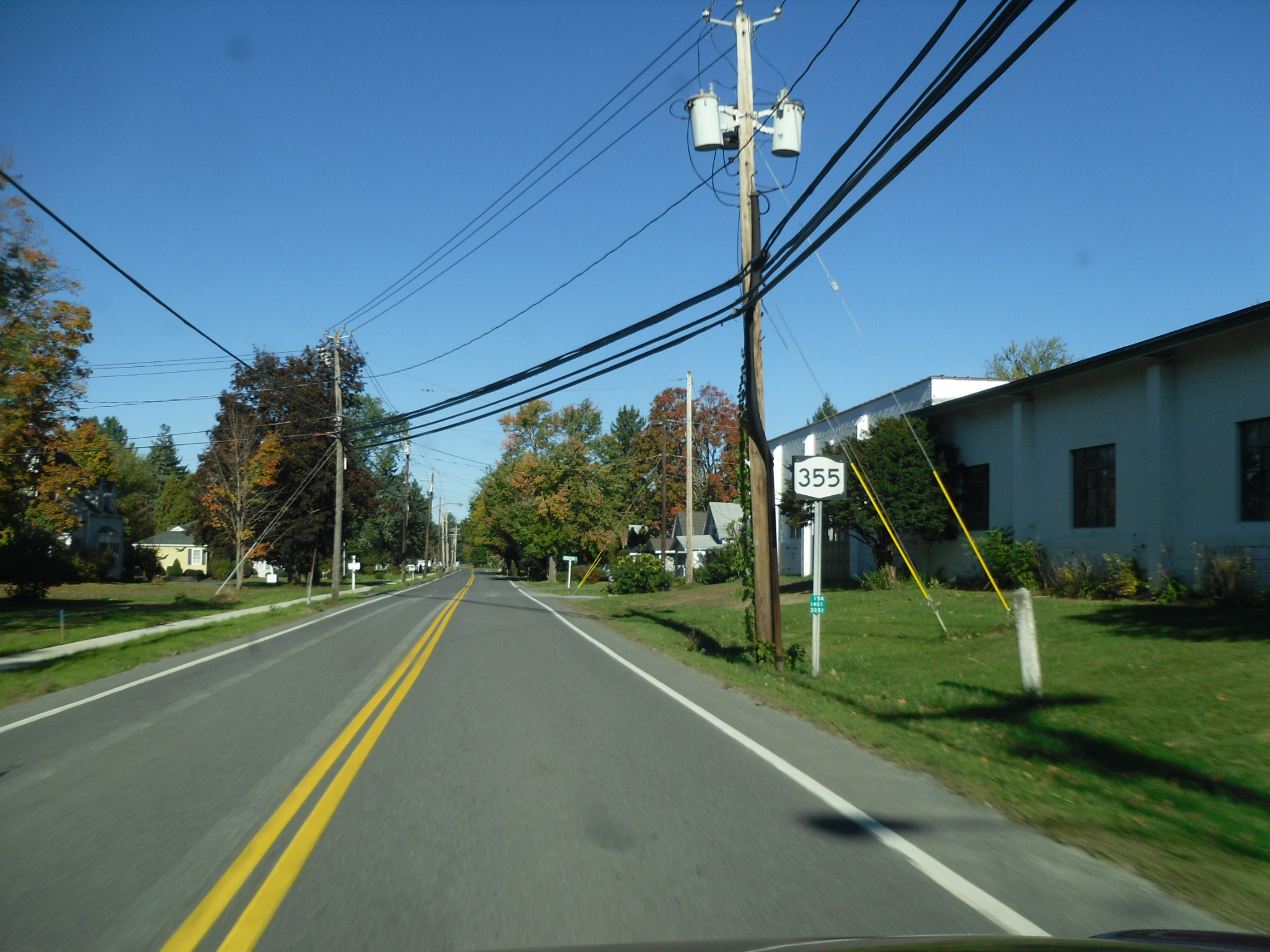
NY State Route 355 Ends
(includes former eastern terminus of NY 154)
state highway
A state highway, state road, or state route (and the equivalent provincial highway, provincial road, or provincial route) is usually a road that is either ''numbered'' or ''maintained'' by a sub-national state or province. A road numbered by a ...
in Rensselaer County, New York
Rensselaer County is a county in the U.S. state of New York. As of the 2020 census, the population was 161,130. Its county seat is Troy. The county is named in honor of the family of Kiliaen van Rensselaer, the original Dutch owner of the l ...
, in the United States. It began at an intersection with U.S. Route 4 (US 4) in the city of Troy and ended at then-County Route 77 (CR 77, now NY 351) in the hamlet of Poestenkill. Along the way, it intersected NY 66 and NY 355. The route was assigned in the early 1930s and eliminated in 1980 as part of a highway maintenance swap between the state of New York and Rensselaer County. The portion of the highway between the Troy city line and NY 355 became County Route 130 while the part connecting NY 355 to Poestenkill became an extension of NY 355.
Route description
 NY 154 began at the intersection of US 4 (Vandenburgh Avenue) and Campbell Avenue in southern Troy. The route headed to the northeast, running alongside
 Wynants Kill
The Wynants Kill is a U.S. Geological Survey. National Hydrography Dataset high-resolution flowline dataThe National Map accessed October 3, 2011 stream which has its source at Glass Lake near Averill Park, New York, and terminates at the Hudson ...
as it followed Campbell Avenue through the residential southern portion of Troy. The route and the river crossed paths after , with Wynants Kill proceeding southeastward toward the hamlet of Wynantskill
Wynantskill is a census-designated place (CDP) in Rensselaer County, New York, United States. The population was 3,276 at the 2010 census. Wynantskill is located at the northern town line and the northeastern corner of the town of North Greenb ...
and NY 154 continuing northeastward to a junction with Spring Avenue, a street linking NY 154 to the downtown district. Campbell Avenue ended here; however, the route continued on, following Spring Avenue east for three blocks to an intersection with NY 66 (Pawling Avenue) just south of the Emma Willard School.
Past NY 66, NY 154 traversed several additional city blocks before leaving Troy and entering the town of Brunswick. This section of the route passed through a mostly rural portion of Rensselaer County as it gradually headed southeastward toward an intersection with NY 355. Until 1980, NY 355 ended here while NY 154 continued into the hamlet of Poestenkill along Main Street. NY 154 passed north of the Rensselaer County Airpark west of the hamlet before coming to an end in the center of the community at a junction with CR 77 (now NY 351).
History
NY 154 was assigned to an alignment extending from NY 66 to the hamlet of Poestenkill by way of Spring Avenue and Main Street. It was extended southwestward along Spring and Campbell Avenues to a new terminus at US 4 in the late 1970s, but was eliminated on May 14, 1980, as a result of a highway maintenance swap between the state ofNew York
New York most commonly refers to:
* New York City, the most populous city in the United States, located in the state of New York
* New York (state), a state in the northeastern United States
New York may also refer to:
Film and television
* '' ...
and Rensselaer County that took effect on April 1 of that year. As part of the swap, the portion of NY 154 between the Troy city limits and NY 355 was transferred from the state to the county and redesignated as CR 130. The remaining state-maintained portion of NY 154 from NY 355 to Poestenkill became an extension of NY 355; however, the segment still bears reference marker
In New York, a reference marker is a small green sign mounted approximately every one-tenth mile on highways maintained by the New York State Department of Transportation. This was initiated in response to the Highway Safety Act of 1966 enacte ...
s for NY 154. Within Troy, the route was maintained by the city.
Major intersections
See also
*List of county routes in Rensselaer County, New York
County routes in Rensselaer County, New York, are maintained by the Rensselaer County Highway Department and signed with the Manual on Uniform Traffic Control Devices-standard yellow-on-blue pentagon route marker. Routes generally do not enter citi ...
References
External links
{{NYSR external links, type=N, nyroutes=yes, route=154NY State Route 355 Ends
(includes former eastern terminus of NY 154)
154
Year 154 ( CLIV) was a common year starting on Monday (link will display the full calendar) of the Julian calendar. At the time, it was known as the Year of the Consulship of Aurelius and Lateranus (or, less frequently, year 907 ''Ab urbe cond ...
Transportation in Rensselaer County, New York