Chavez Island (Galápagos) on:
[Wikipedia]
[Google]
[Amazon]
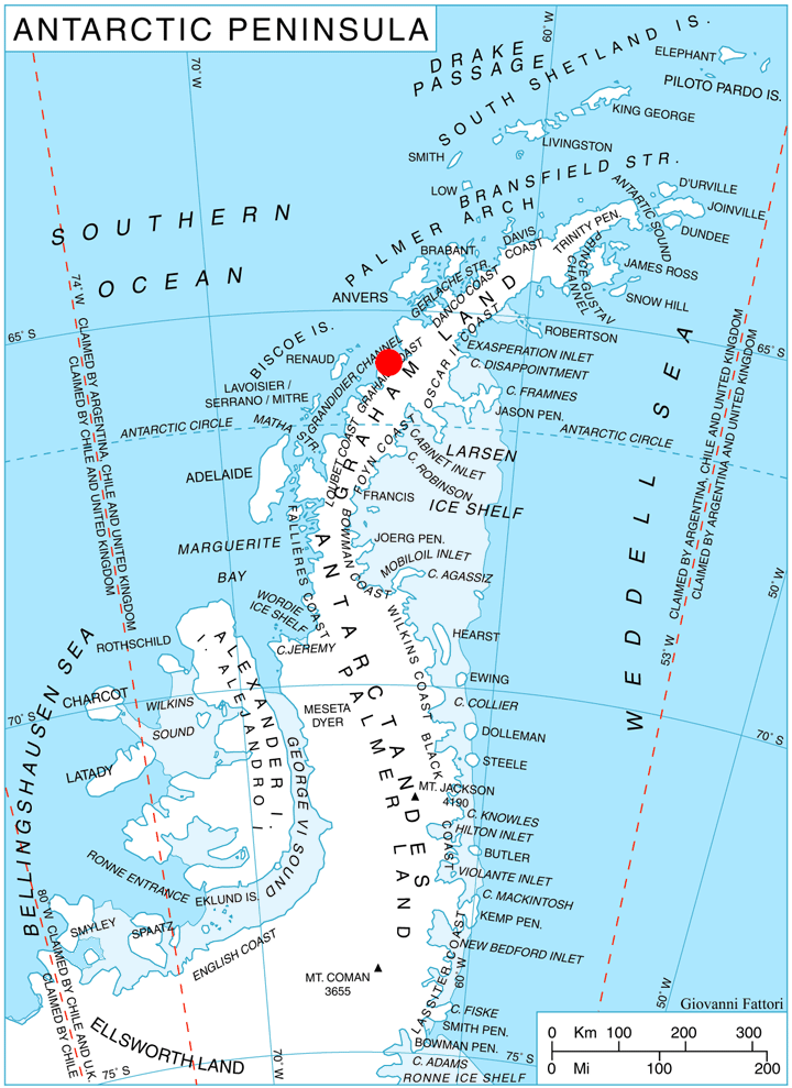
 Chavez Island () is an island long which rises to , lying immediately west of
SCAR Composite Gazetteer of Antarctica
Islands of Graham Land Graham Coast {{GrahamCoast-geo-stub
Magnier Peninsula
Magnier Peninsula is the mostly ice-covered peninsula projecting 18 km in northwest direction from Graham Coast in Graham Land, Antarctica. It is 17 km wide between Leroux Bay to the northeast and Bigo Bay to the southwest. Magnier Peaks rise ...
, which is between Leroux Bay
Leroux Bay () is a bay long in a northwest–southeast direction and averaging wide, between Nunez Point and the narrow Magnier Peninsula surmounted by the Magnier Peaks and Lisiya Ridge, along the west coast of Graham Land, Antarctica. The ...
and Bigo Bay
Bigo Bay () is a bay long and wide, indenting the west coast of Graham Land between Cape Garcia and Magnier Peninsula surmounted by the Magnier Peaks and Lisiya Ridge.
The French Antarctic Expedition, 1908–10, first sighted this bay but ch ...
, off the west coast of Graham Land. It was discovered and named by the French Antarctic Expedition, 1908–10
The French Antarctic Expedition is any of several French expeditions in Antarctica.
First expedition
In 1772, Yves-Joseph de Kerguelen-Trémarec and the naturalist Jean Guillaume Bruguière sailed to the Antarctic region in search of the fab ...
, under Jean-Baptiste Charcot, probably for Commandant Alfonso Chaves
Alphons (Latinized ''Alphonsus'', ''Adelphonsus'', or ''Adefonsus'') is a male given name recorded from the 8th century (Alfonso I of Asturias, r. 739–757) in the Christian successor states of the Visigothic kingdom in the Iberian peninsula. ...
of Ponta Delgada, Azores, but the spelling Chavez has become established through long usage.
See also
* List of Antarctic and sub-Antarctic islands *Trickster Rocks Trickster Rocks () are several small rocks emerging from the sea less than 1 nautical mile (1.9 km) northwest of Chavez Island in Grandidier Channel, off the west coast of Graham Land. So named by United Kingdom Antarctic Place-Names Committee ...
* Verge Rocks Verge Rocks () is a two rocks lying 2 nautical miles (3.7 km) north of Chavez Island, off the west coast of Graham Land. It was mapped by the Falkland Islands Dependencies Survey (FIDS) from photos taken by Hunting Aerosurveys Ltd. in 1956–57 ...
Maps
* British Antarctic Territory. Scale 1:200000 topographic map. DOS 610 Series, Sheet W 65 64. Directorate of Overseas Surveys, Tolworth, UK, 1971.References
SCAR Composite Gazetteer of Antarctica
Islands of Graham Land Graham Coast {{GrahamCoast-geo-stub