Cape Sterneck on:
[Wikipedia]
[Google]
[Amazon]
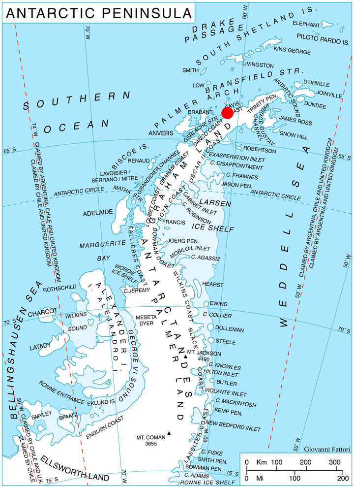
 Cape Sterneck () is a bold, black cliff on a projecting point forming the west extremity of Chavdar Peninsula on the west coast of
 Cape Herschel.
SCAR Composite Gazetteer of Antarctica
Antarctic Digital Database (ADD).
Scale 1:250000 topographic map of Antarctica. Scientific Committee on Antarctic Research (SCAR). Since 1993, regularly upgraded and updated.
Atlas of Antarctica: Topographic Maps from Geostatistical Analysis of Satellite Radar Altimeter Data
', P 115
Cape Sterneck.
SCAR Composite Gazetteer of Antarctica * Headlands of Graham Land Danco Coast Davis Coast {{DavisCoast-geo-stub
Graham Land
Graham Land is the portion of the Antarctic Peninsula that lies north of a line joining Cape Jeremy and Cape Agassiz. This description of Graham Land is consistent with the 1964 agreement between the British Antarctic Place-names Committee an ...
, Antarctica. It is situated on the north side of the entrance to Hughes Bay and the west side of the entrance to Curtiss Bay
Curtiss Bay () is a bay about wide, indenting the west coast of Graham Land just north of the Chavdar Peninsula, and entered between Cape Sterneck and Cape Andreas on the Davis Coast. Its head is fed by Samodiva Glacier, Pirin Glacier and Tu ...
, and separating Davis Coast
Davis Coast () is that portion of the west coast of the Antarctic Peninsula between Cape Kjellman and Cape Sterneck. It was named by the Advisory Committee on Antarctic Names for Captain John Davis, the American sealer who claimed to have mad ...
to the northeast from Danco Coast
The Danco Coast () is the portion of the west coast of the Antarctic Peninsula between Cape Sterneck and Cape Renard. This coast was explored in January and February 1898 by the Belgian Antarctic Expedition under Adrien de Gerlache, who named it ...
to the southwest.
In 1898, the Belgian Antarctic Expedition
The Belgian Antarctic Expedition of 1897–1899 was the first expedition to winter in the Antarctic region. Led by Adrien de Gerlache de Gomery aboard the RV ''Belgica'', it was the first Belgian Antarctic expedition and is considered the firs ...
under Lieutenant Adrien de Gerlache explored this area and named this cape for the Austrian geophysicist Robert von Sterneck
Robert von Sterneck (''Robert Freiherr Daublebsky von Sterneck the Elder'', 1839–1910) was a member of the Budweis Daublebsky von Sterneck baronial family who served as an Austro-Hungarian general major, geophysicist and astronomer. He st ...
, whose apparatus was used on the expedition. The British name for the feature is Cape Herschel.SCAR Composite Gazetteer of Antarctica
Maps
* British Antarctic Territory. Scale 1:200000 topographic map. DOS 610 Series, Sheet W 64 60. Directorate of Overseas Surveys, Tolworth, UK, 1978.Antarctic Digital Database (ADD).
Scale 1:250000 topographic map of Antarctica. Scientific Committee on Antarctic Research (SCAR). Since 1993, regularly upgraded and updated.
See also
* Monument Rocks, lying northeast of Cape SterneckReferences
Further reading
* Ute Christina Herzfeld,Atlas of Antarctica: Topographic Maps from Geostatistical Analysis of Satellite Radar Altimeter Data
', P 115
External links
Cape Sterneck.
SCAR Composite Gazetteer of Antarctica * Headlands of Graham Land Danco Coast Davis Coast {{DavisCoast-geo-stub