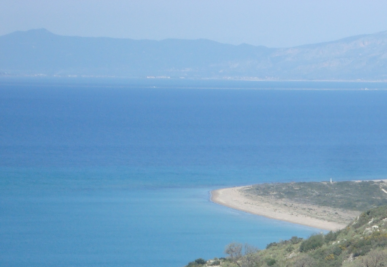
Cape Araxos on:
[Wikipedia]
[Google]
[Amazon]
 Cape Araxos ( el, Ακρωτήριον Άραξος), also known as Cape Pappas (Άκρα Πάππα), is a
cape
A cape is a clothing accessory or a sleeveless outer garment which drapes the wearer's back, arms, and chest, and connects at the neck.
History
Capes were common in medieval Europe, especially when combined with a hood in the chaperon. Th ...
in the northwest of the Peloponnese
The Peloponnese (), Peloponnesus (; el, Πελοπόννησος, Pelopónnēsos,(), or Morea is a peninsula and geographic regions of Greece, geographic region in southern Greece. It is connected to the central part of the country by the Isthmu ...
in Greece
Greece,, or , romanized: ', officially the Hellenic Republic, is a country in Southeast Europe. It is situated on the southern tip of the Balkans, and is located at the crossroads of Europe, Asia, and Africa. Greece shares land borders with ...
. It is the northwesternmost point of Peloponnese and separates the Gulf of Patras
The Gulf of Patras ( el, Πατραϊκός Κόλπος, ''Patraikós Kólpos'') is a branch of the Ionian Sea in Western Greece. On the east, it is closed by the Strait of Rion between capes Rio and Antirrio, near the Rio-Antirrio bridge, that ...
from the Ionian Sea
The Ionian Sea ( el, Ιόνιο Πέλαγος, ''Iónio Pélagos'' ; it, Mar Ionio ; al, Deti Jon ) is an elongated bay of the Mediterranean Sea. It is connected to the Adriatic Sea to the north, and is bounded by Southern Italy, including C ...
. It lies at a distance of west of the city of Patras
)
, demographics_type1 =
, demographics1_footnotes =
, demographics1_title1 =
, demographics1_info1 =
, demographics1_title2 =
, demographics1_info2 =
, timezone1 = EET
, utc_offset1 = +2
, ...
and very close to the village of Akrotirio Araxou. In 1877 a stone lighthouse was built, but it was destroyed during the Second World War
World War II or the Second World War, often abbreviated as WWII or WW2, was a world war that lasted from 1939 to 1945. It involved the vast majority of the world's countries—including all of the great powers—forming two opposin ...
and a modern lighthouse was installed after some years. The waters in the area are dangerous because of the continuous additions of sediments, eroding from the uplands of Aetolia-Acarnania
Aetolia-Acarnania ( el, Αιτωλοακαρνανία, ''Aitoloakarnanía'', ) is one of the regional units of Greece. It is part of the geographic region of Central Greece and the administrative region of West Greece. A combination of the histor ...
via the rivers Acheloos and Evinos
The Evinos ( el, Εύηνος) is a river in western Greece, flowing into the Gulf of Patras. Its source is in the northern Vardousia mountains, near the village Artotina, Phocis. The river flows in a generally southwestern direction, for most o ...
, The waters are quite shallow in some parts.
Naval minefield and shipwrecks
DuringWorld War II
World War II or the Second World War, often abbreviated as WWII or WW2, was a world war that lasted from 1939 to 1945. It involved the vast majority of the world's countries—including all of the great powers—forming two opposin ...
, the area close to the cape was a naval minefield
A naval mine is a self-contained explosive device placed in water to damage or destroy surface ships or submarines. Unlike depth charges, mines are deposited and left to wait until they are triggered by the approach of, or contact with, any v ...
, and there were many losses of ships and human lives. On 29 May 1945, the Dutch cargo ship ''Mars'' hit a mine and was sunk. Today it is one of the most well-preserved shipwrecks of the Gulf of Patras
The Gulf of Patras ( el, Πατραϊκός Κόλπος, ''Patraikós Kólpos'') is a branch of the Ionian Sea in Western Greece. On the east, it is closed by the Strait of Rion between capes Rio and Antirrio, near the Rio-Antirrio bridge, that ...
.
Hellenic Navy and Hellenic Coast Guard installations
The land around the cape belongs to theGreek Navy
The Hellenic Navy (HN; el, Πολεμικό Ναυτικό, Polemikó Naftikó, War Navy, abbreviated ΠΝ) is the naval force of Greece, part of the Hellenic Armed Forces. The modern Greek navy historically hails from the naval forces of vari ...
which operates a small naval base (Araxos Naval Fort) so the access to the area is restricted same like the navigation without permission closer to a distance of from the coast. The base hosts the Naval Radio Transmitter Facility of Araxos (Κέντρο Εκπομπής Αράξου).
According to Hellenic Coast Guard
The Hellenic Coast Guard ( el, Λιμενικό Σώμα-Ελληνική Ακτοφυλακή, Limeniko Soma-Elliniki Aktofylaki, Port Corps-Hellenic Coast Guard) is the national coast guard of Greece. Like many other coast guards, it is a para ...
, in the area operates the ''cape Pappas RSS'' (Remote Site Sensor) which is a remotely controlled sensor and radar facility of the national Vessel traffic service system of Greece (Officially called Vessel Traffic Management and Information System).
References
External links
{{coord, 38.216, 21.377, type:landmark_region:GR_dim:5000, display=title, format=dmsAraxos
Araxos ( el, Άραξος, la, Araxus) is a village and a community in the municipal unit of Larissos of the municipality West Achaea in the northwestern part of Achaea, Greece. The community consists of the villages Araxos, Akrotirio Araxos and ...
Landforms of Western Greece