Britannia Depicta on:
[Wikipedia]
[Google]
[Amazon]
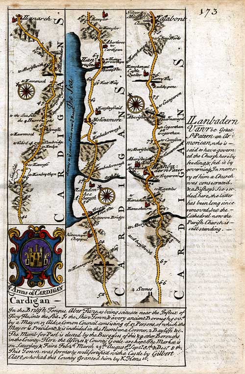
 ''Britannia Depicta'' was an illustrated
  The atlas was based on the earlier work of John Ogilby who published the first British

 Landscapes by
 ''Britannia Depicta'' was an illustrated
 road atlas
A road map, route map, or street map is a map that primarily displays roads and transport links rather than natural geographical information. It is a type of navigational map that commonly includes political boundaries and labels, making it a ...
for Britain. It was printed in numerous editions over many decades from 1720 into the 19th century and updated with engravings by many artisans who worked from drawings of other artists. It featured strip maps.
 The atlas was based on the earlier work of John Ogilby who published the first British
 road atlas
A road map, route map, or street map is a map that primarily displays roads and transport links rather than natural geographical information. It is a type of navigational map that commonly includes political boundaries and labels, making it a ...
in 1675. ''Britannia Depicta'' was printed in 1720 by Emanuel Bowen
Emanuel Bowen (1694 – 8 May 1767) was a Welsh map engraver, who achieved the unique distinction of becoming Royal Mapmaker to both to King George II of Great Britain and Louis XV of France. Bowen was highly regarded by his contemporaries for p ...
and John Owen's firm Bowen & Owen. It was one of Bowen's earliest works.
A road atlas, it contains two hundred and seventy three road maps along with drawings of landmarks and miniature county maps of each of the counties of England and Wales. It followed on John Ogilby's original with updated style of historical and heraldic detail. It was an unusual feature of the atlas that the maps were engraved on both sides of each page, and this resulted in a handier-sized book.
Cadell & Davies editions

Cadell & Davies Cadell and Davies was a publishing company established in London in 1793. The business was formed when bookseller and publisher Thomas Cadell the elder (1742–1802) bequeathed his business to his son Thomas Cadell the younger (1773–1836) and th ...
published its own editions of the ''Britannia Depicta'' atlas over many years, with accompanying descriptions by Samuel Lysons. Engraved plates for their Britannia Depicta are dated 1803–1818.
The Quarterly Review of 1816 reported it was ordered along with ''Magna Britannia
''Magna Britannia, being a concise topographical account of the several counties of Great Britain'' was a topographical and historical survey published by the antiquarians Daniel Lysons and his brother Samuel Lysons in several volumes between 18 ...
''.
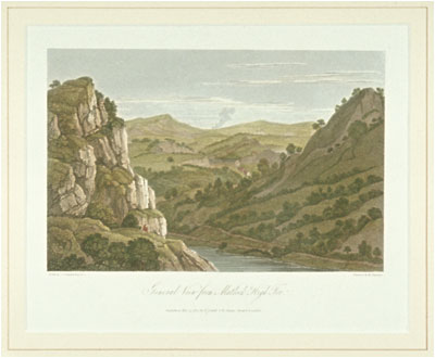
 Landscapes by
 Joseph Farington
Joseph Farington (21 November 1747 – 30 December 1821) was an 18th-century English landscape painter and diarist.
Life and work
Born in Leigh, Lancashire, Farington was the second of seven sons of William Farington and Esther Gilbody. His ...
were included in Cadell and Davies' six-volume "modernisation" of the illustrated atlas. His contributions include topographical ''Views in Cornwall'' (1814) and other views. He also depicted Devon for a 7th edition and had his drawings engraved but they were never published.
Engravers
Engravers who worked on the Cadell & Davies editions include: * William Angus (engraver) 1752–1821 * M. S. Barenger * John Byrne (engraver), 1786–1847 * Letitia Byrne 1779–1849 * William Byrne (engraver) 1743–1805 * George Cooke (engraver) 1781–1834 * Frederick Rudolph Hay 1784–? * John Landseer 1769–1852 * Samuel Middiman ca. 1750–1831 * James Neagle 1760?–1822 * Charles Pye (engraver) 1777–1864 * John Pye 1782–1874 * John Scott (engraver) 1774–1827 * Thomas Woolnoth, 1785–1857 * William Woolnoth 1780–1837Illustrators
Illustrations in the Cadell & Davies editions were made by artists including: * William Alexander 1767–1816 * John Byrne 1786–1847 *Joseph Farington
Joseph Farington (21 November 1747 – 30 December 1821) was an 18th-century English landscape painter and diarist.
Life and work
Born in Leigh, Lancashire, Farington was the second of seven sons of William Farington and Esther Gilbody. His ...
1747–1821
* Thomas Hearne 1744–1817
* Frederick Nash
Frederick Nash (February 9, 1781 – December 5, 1858) was an American lawyer and jurist from Hillsborough, North Carolina. He served on the North Carolina Supreme Court and was its chief justice from 1852 until his death.
Frederick was the son ...
1782–1856
* John Powell, 1780-ca. 1833
* Robert Smirke 1752–1845
* John Smith (perhaps John Raphael Smith?)
* William Turner
* J. M. W. Turner (Joseph Mallord William), 1775–1851
* John Varley 1778–1842
* Thomas Webster 1800–1886
References
{{Reflist Maps of the United Kingdom 18th century in transport 18th-century books