Bay of Fires on:
[Wikipedia]
[Google]
[Amazon]
 The Bay of Fires ( palawa kani: ''larapuna)'' is a

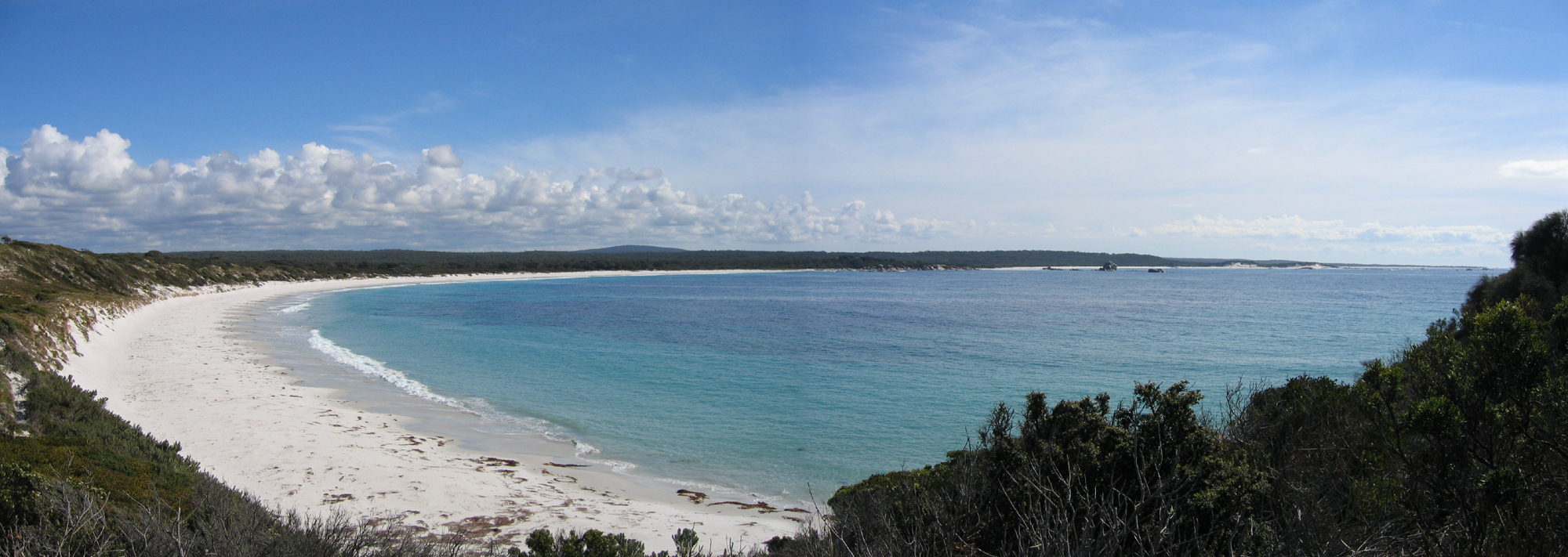
File:Binalong Bay beach.JPG, Binalong Bay Beach
File:Bay of Fires rocks.JPG, Beach and Rocks
File:Bay of Fires-07.jpg
File:Bay of Fires-10.jpg
File:Bay of Fires-06.jpg
 The Bay of Fires ( palawa kani: ''larapuna)'' is a
 bay
A bay is a recessed, coastal body of water that directly connects to a larger main body of water, such as an ocean, a lake, or another bay. A large bay is usually called a Gulf (geography), gulf, sea, sound (geography), sound, or bight (geogra ...
on the northeastern coast of Tasmania
)
, nickname =
, image_map = Tasmania in Australia.svg
, map_caption = Location of Tasmania in AustraliaCoordinates:
, subdivision_type = Country
, subdi ...
in Australia
Australia, officially the Commonwealth of Australia, is a Sovereign state, sovereign country comprising the mainland of the Australia (continent), Australian continent, the island of Tasmania, and numerous List of islands of Australia, sma ...
, extending from Binalong Bay
Binalong Bay is a rural locality in the local government area (LGA) of Break O'Day in the North-east LGA region of Tasmania. The locality is about north-east of the town of St Helens. The 2016 census recorded a population of 290 for the stat ...
to Eddystone Point. The bay was given its name in 1773 by Captain Tobias Furneaux in ,
who saw the fires of Aboriginal people on the beaches.
Bay whaling activities were carried out in the area in the 1840s.
The Bay of Fires is a region of white beaches, blue water and orange-hued granite
Granite () is a coarse-grained (phaneritic) intrusive igneous rock composed mostly of quartz, alkali feldspar, and plagioclase. It forms from magma with a high content of silica and alkali metal oxides that slowly cools and solidifies undergro ...
(the colour of which is actually produced by a lichen
A lichen ( , ) is a composite organism that arises from algae or cyanobacteria living among filaments of multiple fungi species in a mutualistic relationship.Mount William National Park
Mount William is a national park, mountain, and locality in Tasmania (Australia), 234 km northeast of Hobart. Established in 1973 as an 8,640 hectares large national park, it has been expanded multiple times, reaching 13,806 ha in 1980 and ...
; the southern end is a conservation area.
A wide range of activities can be pursued in the Bay of Fires area, including camping, beach activities, boating, bird watching, fishing, swimming, surfing and walking.
Tourism
In the 2000s, the Bay of Fires received several tourism accolades. In 2005, it was named as the world's second best beach byCondé Nast
Condé Nast () is a global mass media company founded in 1909 by Condé Montrose Nast, and owned by Advance Publications. Its headquarters are located at One World Trade Center in the Financial District of Lower Manhattan.
The company's media ...
. In 2008, it was named the world's "hottest" travel destination for 2009 by international guide book Lonely Planet
Lonely Planet is a travel guide book publisher. Founded in Australia in 1973, the company has printed over 150 million books.
History Early years
Lonely Planet was founded by married couple Maureen and Tony Wheeler. In 1972, they embarked ...
.

History
The Bay of Fires was a meeting place for Aboriginal family groups such as Panpe-kanner, Leener-rerter and Pinter-rairer.Pictures
References
East Coast Tasmania Beaches of Tasmania Bays of Tasmania Whaling stations in Australia {{Tasmania-geo-stub