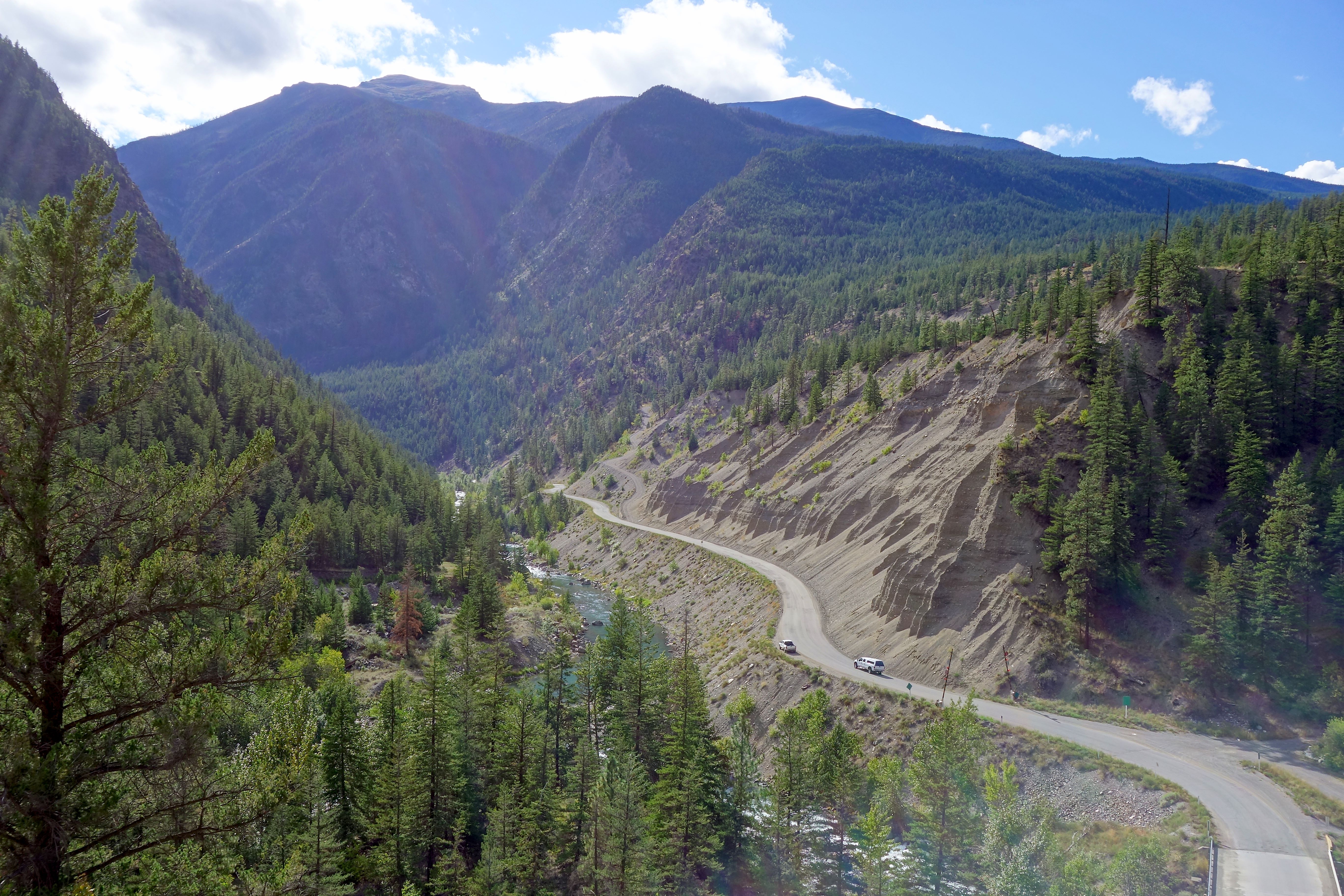
Bridge River-Lillooet Country on:
[Wikipedia]
[Google]
[Amazon]
 The Bridge River Country is a historic geographic region and mining district in the Interior of
 The Bridge River Country is a historic geographic region and mining district in the Interior of
 British Columbia
British Columbia (commonly abbreviated as BC) is the westernmost province of Canada, situated between the Pacific Ocean and the Rocky Mountains. It has a diverse geography, with rugged landscapes that include rocky coastlines, sandy beaches, ...
, Canada
Canada is a country in North America. Its ten provinces and three territories extend from the Atlantic Ocean to the Pacific Ocean and northward into the Arctic Ocean, covering over , making it the world's second-largest country by tot ...
, lying between the Fraser Canyon
The Fraser Canyon is a major landform of the Fraser River where it descends rapidly through narrow rock gorges in the Coast Mountains en route from the Interior Plateau of British Columbia to the Fraser Valley. Colloquially, the term "Fraser ...
and the valley of the Lillooet River
The Lillooet River is a major river of the southern Coast Mountains of British Columbia. It begins at Silt Lake, on the southern edge of the Lillooet Crown Icecap about 80 kilometres northwest of Pemberton and about 85 kilometres northwest of W ...
, south of the Chilcotin Plateau
The Chilcotin Plateau is part of the Fraser Plateau, a major subdivision of the Interior Plateau of British Columbia. The Chilcotin Plateau is physically near-identical with the region of the same name, i.e. "the Chilcotin", which lies between t ...
and north of the Lillooet Ranges
The Lillooet Ranges are the southeasternmost subdivision of the Pacific Ranges of the Coast Mountains of British Columbia. They are located between the drainage of the Lillooet River and Harrison Lake on the west and the canyon of the Fraser Rive ...
. "The Bridge River" can mean the Bridge River Country as opposed to the Bridge River
The Bridge River is an approximately long river in southern British Columbia. It flows south-east from the Coast Mountains. Until 1961, it was a major tributary of the Fraser River, entering that stream about six miles upstream from the town of ...
itself, and is considered to be part of the Lillooet Country
The Lillooet Country, also referred to as the Lillooet District, is a region spanning from the central Fraser Canyon town of Lillooet west to the valley of the Lillooet River, and including the valleys in between, in the Southern Interior of Br ...
, but has a distinct history and identity within the larger region. As Lillooet is sometimes considered to be the southwest limit of the Cariboo, some efforts were made to refer to the Bridge River as the "West Cariboo" but this never caught on.
Though essentially consisting of the basin of the Bridge River and its tributaries, the Bridge River Country includes the communities of D'Arcy, McGillivray Falls, Seton Portage and Shalalth, which lie in the valley of Seton and Anderson Lakes and the Gates River just to the south, are also considered to be part of the Bridge River Country, and also simultaneously of the Lillooet Country. After the 1930s, the term "Bridge River-Lillooet" came into currency as a result of the chosen masthead of the fledgling Bridge River-Lillooet News, which served the town and environs of Lillooet as well as the mining towns of the upper Bridge River.
See also
*Bridge River
The Bridge River is an approximately long river in southern British Columbia. It flows south-east from the Coast Mountains. Until 1961, it was a major tributary of the Fraser River, entering that stream about six miles upstream from the town of ...
*Bridge River, British Columbia
Bridge River was used to describe three separate towns or localities in the Lillooet Country of the Interior of British Columbia connected with the river and valley of the same name.
History 1858-1860
The boomtown of Bridge River was one of a hal ...
*Bridge River Power Project
The Bridge River Power Project is a hydroelectric power development in the Canadian province of British Columbia, located in the Lillooet Country between Whistler and Lillooet. It harnesses the power of the Bridge River, a tributary of the Frase ...
*Lillooet Country
The Lillooet Country, also referred to as the Lillooet District, is a region spanning from the central Fraser Canyon town of Lillooet west to the valley of the Lillooet River, and including the valleys in between, in the Southern Interior of Br ...
*Chilcotin District
The Chilcotin () region of British Columbia is usually known simply as "the Chilcotin", and also in speech commonly as "the Chilcotin Country" or simply Chilcotin. It is a plateau and mountain region in British Columbia on the inland lee of the Co ...
* Cariboo
*Thompson Country
Thompson Country, also referred to as The Thompson and sometimes as the Thompson Valley and historically known as the Couteau Country or Couteau District, is a historic geographic region of the Southern Interior of British Columbia, more or less de ...
*Spruce Lake Protected Area
The Spruce Lake Protected Area, formerly known variously as the Southern Chilcotin Mountains Provincial Park, Southern Chilcotins, and also as South Chilcotin Provincial Park, is a 71,347-hectare Protected Area in the British Columbia provincial ...
External links
* * History of British Columbia {{cariboo-geo-stub