Bono, Texas on:
[Wikipedia]
[Google]
[Amazon]
Bono is an
 The area was first settled in the early 1870s by two families (one of Calvin L. Jones and one of B.H. Williamson), who each donated 20 acres for a townsite. Sixteen acres were set aside for a church and school site, and the rest was free for individuals to build homes. Families were attracted to the area because of the church and school and the community, named Bono by Jones, established a post office in 1879. A tornado struck the town on May 4, 1890, destroying homes and killing several people. The population reached 75 by 1900 and continued to thrive until the
unincorporated community
An unincorporated area is a region that is not governed by a local municipal corporation. Widespread unincorporated communities and areas are a distinguishing feature of the United States and Canada. Most other countries of the world either have ...
in Johnson County, Texas
Johnson County is a county located in the U.S. state of Texas. As of the 2020 census, its population was 179,927. Its county seat is Cleburne. Johnson County is named for Middleton Johnson, a Texas Ranger, soldier, and politician. Johnson Co ...
, United States.
Location
Located on Farm to Market Road 2331 in the southwestern portion of the county, Bono is one mile west ofU.S. Highway 67
U.S. Route 67 is a major north–south U.S. highway which extends for 1,560 miles (2,511 km) in the Central United States. The southern terminus of the route is at the United States-Mexico border in Presidio, Texas, where it continues so ...
.
History
 The area was first settled in the early 1870s by two families (one of Calvin L. Jones and one of B.H. Williamson), who each donated 20 acres for a townsite. Sixteen acres were set aside for a church and school site, and the rest was free for individuals to build homes. Families were attracted to the area because of the church and school and the community, named Bono by Jones, established a post office in 1879. A tornado struck the town on May 4, 1890, destroying homes and killing several people. The population reached 75 by 1900 and continued to thrive until the
 Great Depression
The Great Depression (19291939) was an economic shock that impacted most countries across the world. It was a period of economic depression that became evident after a major fall in stock prices in the United States. The economic contagio ...
, unusual compared to other settlements that were bypassed by the railroad in the area. The settlement had a cotton gin
A cotton gin—meaning "cotton engine"—is a machine that quickly and easily separates cotton fibers from their seeds, enabling much greater productivity than manual cotton separation.. Reprinted by McGraw-Hill, New York and London, 1926 (); a ...
, two stores, two churches, and a school. The 1940s saw a decline in population, as the number of area farmers decreased as the region moved on from cotton production
Cotton is a soft, fluffy staple fiber that grows in a boll, or protective case, around the seeds of the cotton plants of the genus ''Gossypium'' in the mallow family Malvaceae. The fiber is almost pure cellulose, and can contain minor perce ...
and switched to dairy production
A dairy is a business enterprise established for the harvesting or processing (or both) of animal milk – mostly from cows or buffaloes, but also from goats, sheep, horses, or camels – for human consumption. A dairy is typically located on a ...
. The post office closed during this time, although a community building and Baptist
Baptists form a major branch of Protestantism distinguished by baptizing professing Christian believers only (believer's baptism), and doing so by complete immersion. Baptist churches also generally subscribe to the doctrines of soul compete ...
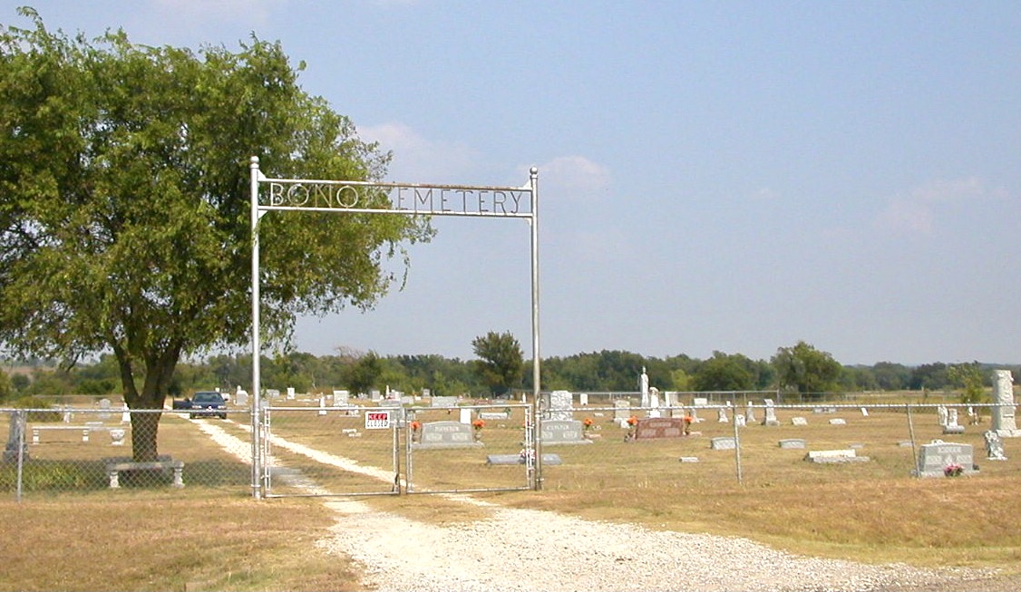
church remained in the area in 1971 and a state map noted the presence of a small cemetery in 1984.
References
Unincorporated communities in Johnson County, Texas Unincorporated communities in Texas Dallas–Fort Worth metroplex {{JohnsonCountyTX-geo-stub