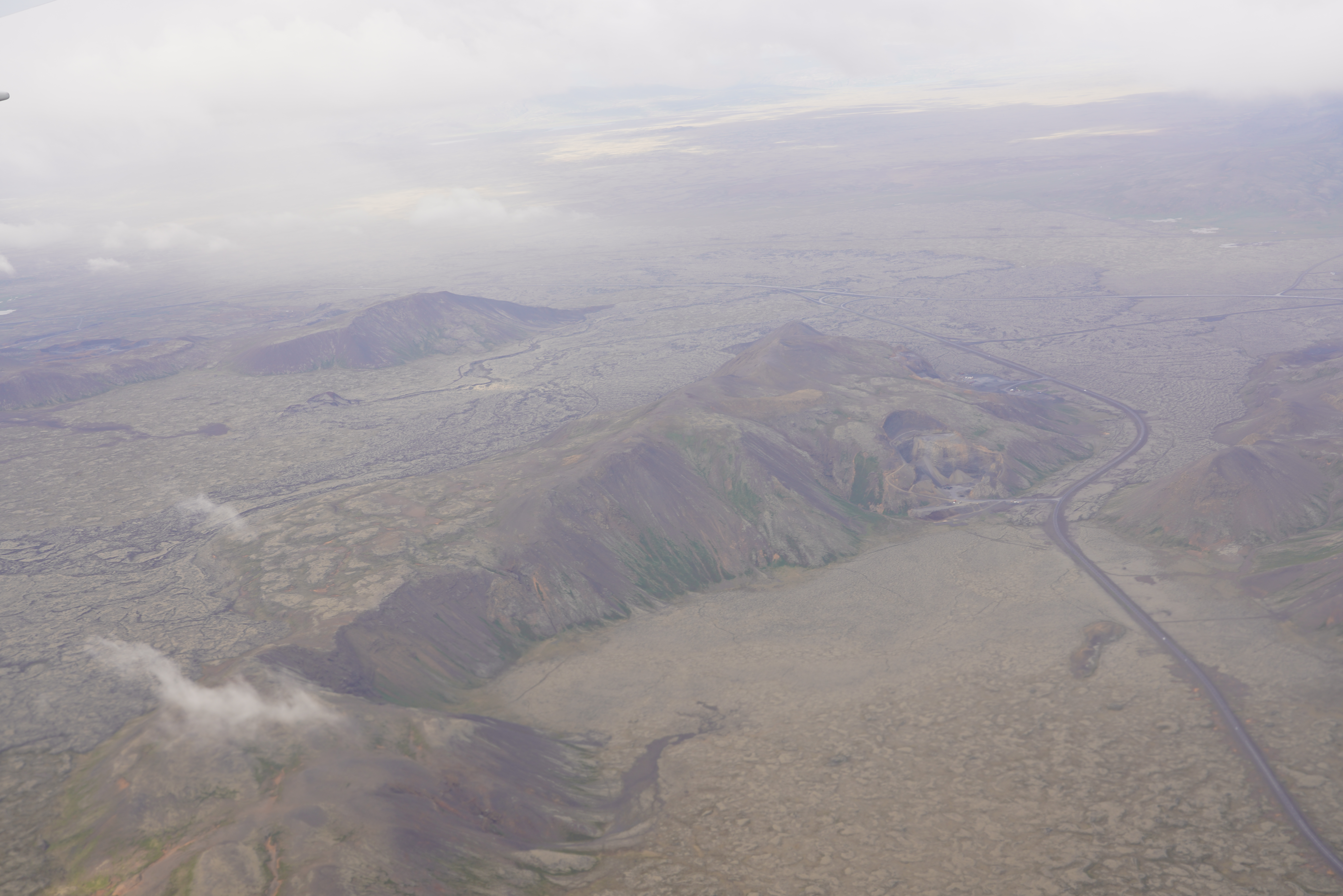
Bláfjöll From Plane on:
[Wikipedia]
[Google]
[Amazon]
 Bláfjöll (, "blue mountains") are a small mountain range in the southwest of
Skídasvaedi.is, description with map of hiking and cross country ski tracks. Retrieved 6 August 2020.
Bláfjöll. The Environment Agency of Iceland. (in Icelandic, with map of Bláfjallafólkvangur, the protected area)
 Bláfjöll (, "blue mountains") are a small mountain range in the southwest of
 Iceland
Iceland ( is, Ísland; ) is a Nordic island country in the North Atlantic Ocean and in the Arctic Ocean. Iceland is the most sparsely populated country in Europe. Iceland's capital and largest city is Reykjavík, which (along with its s ...
on Reykjanes peninsula at about 30 km from Reykjavík.
They form sort of a double mountain massif to the west and in the east of Jósepsdalur
Jósepsdalur (), also Josefsdalur , is a small valley, about 2 km long in southwestern direction, and to the east of the volcano Vífilsfell up on Hellisheiði at a distance of about 25 km from Reykjavík within Selvogshreppur municipality.Ari Tra ...
Þór Vigfússon: Í Árnesþingi vestanverðu. Ferðafélag Íslands Árbók 2003. Reykjavík 2003, p.83 on Hellisheiði.Íslandshandbókin. Náttúra, saga og sérkenni. Reykjavík 1989, p. 780
Geography
The mountain massif has a length of about 9 km. The western part includesVífilsfell
Vífilsfell () is a hyaloclastite ridge in southwestern Iceland (Weichselian). It is 655 m high and located west of Jósepsdalur valley on the volcanic plateau of Hellisheiði. It forms the northernmost offset of the Bláfjöll mountain massif ...
as well as , the eastern one reaches from to . The highest mountain is ''Hákollur'' (685 m).
Geology
The Bláfjöll arePleistocene
The Pleistocene ( , often referred to as the ''Ice age'') is the geological Epoch (geology), epoch that lasted from about 2,580,000 to 11,700 years ago, spanning the Earth's most recent period of repeated glaciations. Before a change was fina ...
subglacial volcano
A subglacial volcano, also known as a glaciovolcano, is a volcanic form produced by subglacial eruptions or eruptions beneath the surface of a glacier or ice sheet which is then melted into a lake by the rising lava. Today they are most ...
es and part of the Brennisteinsfjöll
Brennisteinsfjöll (, "Sulfur mountains"
Brennisteinsfjöll. Detailed description. In: Catalogue of Icelandic Volcanoes ...
volcanic system.
Brennisteinsfjöll. Detailed description. In: Catalogue of Icelandic Volcanoes ...
Winter sports
The area is the most popular ski resort for the inhabitants of Iceland's Höfuðborgarsvæði, Capital City Area. Thewinter sports
Winter sports or winter activities are competitive sports or non-competitive recreational activities which are played on snow or ice. Most are variations of skiing, ice skating and sledding. Traditionally, such games were only played in cold area ...
area is situated at elevations between 460 and 700 m.https://www.skiresort.info/ski-resort/blafjoell/ Ski resort Bláfjöll. Retrieved 30 July 2020.
15 km of easy and intermediate slopes for skiing and snowboarding
Snowboarding is a recreational and competitive activity that involves descending a snow-covered surface while standing on a snowboard that is almost always attached to a rider's feet. It features in the Winter Olympic Games and Winter Paralympi ...
as well as 15 lifts (tow lift
A surface lift is a type of cable transport for snow sports in which skiers and snowboarders remain on the ground as they are pulled uphill. While they were once prevalent, they have been overtaken in popularity by higher-capacity and higher-co ...
s and chair lifts) are available as well as possibilities for night skiing. Cross country skiing is also possible. Two huts with accommodation and restaurant provide service for the guests. All this makes it the largest ski resort in Iceland.
Accessibility
From Reykjavík the Hringvegur is followed in southern direction, at the airfield ofSandskeið
Sandskeið () is the main gliding center in Iceland and home of the Icelandic gliding club ( Svifflugfélag Íslands) since 1936. It is situated 20 km to the east of Reykjavík, the Icelandic capital, by Route 1
The following highways are ...
taken the Route 417
The following highways are numbered 417:
Canada
* Manitoba Provincial Road 417
* Newfoundland and Labrador Route 417
* Ontario Highway 417
Costa Rica
* National Route 417
Iceland
* Route 417
Japan
* Japan National Route 417
United States
* ...
in direction of Hafnarfjörður/Bláfjöll, but up on the lava plateau turned left into the short Bláfjallavegur/Route 407. It leads directly to the mountains and the skiing area.Ísland Vegaatlas. Reykjavík 2006, p.1
Nature protection
Part of the mountain range is protected since 1973 as .See also
*Eldborg í Bláfjöllum
The volcanic cone of Eldborg í Bláfjöllum () is to be found at about 2 km from the skiing area in Bláfjöll, i.e. at about 25 km from Reykjavík, in Iceland.Ísland Vegaatlas. Reykjavík 2006, p.1
Scoria cones
Eldborg í Bláfjö ...
* Heiðin há
Heiðin há () is a shield volcano up on Hellisheiði at about 35 km to the south of Reykjavík in Iceland. The mountain has a height of 626 m.Björn Hróarsson: Hellahandbókin. Leiðsögn um 77 íslenska hraunhella. Reykjavík 2008, p. 1 ...
* Brennisteinsfjöll
Brennisteinsfjöll (, "Sulfur mountains"
Brennisteinsfjöll. Detailed description. In: Catalogue of Icelandic Volcanoes ...
* Sport in Iceland
Brennisteinsfjöll. Detailed description. In: Catalogue of Icelandic Volcanoes ...
External links
* https://skidasvaedi.is/english/ Official website, ski resorts of IcelandSkídasvaedi.is, description with map of hiking and cross country ski tracks. Retrieved 6 August 2020.
Bláfjöll. The Environment Agency of Iceland. (in Icelandic, with map of Bláfjallafólkvangur, the protected area)
References
{{DEFAULTSORT:Bláfjöll Mountains of Iceland Reykjanes Volcanic Belt Subglacial volcanoes of Iceland Brennisteinsfjöll Volcanic System