Blodgett Canyon on:
[Wikipedia]
[Google]
[Amazon]
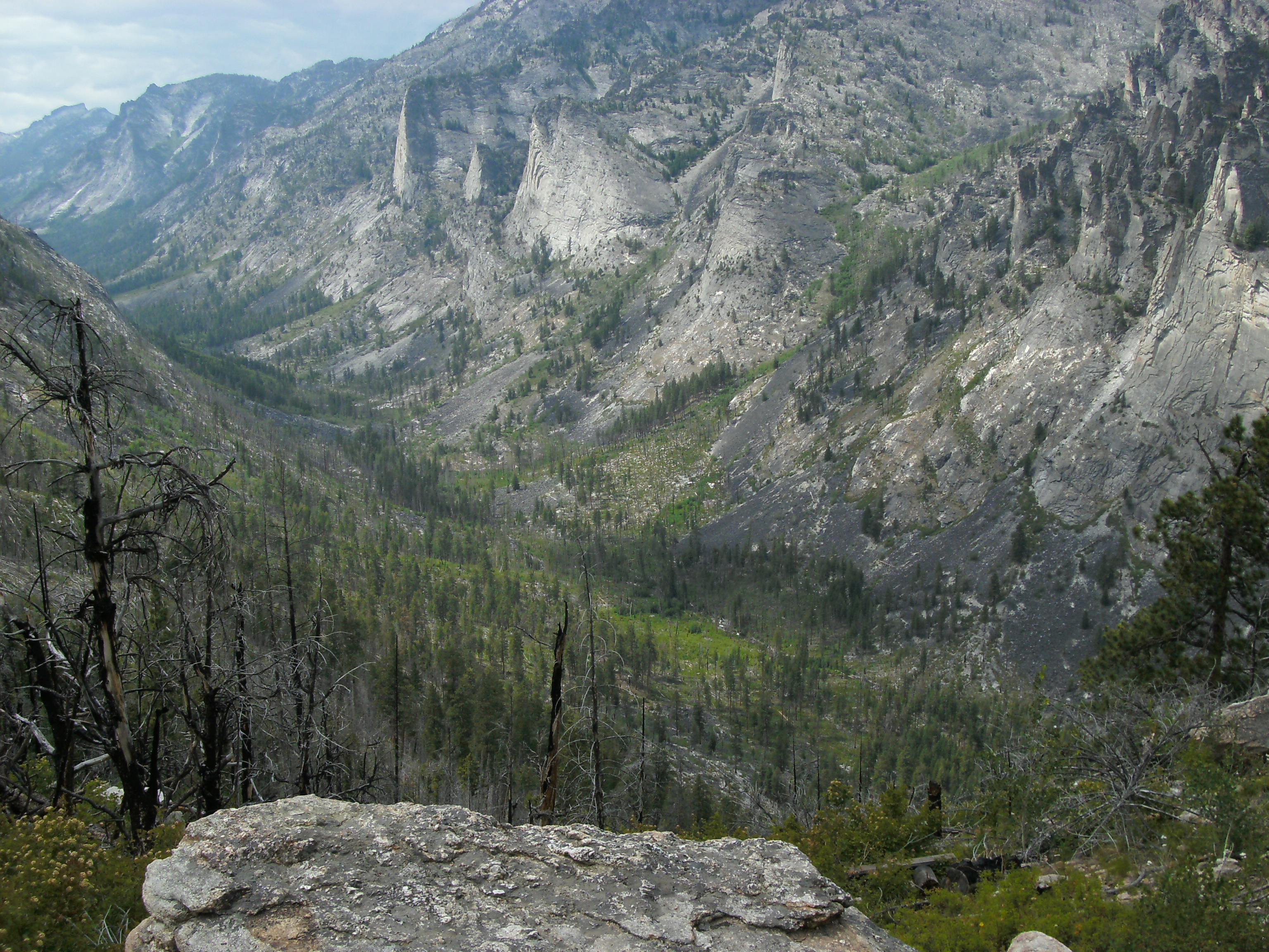
Blodgett Canyon is located in southwestern  The vertical canyon walls in the lower section rise over above Blodgett Creek. Printz Ridge and Mill Point make up the northern wall, while Canyon Peak and Romney Ridge contribute to the southern wall. The upper (eastern) section of the canyon is part of the Selway-Bitterroot Wilderness Area.
In the year 2000, the forest in the lower section of Blodgett Canyon was extensively burned. This damage extends about above the trailhead.
Montana
Montana () is a state in the Mountain West division of the Western United States. It is bordered by Idaho to the west, North Dakota and South Dakota to the east, Wyoming to the south, and the Canadian provinces of Alberta, British Columbi ...
in the northwestern United States
The United States of America (U.S.A. or USA), commonly known as the United States (U.S. or US) or America, is a country primarily located in North America. It consists of 50 states, a federal district, five major unincorporated territorie ...
. It is one of more than two dozen scenic canyon
A canyon (from ; archaic British English spelling: ''cañon''), or gorge, is a deep cleft between escarpments or cliffs resulting from weathering and the erosion, erosive activity of a river over geologic time scales. Rivers have a natural tenden ...
s deeply carved into the eastern flanks of the Bitterroot Range
The Bitterroot Range is a mountain range and a subrange of the Rocky Mountains that runs along the border of Montana and Idaho in the northwestern United States. The range spans an area of and is named after the bitterroot (''Lewisia rediviva' ...
in Bitterroot National Forest
Bitterroot National Forest comprises 1.587 million acres (6,423 km²) in west-central Montana and eastern Idaho, of the United States. It is located primarily in Ravalli County, Montana (70.26% of the forest), but also has acreage in Idaho ...
. Starting from a group of peaks at over along the Idaho/Montana border, the canyon steeply drops to Blodgett Lake at . After running northeast for about a mile, it turns due east and descends for a total of about to the Bitterroot Valley
The Bitterroot Valley is located in southwestern Montana, along the Bitterroot River between the Bitterroot Range and Sapphire Mountains, in the Northwestern United States.
Geography
The valley extends approximately from Lost Trail Pass in Id ...
. A trailhead is located at the mouth of the canyon, just west of the community of Hamilton Hamilton may refer to:
People
* Hamilton (name), a common British surname and occasional given name, usually of Scottish origin, including a list of persons with the surname
** The Duke of Hamilton, the premier peer of Scotland
** Lord Hamilt ...
and at an elevation of 4,000 feet (m).
Geology
The canyons in this region were carved out byice age
An ice age is a long period of reduction in the temperature of Earth's surface and atmosphere, resulting in the presence or expansion of continental and polar ice sheets and alpine glaciers. Earth's climate alternates between ice ages and gree ...
glacier
A glacier (; ) is a persistent body of dense ice that is constantly moving under its own weight. A glacier forms where the accumulation of snow exceeds its Ablation#Glaciology, ablation over many years, often Century, centuries. It acquires dis ...
s, which left behind U-shaped valleys, moraine
A moraine is any accumulation of unconsolidated debris (regolith and rock), sometimes referred to as glacial till, that occurs in both currently and formerly glaciated regions, and that has been previously carried along by a glacier or ice shee ...
s, hanging valleys, and steeply carved granite mountains, cliffs, and cirques
A (; from the Latin word ') is an amphitheatre-like valley formed by glacial erosion. Alternative names for this landform are corrie (from Scottish Gaelic , meaning a pot or cauldron) and (; ). A cirque may also be a similarly shaped landform ...
, all of which are visible within Blodgett Canyon. The glacial valley is carved into granitic rocks of the Bitterroot Lobe of the Idaho Batholith
The Idaho Batholith is a granitic and granodioritic batholith of Cretaceous- Paleogene age that covers approximately of central Idaho and adjacent Montana. The batholith has two lobes that are separate from each other geographically and geo ...
, a Late Cretaceous
The Late Cretaceous (100.5–66 Ma) is the younger of two epochs into which the Cretaceous Period is divided in the geologic time scale. Rock strata from this epoch form the Upper Cretaceous Series. The Cretaceous is named after ''creta'', the ...
to Paleocene
The Paleocene, ( ) or Palaeocene, is a geological epoch (geology), epoch that lasted from about 66 to 56 mya (unit), million years ago (mya). It is the first epoch of the Paleogene Period (geology), Period in the modern Cenozoic Era (geology), E ...
intrusive body emplaced by subduction
Subduction is a geological process in which the oceanic lithosphere is recycled into the Earth's mantle at convergent boundaries. Where the oceanic lithosphere of a tectonic plate converges with the less dense lithosphere of a second plate, the ...
beneath the western margin of North America.
Recreation
Blodgett Canyon is known among the climbing community as one of the best big wall climbing spots in Montana and the region. The tallest route is the South Face of Flathead Buttress, at about 1,200 feet of sustained vertical.Green, Randall; ed. 1995. Rock Climbing Montana. Falcon Press: Helena, MT, 1995.References