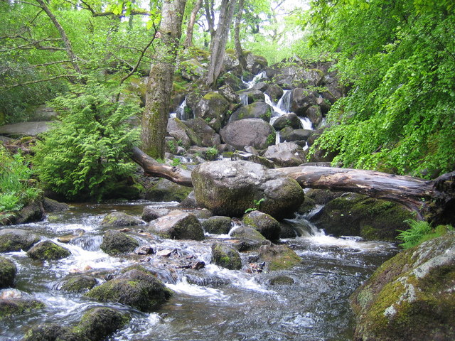
Becky Falls on:
[Wikipedia]
[Google]
[Amazon]
 Becky Falls, originally known as Becka Falls, is a tourist attraction in
 Becky Falls, originally known as Becka Falls, is a tourist attraction in
 Dartmoor
Dartmoor is an upland area in southern Devon, England. The moorland and surrounding land has been protected by National Park status since 1951. Dartmoor National Park covers .
The granite which forms the uplands dates from the Carboniferous ...
, England
England is a country that is part of the United Kingdom. It shares land borders with Wales to its west and Scotland to its north. The Irish Sea lies northwest and the Celtic Sea to the southwest. It is separated from continental Europe b ...
, centered on a waterfall
A waterfall is a point in a river or stream where water flows over a vertical drop or a series of steep drops. Waterfalls also occur where meltwater drops over the edge of a tabular iceberg or ice shelf.
Waterfalls can be formed in several wa ...
of around 20 metres down a boulder-strewn bed. In addition to the waterfall as the centrepiece, there is a woodland park with features such as a children's zoo, woodland trail, and crafts.
Waterfall
The waterfall is on the Becka Brook, one of the main tributaries of theRiver Bovey
The River Bovey rises on the eastern side of Dartmoor in Devon, England, and is the largest tributary to the River Teign. The river has two main source streams, both rising within a mile of each other, either side of the B3212 road between Moret ...
. The brook rises just South of Hound Tor
Hound Tor is a tor on Dartmoor, Devon, England and is a good example of a heavily weathered granite outcrop. It is easily accessible, situated within a few minutes from the B3387 between Bovey Tracey and Widecombe-in-the-Moor.
The site is admin ...
, and continues through Becky Falls before reaching the Bovey just below Trendlebere Down.
As the brook passes through, there are two sets of waterfalls created, with a drop of around 20 metres.
The falls were originally known as Becka Falls, including on Ordnance Survey
, nativename_a =
, nativename_r =
, logo = Ordnance Survey 2015 Logo.svg
, logo_width = 240px
, logo_caption =
, seal =
, seal_width =
, seal_caption =
, picture =
, picture_width =
, picture_caption =
, formed =
, preceding1 =
, di ...
maps up until the 1940s, but the name was changed when it became a tourist attraction.
References
{{coord, 50, 36, 26, N, 3, 45, 4, W, display=title, type:landmark_region:GB Amusement parks in England Buildings and structures in Devon Tourist attractions in Devon Waterfalls of England Dartmoor