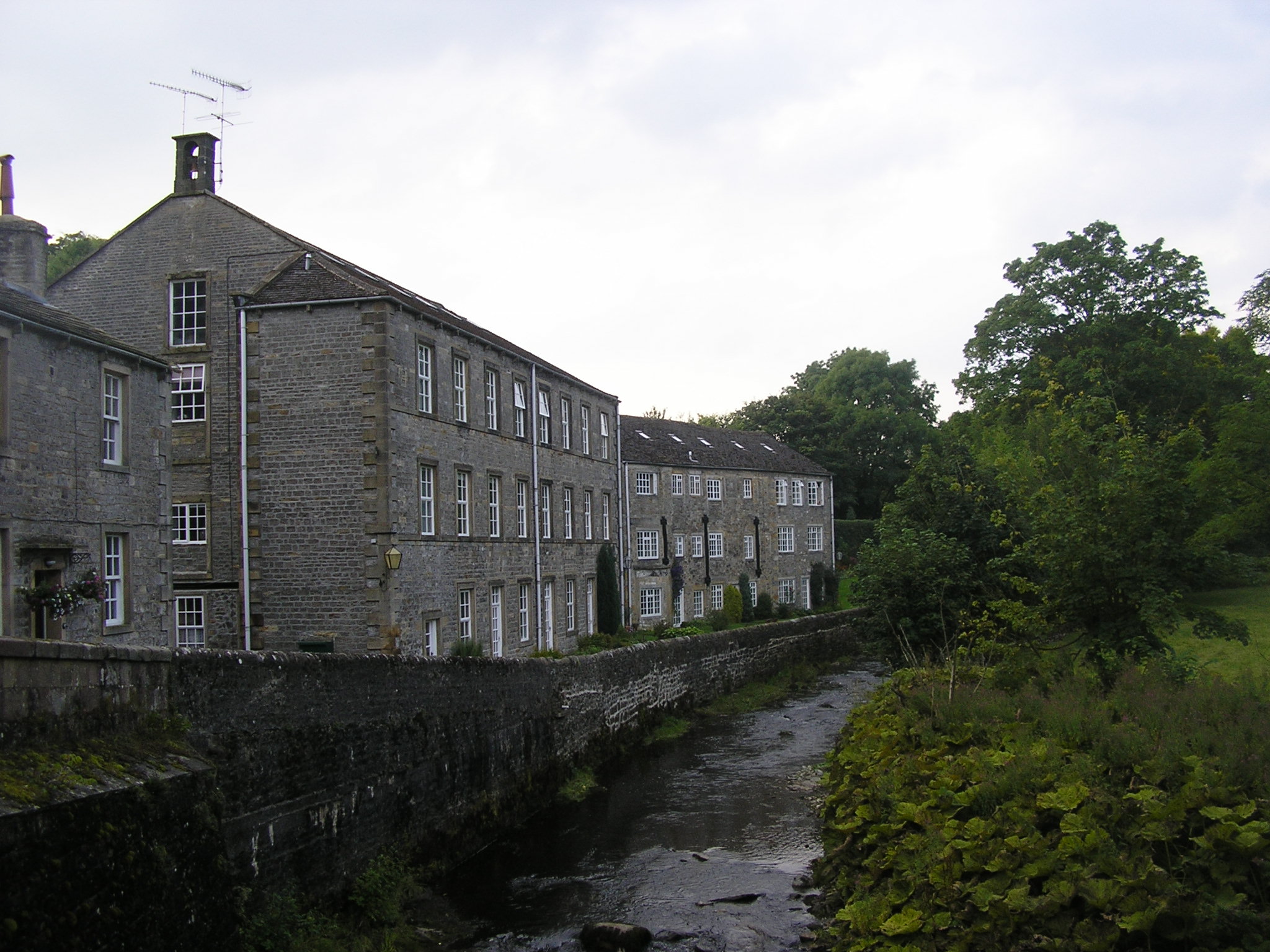
Airton on:
[Wikipedia]
[Google]
[Amazon]
Airton (also known as Airton-in-Craven) is a small village and
 The village is in the
Village and area web site
* {{authority control Villages in North Yorkshire Civil parishes in North Yorkshire
civil parish
In England, a civil parish is a type of administrative parish used for local government. It is a territorial designation which is the lowest tier of local government below districts and counties, or their combined form, the unitary authorit ...
in the Craven district of North Yorkshire
North Yorkshire is the largest ceremonial counties of England, ceremonial county (lieutenancy area) in England, covering an area of . Around 40% of the county is covered by National parks of the United Kingdom, national parks, including most of ...
, England, situated north-west of Skipton
Skipton (also known as Skipton-in-Craven) is a market town and civil parish in the Craven district of North Yorkshire, England. Historically in the East Division of Staincliffe Wapentake in the West Riding of Yorkshire, it is on the River Ai ...
. The village had a population of 175 according to the 2001 Census, increasing to 228 at the 2011 Census.
History
Listed as Airtone in the ''Domesday Book
Domesday Book () – the Middle English spelling of "Doomsday Book" – is a manuscript record of the "Great Survey" of much of England and parts of Wales completed in 1086 by order of King William I, known as William the Conqueror. The manus ...
'', the village takes its name from the River Aire
The River Aire is a major river in Yorkshire, England, in length. The ''Handbook for Leeds and Airedale'' (1890) notes that the distance from Malham to Howden is direct, but the river's meanderings extend that to . Between Malham Tarn and Ai ...
which runs along its eastern edge. In the late 1600s a significant Quaker community developed in the village around the Friends Meeting House. In use for the majority of its history, this building was restored between 2010 and 2012 and continues to host an active Quaker meeting.
Other significant buildings in Airton include a squatter's cottage on the village green, a former Methodist Chapel (now closed) and an old mill on the River Aire
The River Aire is a major river in Yorkshire, England, in length. The ''Handbook for Leeds and Airedale'' (1890) notes that the distance from Malham to Howden is direct, but the river's meanderings extend that to . Between Malham Tarn and Ai ...
which is in use as a private residence. The old cotton mill was given listed status in 1989. There is no pub or Post Office in the village; however there is a Farm Shop and Tea Room at Town End Farm on the road to Malham
Malham is a village and civil parish in the Craven district of North Yorkshire, England. Before 20th century boundary changes, the village was part of the Settle Rural District, in the historic West Riding of Yorkshire. In the ''Domesday Book' ...
.
Airton lies in the Ecclesiastical Parish of St. Michael and All Angels, Kirkby Malham
Kirkby Malham is a small village and civil parish in the Craven district of North Yorkshire, England. Situated in the Yorkshire Dales it lies east of Settle. The population of the civil parish as taken in the 2011 Census (including Hanlith a ...
.
Transport
There is a bus stop in the village with daily links to Malham and Skipton. Also, the local roads link the village to the A65.Tourism
Yorkshire Dales National Park
The Yorkshire Dales National Park is a national park in England covering most of the Yorkshire Dales. Most of the park is in North Yorkshire, with a sizeable area in Westmorland (Cumbria) and a small part in Lancashire. The park was designa ...
and lies on the tourist route to Malham Cove
Malham Cove is a large curved limestone formation north of the village of Malham, North Yorkshire, England. It was formed by a waterfall carrying meltwater from glaciers at the end of the last Ice Age more than 12,000 years ago. Today it is a ...
and Malham Tarn
Malham Tarn is a glacial lake near the village of Malham in the Yorkshire Dales, England. The lake is one of only eight upland alkaline lakes in Europe. At an altitude of above sea level it is the highest marl lake in the United Kingdom. Its ...
. The Pennine Way
The Pennine Way is a National Trail in England, with a small section in Scotland. The trail stretches for from Edale, in the northern Derbyshire Peak District, north through the Yorkshire Dales and Northumberland National Park and ends at Kir ...
passes around the edge of the village, alongside the river. The Way of the Roses cycle route passes through the village on the road between Settle
Settle or SETTLE may refer to:
Places
* Settle, Kentucky, United States
* Settle, North Yorkshire, a town in England
** Settle Rural District, a historical administrative district
Music
* Settle (band), an indie rock band from Pennsylvania
* ''S ...
and Grassington
Grassington is a market town and civil parish in the Craven district of North Yorkshire, England. The population of the parish at the 2011 Census was 1,126. Historically part of the West Riding of Yorkshire, the town is situated in Wharfedal ...
.
References
External links
*Village and area web site
* {{authority control Villages in North Yorkshire Civil parishes in North Yorkshire