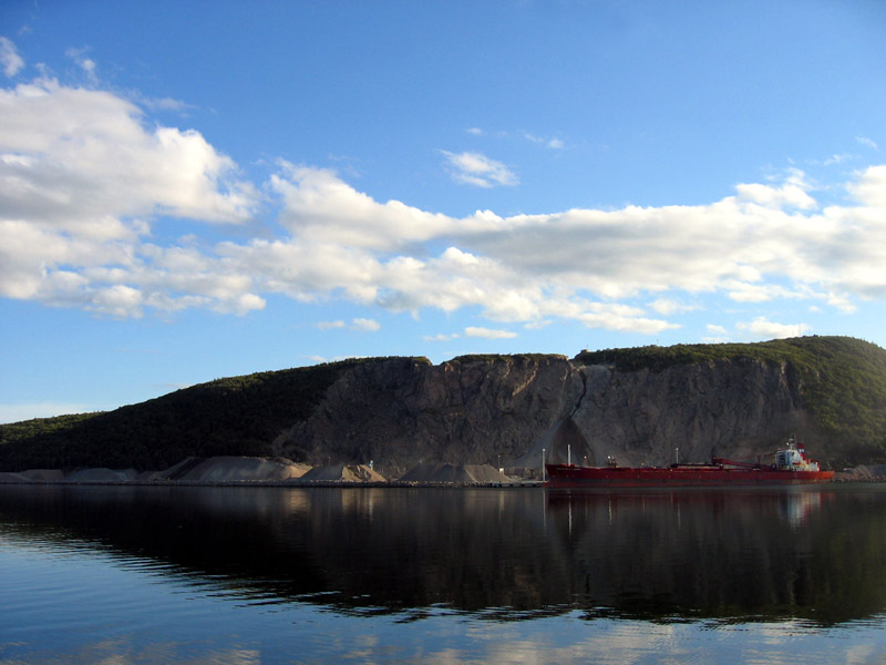
Auld's Cove, Nova Scotia on:
[Wikipedia]
[Google]
[Amazon]

 Aulds Cove is a community in the Canadian province of

 Aulds Cove is a community in the Canadian province of
 Nova Scotia
Nova Scotia ( ; ; ) is one of the thirteen provinces and territories of Canada. It is one of the three Maritime provinces and one of the four Atlantic provinces. Nova Scotia is Latin for "New Scotland".
Most of the population are native Eng ...
, located in both Antigonish County
, nickname =
, settlement_type = List of counties of Nova Scotia, County
, motto =
, image_skyline = Antigonish Harbour Panorama2.jpg
, image_caption =
, image_flag ...
and Guysborough County
Guysborough County is a county in the Provinces and territories of Canada, Canadian province of Nova Scotia.
History
Taking its name from the Guysborough, Nova Scotia, Township of Guysborough, which was named in honour of Sir Guy Carleton, 1st B ...
.
Situated on the western shore of the Strait of Canso, Aulds Cove is bifurcated by the county line. The northern section of the community is located in Antigonish County and the southern section is located in Guysborough County. Aulds Cove is directly opposite the community of Port Hastings
Port Hastings is a unincorporated settlement on Cape Breton Island, within the Municipality of the County of Inverness, Canada. The population in 2021 was 90.
The community is located at the eastern end of the Canso Causeway on Cape Breton Isla ...
located on Cape Breton Island
Cape Breton Island (french: link=no, île du Cap-Breton, formerly '; gd, Ceap Breatainn or '; mic, Unamaꞌki) is an island on the Atlantic coast of North America and part of the province of Nova Scotia, Canada.
The island accounts for 18. ...
. The community is thought to have derived its name from Alexander Auld, an early settler who had grist and saw mills at this location.
In 1955, the Canso Causeway
The Canso Causeway (''Cabhsair Chanso'' in Gaelic) is a rock-fill causeway crossing the Strait of Canso, connecting Cape Breton Island by road to the Nova Scotia peninsula. Its crest thickness is , carrying the two vehicle traffic lanes of th ...
opened, connecting the southern part of Aulds Cove with Port Hastings by road and railway. As part of this project, new alignments of Nova Scotia Trunk 4
Trunk 4 is part of the Canadian province of Nova Scotia's system of Trunk Highways. The route runs from Highway 104 exit 7 near Thomson Station to Glace Bay. Until the construction of the Trans-Canada Highway, Trunk 4 was a major traffic link ...
and the Canadian National Railway
The Canadian National Railway Company (french: Compagnie des chemins de fer nationaux du Canada) is a Canadian Class I freight railway headquartered in Montreal, Quebec, which serves Canada and the Midwestern and Southern United States.
CN i ...
(CNR) were built through the community. A large quarry on Cape Porcupine Mountain was also built at the southern end of Aulds Cove to supply fill material for the causeway; as of 2015, this quarry continues to operate in its sixth decade.
In the 1960s, the section of Trunk 4 through the community was upgraded as part of the Trans-Canada Highway
The Trans-Canada Highway ( French: ; abbreviated as the TCH or T-Can) is a transcontinental federal–provincial highway system that travels through all ten provinces of Canada, from the Pacific Ocean on the west coast to the Atlantic Ocean o ...
project and re-designated Nova Scotia Highway 104
Highway 104 in Nova Scotia, Canada, runs from Fort Lawrence at the New Brunswick border near Amherst to River Tillard near St. Peter's. Except for the portion on Cape Breton Island between Port Hawkesbury and St. Peter's, it forms the main ...
. Several motels, gas stations, and restaurants have opened in the last few decades and today Aulds Cove primarily serves as a service centre for motorists on Highway 104.
References
Communities in Antigonish County, Nova Scotia Communities in Guysborough County, Nova Scotia {{GuysboroughNS-geo-stub