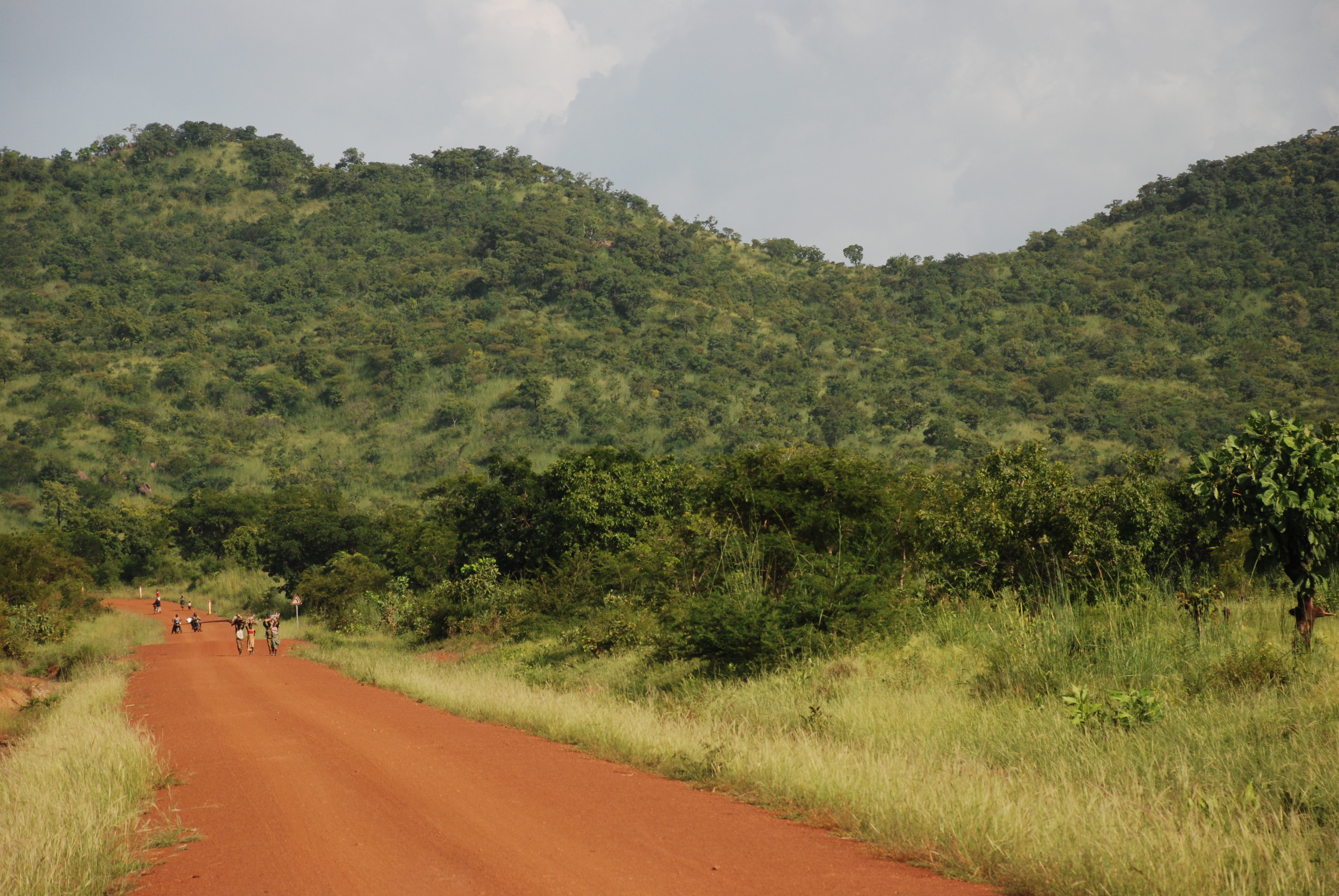
Atacora Range on:
[Wikipedia]
[Google]
[Amazon]
Atakora is the northwesternmost
 Atakora Department is located in the northwest of Benin, bordering
 The
The
department
Department may refer to:
* Departmentalization, division of a larger organization into parts with specific responsibility
Government and military
*Department (administrative division), a geographical and administrative division within a country, ...
of Benin
Benin ( , ; french: Bénin , ff, Benen), officially the Republic of Benin (french: République du Bénin), and formerly Dahomey, is a country in West Africa. It is bordered by Togo to the west, Nigeria to the east, Burkina Faso to the north ...
. Externally it borders Togo
Togo (), officially the Togolese Republic (french: République togolaise), is a country in West Africa. It is bordered by Ghana to the west, Benin to the east and Burkina Faso to the north. It extends south to the Gulf of Guinea, where its c ...
to the west and Burkina Faso
Burkina Faso (, ; , ff, 𞤄𞤵𞤪𞤳𞤭𞤲𞤢 𞤊𞤢𞤧𞤮, italic=no) is a landlocked country in West Africa with an area of , bordered by Mali to the northwest, Niger to the northeast, Benin to the southeast, Togo and Ghana to the ...
to the north; internally it borders the departments of Alibori, Borgou and Donga. Major towns in the Atakora include Natitingou and Tanguiéta, and the major tourist areas include the Tata Somba
The Tammari people, or Batammariba, also known as Otamari or Ottamari, are an Oti–Volta-speaking people of the Atakora Department of Benin where they are also known as Somba and neighboring areas of Togo, where they are officially known as ' ...
houses, Pendjari National Park, and various waterfalls. The department of Atakora was bifurcated in 1999, with its southern territory removed to form the newly created Donga Department. The capital of Atakora Department is Natitingou; it is after the Atakora Mountains.
, the total population of the department was 772,262, with 380,448 males and 391,814 females. The proportion of women was 50.70%. The total rural population was 62.80%, while the urban population was 37.20%. The total labour force in the department was 170,333, of which 27.20% were women. The proportion of households with no level of education was 72.80%.
Geography
Burkina Faso
Burkina Faso (, ; , ff, 𞤄𞤵𞤪𞤳𞤭𞤲𞤢 𞤊𞤢𞤧𞤮, italic=no) is a landlocked country in West Africa with an area of , bordered by Mali to the northwest, Niger to the northeast, Benin to the southeast, Togo and Ghana to the ...
to the north, Alibori Department and Borgou Department to the east, Donga Department to the south and Togo
Togo (), officially the Togolese Republic (french: République togolaise), is a country in West Africa. It is bordered by Ghana to the west, Benin to the east and Burkina Faso to the north. It extends south to the Gulf of Guinea, where its c ...
to the west. The terrain is mainly forested mountains, from which two tributaries of the Niger River
The Niger River ( ; ) is the main river of West Africa, extending about . Its drainage basin is in area. Its source is in the Guinea Highlands in south-eastern Guinea near the Sierra Leone border. It runs in a crescent shape through ...
- the Mékrou River
The Mékrou River is a river of Benin, Burkina Faso, and Niger. It flows through the W National Park.
A tributary of the Niger River
The Niger River ( ; ) is the main river of West Africa, extending about . Its drainage basin is in ...
and the Pendjari River
The Oti River or Pendjari River is an international river in West Africa. It rises in Benin, forms the border between Benin and Burkina Faso, flows through Togo, and joins the Volta River in Ghana.
Geography
The Oti River is about long. Its head ...
- originate. Part of the Atakora Mountain Range is located in the region and continues into northeastern Togo. The mountain range is characterised by numerous dambo areas (shallow wetlands) and head swamps. The bulk of the Pendjari National Park lies within Atakora.
The northern regions of Benin receive one season of rainfall from May to September, compared to the southern regions which receive two spells of rain from March to July and September to November. Harmattan
The Harmattan is a season in West Africa that occurs between the end of November and the middle of March. It is characterized by the dry and dusty northeasterly trade wind, of the same name, which blows from the Sahara over West Africa into the ...
winds blow from the northeast during the months of December to March. The country receives an average annual rainfall of around .
Settlements
Natitingou is the departmental capital; other major settlements includeBoukoumbé
Boukoumbé or Boukombé is a town, arrondissement and commune in north western Benin on the border with Togo. It is known for its market, its whipping ceremony and for its tradition of pipe making. Mount Kousso-Kovangou, the highest point in Ben ...
, Birni
Birni is a town and arrondissement in the Atakora Department of northwestern Benin near the border of Togo. It is an administrative division under the jurisdiction of the commune of Kouandé. According to the population census conducted by the Ins ...
, Firou
Firou is a town and arrondissement in the Atakora Department of northwestern Benin. It is an administrative division under the jurisdiction of the commune of Kérou. According to the population census conducted by the Institut National de la Stat ...
, Kouandé, Péhunco
Péhunco or Péhonko is a town, arrondissement and commune located in the Atakora Department of Benin
Benin ( , ; french: Bénin , ff, Benen), officially the Republic of Benin (french: République du Bénin), and formerly Dahomey, is a c ...
, Porga
Porga is a town located in the Atakora Department of Benin.
The Porga Airport serves Porga.
History
On December 1-2, 2021, a group of militants, possibly from Burkina Faso, attacked a border security post in Porga, killing two soldiers. Thi ...
, Tanguiéta and Toucountouna.
Demographics
According to Benin's 2013 census, the total population of the department was 772,262, with 380,448 males and 391,814 females. The proportion of women was 50.70%. The total rural population was 62.80%, while the urban population was 37.20%. The proportion of women of childbearing age (15 to 49 years old) was 21.80%. The foreign population was 10,395, representing 1.30% of the total population in the department. Thelabour force participation rate
Unemployment, according to the OECD (Organisation for Economic Co-operation and Development), is people above a specified age (usually 15) not being in paid employment or self-employment but currently available for work during the referen ...
among foreigners aged 15–64 years was 32.20%. The proportion of women among the foreign population constituted 47.90%. The number of households in the department was 107,599 and the average household size was 7.2. The intercensal growth rate of the population was 3.10%.
Among women, the average age at first marriage was 19.1 and the average age at maternity was 27.8. The synthetic index of fertility of women was 5.6. The average number of families in a house was 1.6 and the average number of persons per room was 1.7. The total labour force in the department was 170,333, of which 27.20% were women. The proportion of households with no level of education was 72.80% and the proportion of households with children attending school was 42.70%. The crude birth rate was 39.0, the general rate of fertility was 179.20 and the gross reproduction rate was 2.80.
The main ethnolinguistic groups in the Department are the Tammari (also known as the Betammaribe, or Somba), Waama and Dendi people
The Dendi are an ethnic group located in Benin, Niger, Nigeria and northern Togo mainly in the plains of the Niger River. They are part of the Songhai people. Derived from the Songhay language, the term "Dendi" translates to "down the river." Th ...
. Other groups include the Bariba, Biali, Chakosi (also known as Anufo), Gurma
Gurma (also called Gourma or Gourmantché) is an ethnic group living mainly in northeastern Ghana, Burkina Faso, around Fada N'Gourma, and also in northern areas of Togo and Benin, as well as southwestern Niger. They number approximately 1,750 ...
, Lama
Lama (; "chief") is a title for a teacher of the Dharma in Tibetan Buddhism. The name is similar to the Sanskrit term ''guru'', meaning "heavy one", endowed with qualities the student will eventually embody. The Tibetan word "lama" means "hi ...
, Mbelime, Nateni, Ngangam, Notre
Notre may refer to:
*Notre language
*André Le Nôtre
*
See also
*Notre Dame (disambiguation)
Notre Dame, French for "Our Lady", a title of Mary, mother of Jesus, most commonly refers to:
* Notre-Dame de Paris, a cathedral in Paris, France
* Un ...
, Miyobe and Yom
Yom ( he, יום) is a Biblical Hebrew word which occurs in the Hebrew Bible. The word means day in both Modern and Biblical Hebrew.
Overview
Although ''yom'' is commonly rendered as day in English translations, the word yom can be used in diffe ...
.
Local administration
 The
The department
Department may refer to:
* Departmentalization, division of a larger organization into parts with specific responsibility
Government and military
*Department (administrative division), a geographical and administrative division within a country, ...
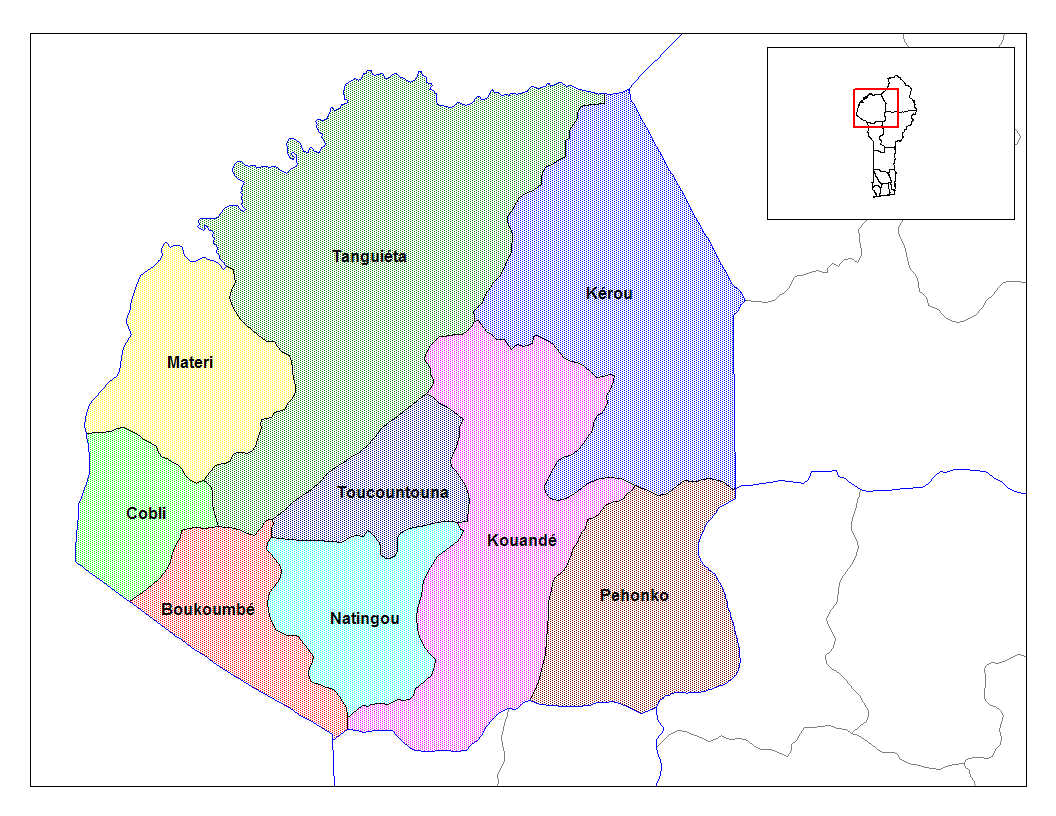
of Atakora was bifurcated in 1999, when its southern territory was transferred to the newly created Donga Department. The capital of the department is Natitingou. Atakora is subdivided into nine communes, each centred at one of the principal towns: Boukoumbé
Boukoumbé or Boukombé is a town, arrondissement and commune in north western Benin on the border with Togo. It is known for its market, its whipping ceremony and for its tradition of pipe making. Mount Kousso-Kovangou, the highest point in Ben ...
, Cobly
Cobly or Kobli is a town, arrondissement and commune in the Atakora Department of north-western Benin.
The commune covers an area of 825 square kilometres and as of 2013 had a population of 67,603 people.
Geography
The town of Cobly is located ...
, Kérou
Kérou is a town, arrondissement and commune located in the Atakora Department of Benin
Benin ( , ; french: Bénin , ff, Benen), officially the Republic of Benin (french: République du Bénin), and formerly Dahomey, is a country in West ...
, Kouandé, Matéri, Natitingou, Pehonko, Tanguiéta and Toucountouna.
Benin originally had six administrative regions (''départements''), which have now been bifurcated to make 12. Each of the deconcentrated
administrative services (''directions départementales'') of the sectoral ministries takes care of two administrative regions. A law passed in 1999 transformed the ''sous-prefectures'', the lowest level of territorial administration, into local governments. Municipalities and communal councils have elected representatives who manage the administration of the regions. The latest elections of the municipal and communal councils were held in June 2015.
References
External links
{{Authority control Departments of Benin