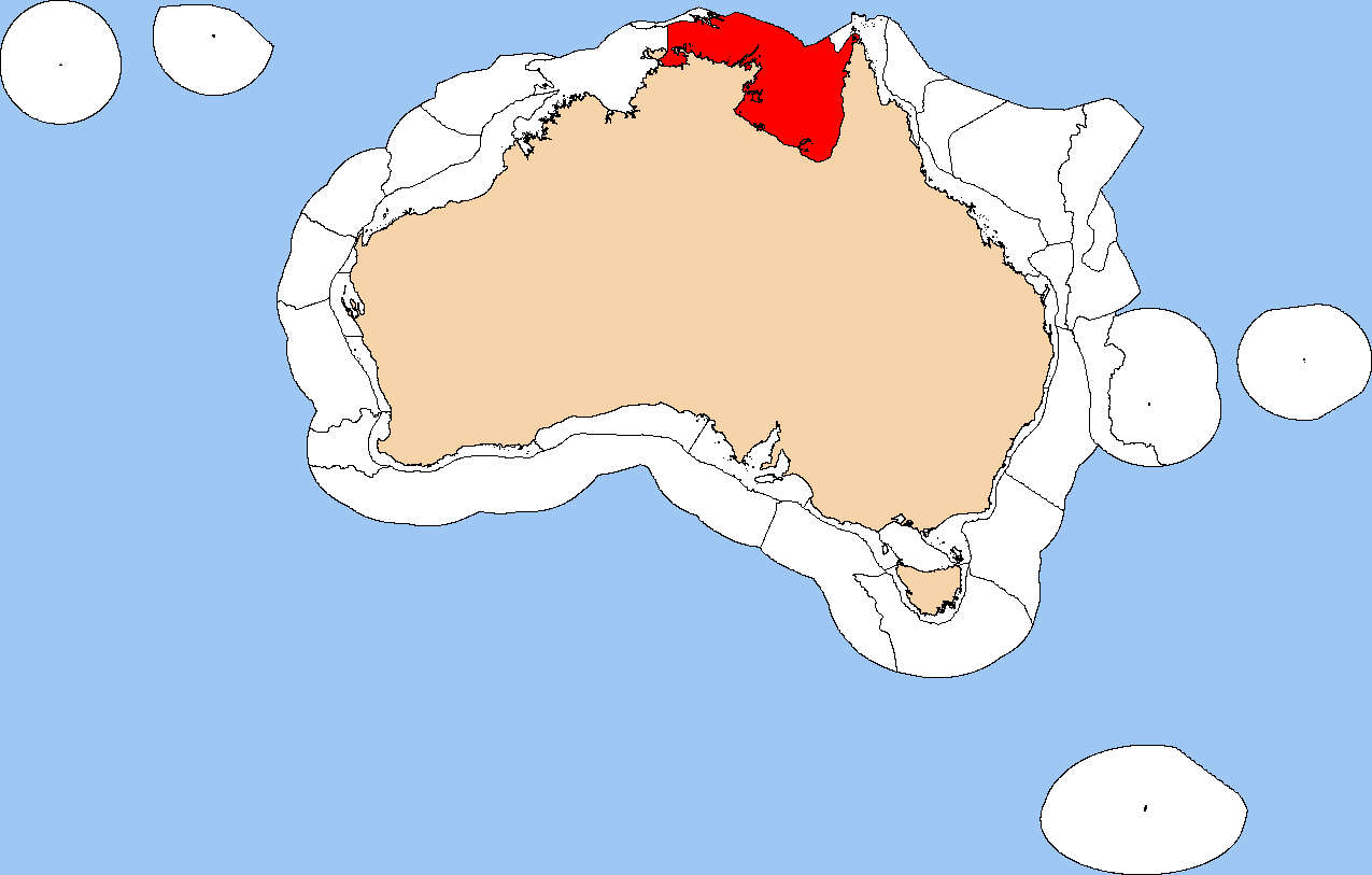
Arnhem Coast To Gulf Of Carpentaria on:
[Wikipedia]
[Google]
[Amazon]
 The Northern Shelf Province, also known as Arnhem Coast to Gulf of Carpentaria, is a
 The Northern Shelf Province, also known as Arnhem Coast to Gulf of Carpentaria, is a
 biogeographic
Biogeography is the study of the distribution of species and ecosystems in geographic space and through geological time. Organisms and biological communities often vary in a regular fashion along geographic gradients of latitude, elevation, ...
region of Australia's continental shelf. It includes the coastal waters of Arnhem Land and the Gulf of Carpentaria in Northern Australia.
Geography
The Northwest Shelf Transition includes the coastal waters and continental shelf of Northern Australia, extending from theNorthern Territory
The Northern Territory (commonly abbreviated as NT; formally the Northern Territory of Australia) is an Australian territory in the central and central northern regions of Australia. The Northern Territory shares its borders with Western Aust ...
's Tiwi Islands
The Tiwi Islands ( tiw, Ratuati Irara meaning "two islands") are part of the Northern Territory, Australia, to the north of Darwin adjoining the Timor Sea. They comprise Melville Island, Bathurst Island, and nine smaller uninhabited islands, w ...
eastwards along the coast of Arnhem Land and the Gulf of Carpentaria to Cape York.
The Northwest Shelf Transition
The Northwest Shelf Transition, also known as Bonaparte Coast, is a biogeographic region of Australia's continental shelf. It adjoins the Kimberley region of Western Australia and the adjacent coast of the Northern Territory.
Geography
The Northw ...
lies to the west, and the Northeast Shelf Transition
The Northeast Shelf Transition is a biogeographic region of Australia's coastal and continental shelf waters. It includes the tropical coastal waters of the northern Great Barrier Reef and the Torres Strait in northeastern-most Australia. It is a ...
to the northeast. To the north the shallow continental shelf extends outside Australian waters to New Guinea
New Guinea (; Hiri Motu: ''Niu Gini''; id, Papua, or , historically ) is the world's second-largest island with an area of . Located in Oceania in the southwestern Pacific Ocean, the island is separated from Australia by the wide Torr ...
."A Guide to the Integrated Marine and Coastal Regionalisation of Australia Version 4.0". Department of Environment and Heritage, Government of Australia. June 2006. ISBN 0 642 552274.
Meso-scale bioregions
TheIntegrated Marine and Coastal Regionalisation of Australia
The Integrated Marine and Coastal Regionalisation of Australia (IMCRA), formerly the Interim Marine and Coastal Regionalisation for Australia, is a biogeographic regionalisation of the oceanic waters of Australia's exclusive economic zone (EE ...
(IMCRA) identifies ten distinct meso-scale bioregions that make up the province.
* Van Diemens Gulf
Van Diemen Gulf is a gulf in the Northern Territory of Australia. It connects to the Timor Sea in the north via Dundas Strait. Most of its area is also gazetted as a locality with the name Van Diemen Gulf. History
The gulf was named after th ...
(VDG)
* Cobourg (COB)
* Arafura (ARA)
* Arnhem Wessel (AWS)
* Carpentaria (CAR)
* Groote (GRO)
* Pellew (PEL)
* Wellesley (WLY)
* Karumba-Nassau (KAN)
* West Cape York (WCY)
References
{{reflist Biogeography of the Northern Territory Biogeography of Queensland Ecoregions of Australia Marine ecoregions Central Indo-Pacific IMCRA provincial bioregions