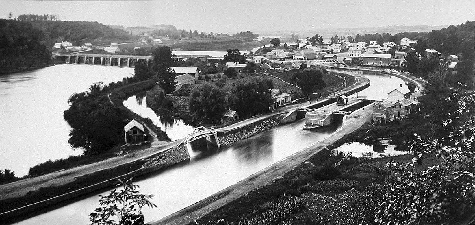
Aqueduct, New York on:
[Wikipedia]
[Google]
[Amazon]
 Aqueduct is a
hamlet
''The Tragedy of Hamlet, Prince of Denmark'', often shortened to ''Hamlet'' (), is a Shakespearean tragedy, tragedy written by William Shakespeare sometime between 1599 and 1601. It is Shakespeare's longest play. Set in Denmark, the play (the ...
in the Town
A town is a type of a human settlement, generally larger than a village but smaller than a city.
The criteria for distinguishing a town vary globally, often depending on factors such as population size, economic character, administrative stat ...
of Niskayuna, Schenectady County, New York
Schenectady County () is a county in the U.S. state of New York. As of the 2020 census, the population was 158,061. The county seat is Schenectady. The name is from a Mohawk language word meaning "on the other side of the pine lands," a te ...
, United States. Its center is at the south end of the bridge of New York State Route 146
New York State Route 146 (NY 146) is a state highway in the Capital District, New York, Capital District of New York (state), New York in the United States. It extends for from Gallupville, New York, Gallupville at New York State Rout ...
(Balltown Road) over the Mohawk River
The Mohawk River is a U.S. Geological Survey. National Hydrography Dataset high-resolution flowline dataThe National Map accessed October 3, 2011 river in the U.S. state of New York (state), New York. It is the largest tributary of the Hudson R ...
, that connects Schenectady County to the south and Saratoga County to the north. It was formerly a transportation hub. Alexander's Bridge across the Mohawk (see the map) antedated the Aqueduct. A new Route 146 steel highway bridge, with board pavement, parallel to the Aqueduct was built in the early 20th century. A Schenectady trolley line ended there, the line also serving Luna Park, just over the river in Rexford. There was, in Aqueduct, a staffed station of the Troy & Schenectady Railroad, which operated from 1841 to 1932.
The navigable aqueduct which gave the name was not part of a water supply. It was, rather, the water bridge that allowed boats on the Erie Canal
The Erie Canal is a historic canal in upstate New York that runs east–west between the Hudson River and Lake Erie. Completed in 1825, the canal was the first navigability, navigable waterway connecting the Atlantic Ocean to the Great Lakes, ...
, and the mules towing them, to cross over the Mohawk River, which ran beneath the water bridge or aqueduct. The aqueduct then continued westward along what is today Aqueduct Street, into downtown Schenectady. The original aqueduct, built in 1828, was of timber (logs). Built and replaced before photography, no visual image of it exists. It was replaced in 1842 with a masonry aqueduct. Pictures of this aqueduct were frequently used in Erie Canal publicity, and on post cards and calendars. Most of the aqueduct bridge was town down in 1918, when the New York State Barge Canal replaced the Erie Canal. A remnant exists in Rexford.
See also
* Mohawk Towpath Scenic BywayReferences
{{Coord, 42.848282, -73.888718, region:US-NY, display=title Hamlets in Schenectady County, New York Transportation in Schenectady County, New York Erie Canal Populated places on the Mohawk River Navigable aqueducts in the United States Transportation in Saratoga County, New York Mohawk River