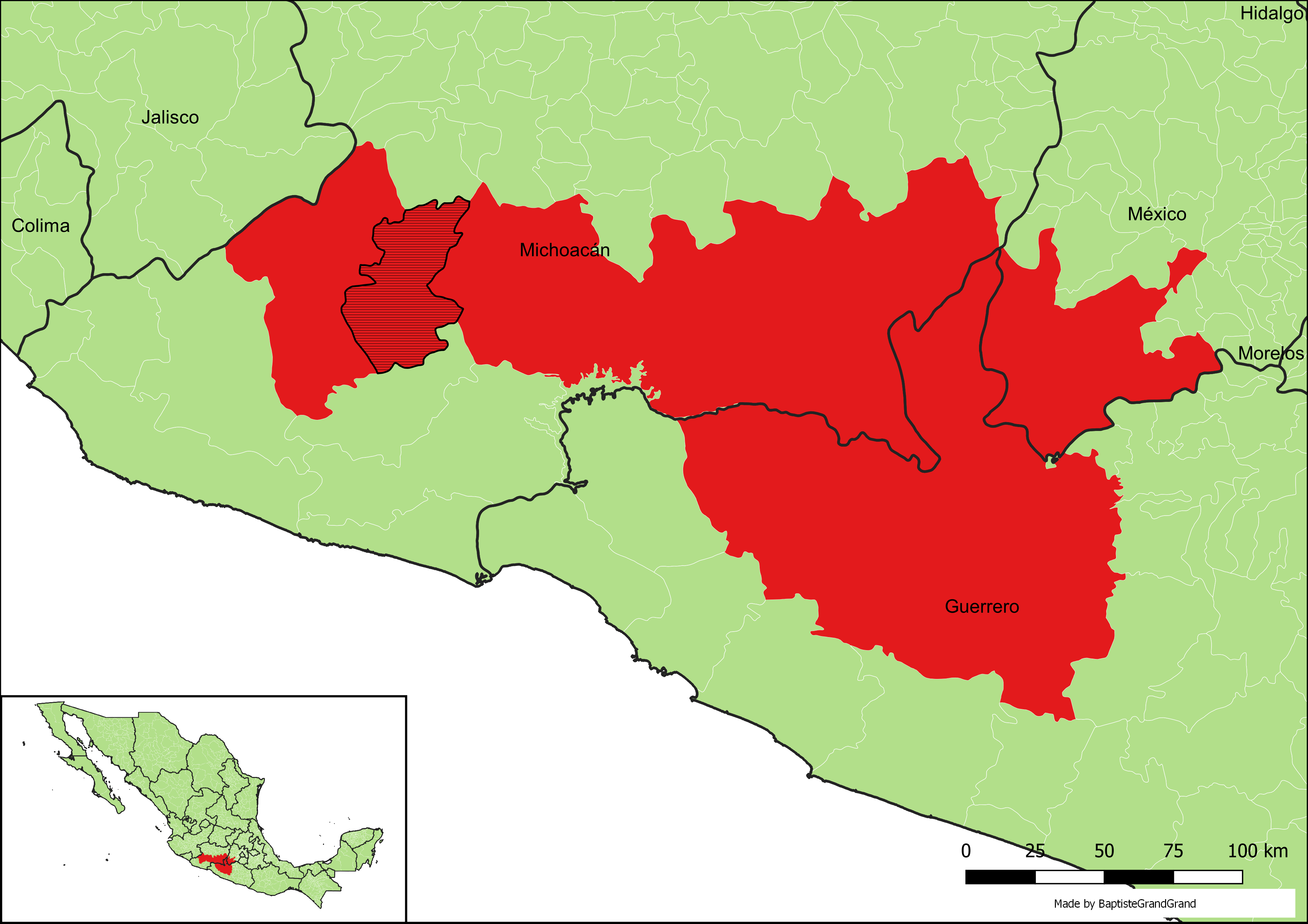
Apatzingán on:
[Wikipedia]
[Google]
[Amazon]
Apatzingán (in full, Apatzingán de la Constitución) is a city and

Link to tables of population data from Census of 2005
Instituto Nacional de Estadística, Geografía e Informática (INEGI)
Michoacán
Enciclopedia de los Municipios de México
Photograph from Apatzingan's main church
Ayuntamiento de Apatzingán
Official website
Apatzingan Map
{{DEFAULTSORT:Apatzingan Municipalities of Michoacán
municipal seat
A municipal seat or ''cabecera municipal'' is an administrative center, seat of government, or capital city of a municipality or civil parish with other villes or towns subordinated. The term is used in Brazil, Colombia,municipality
A municipality is usually a single administrative division having municipal corporation, corporate status and powers of self-government or jurisdiction as granted by national and regional laws to which it is subordinate.
The term ''municipality ...
of Apatzingán in the west-central region of the Mexican state
The states of Mexico are first-level administrative territorial entities of the country of Mexico, which is officially named United Mexican States. There are 32 federal entities in Mexico (31 states and the capital, Mexico City, as a separate ent ...
of Michoacán
Michoacán, formally Michoacán de Ocampo (; Purépecha: ), officially the Free and Sovereign State of Michoacán de Ocampo ( es, Estado Libre y Soberano de Michoacán de Ocampo), is one of the 32 states which comprise the Federal Entities of ...
.
Geography
The Municipality of Apatzingán is located in the Tierra Caliente Valley. It has an area of 1,656.67 km2 (639.64 sq mi), and reported a population of 99,010 (2010). The city of Apatzingán is the sixth-largest in Michoacán (behindMorelia
Morelia (; from 1545 to 1828 known as Valladolid) is a city and municipal seat of the municipality of Morelia in the north-central part of the state of Michoacán in central Mexico. The city is in the Guayangareo Valley and is the capital and larg ...
, Uruapan, Zamora
Zamora may refer to:
Places and jurisdictions
Europe
Spain
* Zamora, Spain, a city in the autonomous community of Castilla y León
* Province of Zamora, a province in the autonomous community of Castilla y León
* Associated with the city and ...
, Lázaro Cárdenas
Lázaro Cárdenas del Río (; 21 May 1895 – 19 October 1970) was a Mexican army officer and politician who served as president of Mexico from 1934 to 1940.
Born in Jiquilpan, Michoacán, to a working-class family, Cárdenas joined the Me ...
, and Zitacuaro), with a 2015 census population of 128,250 persons.
The major Sierra Madre del Sur
The Sierra Madre del Sur is a mountain range in southern Mexico, extending from southern Michoacán east through Guerrero, to the Isthmus of Tehuantepec in eastern Oaxaca.
Geography
The Sierra Madre del Sur joins with the Eje Volcánico Trans ...
mountain range and the municipality of Coalcomán de Vázquez Pallares are to the west.

History
Mexico's Constitution of Apatzingán was signed in the city in 1814, during theMexican War of Independence
The Mexican War of Independence ( es, Guerra de Independencia de México, links=no, 16 September 1810 – 27 September 1821) was an armed conflict and political process resulting in Mexico's independence from Spain. It was not a single, co ...
in the Viceroyalty of New Spain
New Spain, officially the Viceroyalty of New Spain ( es, Virreinato de Nueva España, ), or Kingdom of New Spain, was an integral territorial entity of the Spanish Empire, established by Habsburg Spain during the Spanish colonization of the Ame ...
against the Spanish Empire
The Spanish Empire ( es, link=no, Imperio español), also known as the Hispanic Monarchy ( es, link=no, Monarquía Hispánica) or the Catholic Monarchy ( es, link=no, Monarquía Católica) was a colonial empire governed by Spain and its prede ...
.
Six federal police officers were charged with murder on August 21, 2019
File:2019 collage v1.png, From top left, clockwise: Hong Kong protests turn to widespread riots and civil disobedience; House of Representatives votes to adopt articles of impeachment against Donald Trump; CRISPR gene editing first used to experim ...
for their supposed involvement in a police operation that left nine dead on January 6, 2015
File:2015 Events Collage new.png, From top left, clockwise: Civil service in remembrance of November 2015 Paris attacks; Germanwings Flight 9525 was purposely crashed into the French Alps; the rubble of residences in Kathmandu following the April ...
in Apatzingán. At least nine people died and several were injured when police fired against members and sympathizers of self-defense groups who had taken over the municipal palace.
Climate
Despite having an annual precipitation of , Apatzingán has asemi-arid climate
A semi-arid climate, semi-desert climate, or steppe climate is a dry climate sub-type. It is located on regions that receive precipitation below potential evapotranspiration, but not as low as a desert climate. There are different kinds of semi- ...
(Köppen climate classification
The Köppen climate classification is one of the most widely used climate classification systems. It was first published by German-Russian climatologist Wladimir Köppen (1846–1940) in 1884, with several later modifications by Köppen, nota ...
''BSh'') due to its hot temperatures and high evaporation rates.
See also
*Immaculate Conception Cathedral, Apatzingán
The Immaculate Conception is the belief that the Virgin Mary was free of original sin from the moment of her conception.
It is one of the four Marian dogmas of the Catholic Church, meaning that it is held to be a divinely revealed truth wh ...
References
Sources
Link to tables of population data from Census of 2005
Instituto Nacional de Estadística, Geografía e Informática (INEGI)
Michoacán
Enciclopedia de los Municipios de México
Photograph from Apatzingan's main church
External links
Ayuntamiento de Apatzingán
Official website
Apatzingan Map
{{DEFAULTSORT:Apatzingan Municipalities of Michoacán