Amphoe Si Thep on:
[Wikipedia]
[Google]
[Amazon]
Si Thep ( th, ศรีเทพ, ) is the southernmost district (''
 The district was created on 13 December 1970 as a minor district (''
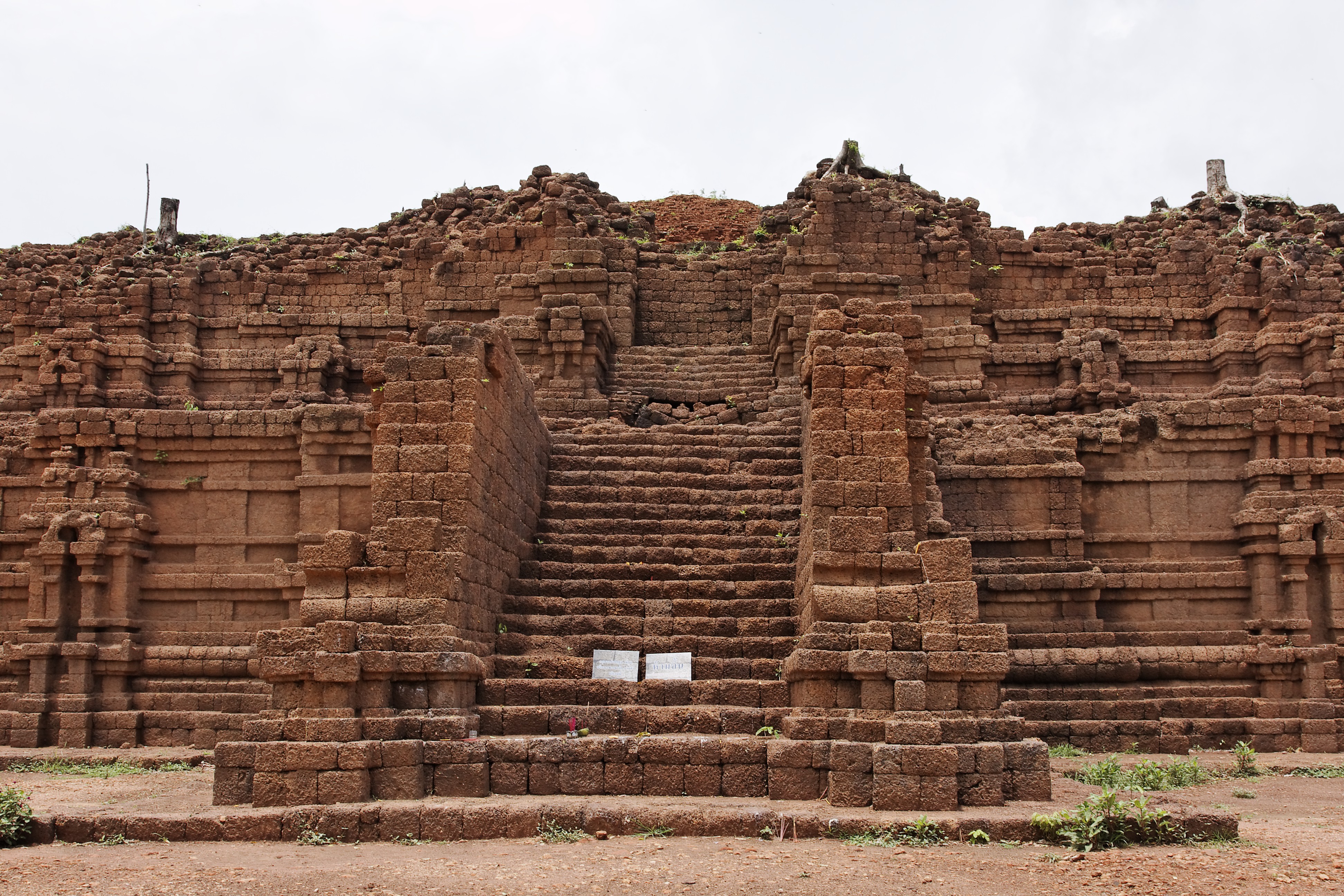
Si Thep Historical Park by Finearts
Si Thep Dvaravati {{Phetchabun-geo-stub
amphoe
An amphoe (sometimes also ''amphur'', th, อำเภอ, )—usually translated as "district"—is the second level administrative subdivision of Thailand. Groups of ''amphoe'' or districts make up the provinces, and are analogous to countie ...
'') of Phetchabun province
Phetchabun ( th, เพชรบูรณ์, ) is one of Thailand's seventy-six provinces (''changwat'') lies in lower northern Thailand. Neighbouring provinces are (from north clockwise) Loei, Khon Kaen, Chaiyaphum, Lopburi, Nakhon Sawan, Phic ...
, Thailand, in the valley of the Pa Sak River
The Pa Sak River ( th, แม่น้ำป่าสัก, , Pronunciation is a river in central Thailand. The river originates in the Phetchabun Mountains, Dan Sai District, Loei Province, and passes through Phetchabun Province as the backb ...
. Si Thep, now on a tentative list of UN World Heritage Site
A World Heritage Site is a landmark or area with legal protection by an international convention administered by the United Nations Educational, Scientific and Cultural Organization (UNESCO). World Heritage Sites are designated by UNESCO for h ...
s, is Thailand's largest ancient city.
History
 The district was created on 13 December 1970 as a minor district (''
king amphoe
An amphoe (sometimes also ''amphur'', th, อำเภอ, )—usually translated as "district"—is the second level administrative subdivision of Thailand. Groups of ''amphoe'' or districts make up the provinces, and are analogous to countie ...
'') with territory from Wichian Buri district. It was upgraded to Si Thep District on 8 August 1976.
The ancient city of Si Thep was built in the Dvaravati era. Prince Damrong
Prince Tisavarakumarn, the Prince Damrong Rajanubhab (Thai language, Thai: ; Full transcription is "Somdet Phrachao Borommawongthoe Phra-ongchao Ditsawarakuman Kromphraya Damrongrachanuphap" (สมเด็จพระเจ้าบรมว� ...
found the area of the old city in 1905 when he visited Monthon Phetchabun
''Monthon'' ( th, มณฑล) were administrative subdivisions of Thailand at the beginning of the 20th century. The Thai word ''monthon'' is a translation of the word ''mandala'' (', literally "circle"), in its sense of a type of political for ...
. It is now Si Thep Historical Park
Si Thep Historical Park ( th, อุทยานประวัติศาสตร์ศรีเทพ) is an archaeological site in Thailand's Phetchabun province. It covers the ancient city of Si Thep, a site inhabited from around the third ...
.
Geography
Si Thep is on a dry highland surrounded by waterways and floodplains bordered by mountains on both sides. To ensure sufficient water for city use, ancient Si Thep had an elaborate system of ponds, tank moats, and a hydraulic system to bring water from higher grounds to sustain the city. Neighboring districts are (from the north clockwise) Wichian Buri of Phetchabun Province, andLam Sonthi
Lam Sonthi (, ) is a tributary of the Pa Sak River. It originates at the Ruak and Phanghoei mountains in the border area of Amphoe Lam Sonthi, Lam Sonthi district, Lopburi province and Amphoe Si Thep, Si Thep, Phetchabun province. The river flows s ...
, Chai Badan, and Khok Charoen of Lopburi province.
Administration
The district is divided into seven sub-districts (''tambon
''Tambon'' ( th, ตำบล, ) is a local governmental unit in Thailand. Below district (''amphoe'') and province (''changwat''), they form the third administrative subdivision level. there were 7,255 tambons, not including the 180 ''khwaeng'' ...
s''), which are further subdivided into 93 villages (''muban
Muban ( th, หมู่บ้าน; , ) is the lowest administrative sub-division of Thailand. Usually translated as 'village' and sometimes as 'hamlet', they are a subdivision of a tambon (subdistrict). , there were 74,944 administrative mu ...
s''). The township (''thesaban tambon
Thesaban ( th, เทศบาล, , ) are the municipalities of Thailand. There are three levels of municipalities: city, town, and sub-district. Bangkok and Pattaya are special municipal entities not included in the ''thesaban'' system.
The mu ...
'') Sawang Watthana covers parts of tambon Sa Kruat. There are seven tambon administrative organizations (TAO).
References
External links
Si Thep Historical Park by Finearts
Si Thep Dvaravati {{Phetchabun-geo-stub