Ailsworth, Cambridgeshire on:
[Wikipedia]
[Google]
[Amazon]

 Ailsworth or Ailesworth is a village and

 Ailsworth or Ailesworth is a village and
 civil parish
In England, a civil parish is a type of administrative parish used for local government. It is a territorial designation which is the lowest tier of local government below districts and counties, or their combined form, the unitary authorit ...
in the City of Peterborough unitary authority, about west of the city centre. The parish is part of the former Soke of Peterborough
The Soke of Peterborough is a historic area of England associated with the City and Diocese of Peterborough, but considered part of Northamptonshire. The Soke was also described as the Liberty of Peterborough, or Nassaburgh hundred, and comp ...
, which was considered geographically part of Northamptonshire
Northamptonshire (; abbreviated Northants.) is a county in the East Midlands of England. In 2015, it had a population of 723,000. The county is administered by
two unitary authorities: North Northamptonshire and West Northamptonshire. It is ...
until in 1974, following the Local Government Act 1972, it became part of Cambridgeshire
Cambridgeshire (abbreviated Cambs.) is a county in the East of England, bordering Lincolnshire to the north, Norfolk to the north-east, Suffolk to the east, Essex and Hertfordshire to the south, and Bedfordshire and Northamptonshire to the ...
.
In the 2001 census the population stood at 413 (188 households) and this has increased to 559 (248 households) in the 2011 census
History
The village'stoponym
Toponymy, toponymics, or toponomastics is the study of '' toponyms'' (proper names of places, also known as place names and geographic names), including their origins, meanings, usage and types. Toponym is the general term for a proper name of ...
comes from the Old English
Old English (, ), or Anglo-Saxon, is the earliest recorded form of the English language, spoken in England and southern and eastern Scotland in the early Middle Ages. It was brought to Great Britain by Anglo-Saxon settlers in the mid-5th c ...
''Ægeleswurth''. The Domesday Book
Domesday Book () – the Middle English spelling of "Doomsday Book" – is a manuscript record of the "Great Survey" of much of England and parts of Wales completed in 1086 by order of King William I, known as William the Conqueror. The manus ...
of 1086 records it as ''Eglesworde'' meaning "an enclosure of a man named Agel".
The common land
Common land is land owned by a person or collectively by a number of persons, over which other persons have certain common rights, such as to allow their livestock to graze upon it, to collect wood, or to cut turf for fuel.
A person who has a ...
s of Ailsworth and the neighbouring parish of Castor were not enclosed
Enclosure or Inclosure is a term, used in English landownership, that refers to the appropriation of "waste" or "common land" enclosing it and by doing so depriving commoners of their rights of access and privilege. Agreements to enclose land ...
until 1898.
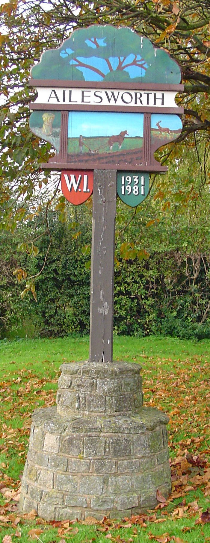
The old village sign (pictured) celebrating the Golden Jubilee of the local Women's Institute
The Women's Institute (WI) is a community-based organisation for women in the United Kingdom, Canada, South Africa and New Zealand. The movement was founded in Stoney Creek, Ontario, Canada, by Erland and Janet Lee with Adelaide Hoodless being the ...
was erected in 1981 on the boundary with the neighbouring village of Castor. A new sign was erected in 2021 and the old sign sold off.
The £9 million dual-carriageway Ailsworth and Castor Bypass, which is part of the A47 road
The A47 is a major road in England linking Birmingham to Lowestoft, Suffolk. Most of the section between Birmingham and Nuneaton is now classified as the B4114. From Peterborough eastwards, it is a trunk road (sections west of the A1 road ha ...
, was opened in September 1991.
Churches
Ailsworth lies in the ecclesiastical parish of Castor. There is a Methodist Chapel.Amenities
In Ailsworth there is a medical practice, village shop, coffee house, recreation ground and children's play area. The village does not have a public house with the nearest being The Prince of Wales Feathers and The Royal Oak in neighbouring Castor. The last pub that was open in the village was The Wheatsheaf which is now a private home situated at the end of Peterborough Road.See also
* Aylesworth (disambiguation)References
External links
* * {{authority control Villages in Cambridgeshire Geography of Peterborough Civil parishes in Cambridgeshire