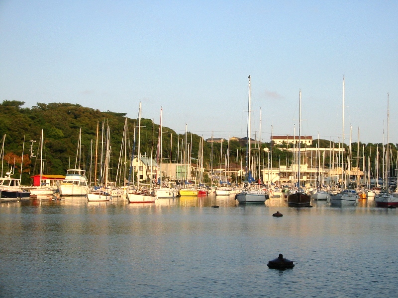
Aburatsubo on:
[Wikipedia]
[Google]
[Amazon]


 is an inlet on the west side of the

 is an inlet on the west side of the
 Miura Peninsula
is a peninsula located in Kanagawa, Japan. It lies south of Yokohama and Tokyo and divides Tokyo Bay, to the east, from Sagami Bay, to the west. Cities and towns on the Miura Peninsula include Yokosuka, Miura, Hayama, Zushi, and Kamakura. ...
in Kanagawa
is a Prefectures of Japan, prefecture of Japan located in the Kantō region of Honshu. Kanagawa Prefecture is the List of Japanese prefectures by population, second-most populous prefecture of Japan at 9,221,129 (1 April 2022) and third-dens ...
, Japan
Japan ( ja, 日本, or , and formally , ''Nihonkoku'') is an island country in East Asia. It is situated in the northwest Pacific Ocean, and is bordered on the west by the Sea of Japan, while extending from the Sea of Okhotsk in the north ...
, facing Sagami Bay
lies south of Kanagawa Prefecture in Honshu, central Japan, contained within the scope of the Miura Peninsula, in Kanagawa, to the east, the Izu Peninsula, in Shizuoka Prefecture, to the west, and the Shōnan coastline to the north, while the ...
on the Pacific Ocean
The Pacific Ocean is the largest and deepest of Earth's five oceanic divisions. It extends from the Arctic Ocean in the north to the Southern Ocean (or, depending on definition, to Antarctica) in the south, and is bounded by the continen ...
. It exits into neighbouring Moroiso
Moroiso (諸磯) is the name of an inlet in the Miura Peninsula south of Tokyo in Japan.
Prehistory
Moroiso was settled by Jōmon people by at least 3,000 BCE. Evidence from that period have been found, including sedentary to semi-sedentary ...
inlet.
History
During historic times, the Aburatsubo inlet was selected by the feudal Miura family to build a series of fortifications, with Arai castle at its center. During theSengoku period
The was a period in History of Japan, Japanese history of near-constant civil war and social upheaval from 1467 to 1615.
The Sengoku period was initiated by the Ōnin War in 1467 which collapsed the Feudalism, feudal system of Japan under the ...
, the castle fell after a 3-year siege to the rival Later Hōjō clan
The was one of the most powerful samurai families in Japan in the Sengoku period and held domains primarily in the Kantō region. Their last name was simply Hōjō (北条) but in order to differentiate between the earlier Hōjō clan with the ...
, in the year 1516. The Hōjō later managed to unify most of the Kantō.
According to some stories, the name Aburatsubo ("Oil Vase"), comes from the time when hundreds of samurai
were the hereditary military nobility and officer caste of medieval and early-modern Japan from the late 12th century until their abolition in 1876. They were the well-paid retainers of the '' daimyo'' (the great feudal landholders). They h ...
, fleeing the troops of Hōjō, drowned in the waters of the inlet and left it a sea of blood.
Aburatsubo today
Aburatsubo is a "hurricane hole" where fishing boats from the area take refuge when atyphoon
A typhoon is a mature tropical cyclone that develops between 180° and 100°E in the Northern Hemisphere. This region is referred to as the Northwestern Pacific Basin, and is the most active tropical cyclone basin on Earth, accounting for a ...
arrives. The calm, protected waters of the inlet suggest they are the actual reason behind the name "Aburatsubo". Regardless of the reason, the adjacent Shirahige shrine
A shrine ( la, scrinium "case or chest for books or papers"; Old French: ''escrin'' "box or case") is a sacred or holy sacred space, space dedicated to a specific deity, ancestor worship, ancestor, hero, martyr, saint, Daemon (mythology), daem ...
, dedicated to Fukurojin, was built as thanks for the inlet's calmness.
References
Landforms of Kanagawa Prefecture Inlets of Japan {{Kanagawa-geo-stub