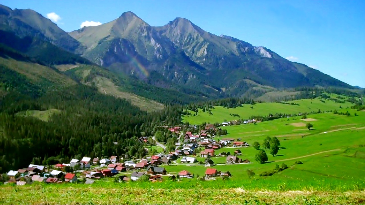
┼Įdiar on:
[Wikipedia]
[Google]
[Amazon]
┼Įdiar (former name ┼Įj├Īr) is a
Official website of ┼Įdiar
Tourist website of ┼Įdiar
 Spi┼Ī
Villages and municipalities in Poprad District
Ski areas and resorts in Slovakia
{{Pre┼Īov-geo-stub
village
A village is a clustered human settlement or community, larger than a hamlet but smaller than a town (although the word is often used to describe both hamlets and smaller towns), with a population typically ranging from a few hundred ...
and municipality
A municipality is usually a single administrative division having corporate status and powers of self-government or jurisdiction as granted by national and regional laws to which it is subordinate.
The term ''municipality'' may also mean the go ...
in the Poprad District
Poprad District (''okres Poprad'') is a district in
the Pre┼Īov Region of eastern Slovakia. The district had been established in 1923 and from 1996 exists in its current borders. It consists of 29 municipalities, from which three have a town statu ...
in the Pre┼Īov Region in Spi┼Ī
Spi┼Ī (Latin: ''Cips/Zepus/Scepus/Scepusia'', german: Zips, hu, Szepess├®g/Szepes, pl, Spisz) is a region in north-eastern Slovakia, with a very small area in south-eastern Poland (14 villages). Spi┼Ī is an informal designation of the territory ...
in northern Slovakia
Slovakia (; sk, Slovensko ), officially the Slovak Republic ( sk, Slovensk├Ī republika, links=no ), is a landlocked country in Central Europe. It is bordered by Poland to the north, Ukraine to the east, Hungary to the south, Austria to the s ...
.
History
In historical records the village was first mentioned in 1409. Its first name had been Stragan. Locals had been engaged in agriculture, pasturage and charcoal production. From the end of 19th century they began to be employed in tourism.It is a historicallyGoral
The gorals are four species in the genus ''Naemorhedus''. They are small ungulates with a goat-like or antelope-like appearance. Until recently, this genus also contained the serow species (now in genus '' Capricornis'').
Etymology
The original ...
village.
Geography
The municipality lies at anelevation
The elevation of a geographic location is its height above or below a fixed reference point, most commonly a reference geoid, a mathematical model of the Earth's sea level as an equipotential gravitational surface (see Geodetic datum ┬¦ Ver ...
of 896 meters at the base of the High Tatras
The High Tatras or High Tatra Mountains ( Slovak: Vysok├® Tatry; pl, Tatry Wysokie; rue, ąÆčŗčüąŠą║č¢ ąóą░čéčĆąĖ,'' Vysoki Tatry''; hu, Magas-T├Ītra; german: Hohe Tatra; french: Hautes Tatras), are a mountain range along the border of norther ...
and covers an area
Area is the quantity that expresses the extent of a region on the plane or on a curved surface. The area of a plane region or ''plane area'' refers to the area of a shape or planar lamina, while '' surface area'' refers to the area of an ope ...
of 27.323 km┬▓. It has a population
Population typically refers to the number of people in a single area, whether it be a city or town, region, country, continent, or the world. Governments typically quantify the size of the resident population within their jurisdiction using a ...
of about 1,340 people.
The village is located about 3 km from the Polish border crossing and 34 km from Poprad.
Recreation
┼Įdiar is located at the base of Strednica alpine and cross country Ski resort. Several hiking trails into the High Tatras begin in the village.External links
Official website of ┼Įdiar
Tourist website of ┼Įdiar
 Spi┼Ī
Villages and municipalities in Poprad District
Ski areas and resorts in Slovakia
{{Pre┼Īov-geo-stub