ŇĆsumi Peninsula on:
[Wikipedia]
[Google]
[Amazon]
 261x261px, Satellite image of ŇĆsumi Peninsula
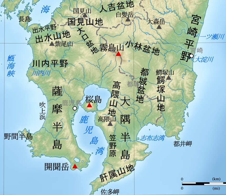
The projects south from the Japanese island of
 261x261px, Satellite image of ŇĆsumi Peninsula
The projects south from the Japanese island of
 KyŇęshŇę
is the third-largest island of Japan's five main islands and the most southerly of the four largest islands ( i.e. excluding Okinawa). In the past, it has been known as , and . The historical regional name referred to Kyushu and its surround ...
and includes the southernmost point on the island, Cape Sata. Its east coast lies on the Pacific Ocean
The Pacific Ocean is the largest and deepest of Earth's five oceanic divisions. It extends from the Arctic Ocean in the north to the Southern Ocean (or, depending on definition, to Antarctica) in the south, and is bounded by the continen ...
, while to the west it faces the Satsuma Peninsula across Kagoshima Bay
also known as KinkŇć Bay, is a deep inlet of the East China Sea on the coast of Japan.''Merriam Webster's Geographical Dictionary, Third Edition'', p. 562.
Kagoshima Bay is on the south coast of the island of KyŇęshŇę. The port city of Kagoshi ...
. Politically it is part of Kagoshima Prefecture
is a prefecture of Japan located on the island of Kyushu and the Ryukyu Islands. Kagoshima Prefecture has a population of 1,599,779 (1 January 2020) and has a geographic area of 9,187 km2 (3,547 sq mi). Kagoshima Prefecture borders Kumamoto P ...
. Lava erupted in 1914 by Sakurajima
Sakurajima ( ja, ś°úŚ≥∂, literally "Cherry Blossom Island") is an active stratovolcano, formerly an island and now a peninsula, in Kagoshima Prefecture in Kyushu, Japan. The lava flows of the 1914 eruption connected it with the ŇĆsumi Peninsula ...
(previously an island) made a land connection with the northwest of the ŇĆsumi Peninsula.
See also
*: Southernmost pointReferences
{{DEFAULTSORT:Osumi Peninsula Peninsulas of Japan Landforms of Kagoshima Prefecture