|
─īardak, Kovin
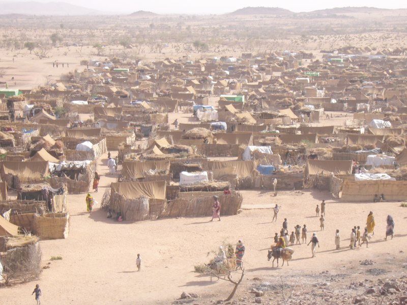
─īardak is a former vacation settlement on the southern edge of the Deliblatska pe┼Ī─Źara (Deliblato Sands), in the community of Kovin in Serbia. It has served as a refugee camp since 1991. The camp is about five km east of the village of Deliblato in the South Banat District. During the Yugoslav Wars many Serbs fled from Croatia , image_flag = Flag of Croatia.svg , image_coat = Coat of arms of Croatia.svg , anthem = "Lijepa na┼Īa domovino"("Our Beautiful Homeland") , image_map = , map_caption = , capit ... and Bosnia, or were driven out. Some of them found refuge in the former vacation settlement in ─īardak. In 2005, about 200 people lived in the camp. References External links Report by Radio Vatican {{DEFAULTSORT:Cardak Refugee camps in Serbia Populated places in South Banat District Kovin ... [...More Info...] [...Related Items...] OR: [Wikipedia] [Google] [Baidu] |
Deliblatska Pe┼Ī─Źara
Deliblato Sands ( sr, ąöąĄą╗ąĖą▒ą╗ą░čéčüą║ą░ ą┐ąĄčłčćą░čĆą░, Deliblatska pe┼Ī─Źara; hu, Delibl├Īti-homokpuszta) is a large sand area covering around of ground in Vojvodina province, Serbia. It is located in southern Banat, situated between the river Danube and the southwestern slopes of the Carpathian Mountains. The sands are named after the village of Deliblato, in the municipality of Kovin. Its main masses are elliptical shaped hills with steppe, steppe grassland plains and Forest steppe, steppe forests. The Deliblato Sands is the largest sandy terrain in Europe, once part of a vast prehistoric desert, having originated from the withdrawal of the Pannonian Sea. They are home to many endemic species of plants and animals which are rare or endangered in Europe and globally. Due to its forest and surroundings, it was declared a special nature reserve. On a national level, it represents a natural asset of special importance falling under protection category I. It is referred to as ... [...More Info...] [...Related Items...] OR: [Wikipedia] [Google] [Baidu] |
Kovin
Kovin (, hu, Kevev├Īra) is a town and municipality located in the South Banat District of the autonomous province of Vojvodina, Serbia. The town has a population of 13,515, while the municipality has 33,722 inhabitants. In Romanian, the town is known as Cuvin, in Hungarian as Kevev├Īra or (until 1899) Temeskubin, and in German as Kubin or Temeschkubin. In the past, the town was also known as Donji Kovin ("lower Kovin") in contrast to the town with same name in Hungary that was known in Serbian as '' Gornji Kovin'' ("upper Kovin") and in Hungarian as ''R├Īckeve'' ("the Serb Kovin"). History The Dacian tribe of Albocenses dwelled in this area in the second century AD. There are remains of the ancient Roman fortress called '' Contra Margum'', opposite to the Margum, a fortress on the other side of the Danube. In the ninth and tenth centuries, this area was populated by Slavs and Romanians and Voivode Glad ruled over the region. Glad was defeated by the Hungarians, and th ... [...More Info...] [...Related Items...] OR: [Wikipedia] [Google] [Baidu] |
Serbia
Serbia (, ; Serbian language, Serbian: , , ), officially the Republic of Serbia (Serbian language, Serbian: , , ), is a landlocked country in Southeast Europe, Southeastern and Central Europe, situated at the crossroads of the Pannonian Basin and the Balkans. It shares land borders with Hungary to the north, Romania to the northeast, Bulgaria to the southeast, North Macedonia to the south, Croatia and Bosnia and Herzegovina to the west, and Montenegro to the southwest, and claims a border with Albania through the Political status of Kosovo, disputed territory of Kosovo. Serbia without Kosovo has about 6.7 million inhabitants, about 8.4 million if Kosvo is included. Its capital Belgrade is also the List of cities in Serbia, largest city. Continuously inhabited since the Paleolithic Age, the territory of modern-day Serbia faced Slavs#Migrations, Slavic migrations in the 6th century, establishing several regional Principality of Serbia (early medieval), states in the early Mid ... [...More Info...] [...Related Items...] OR: [Wikipedia] [Google] [Baidu] |
Refugee Camp
A refugee camp is a temporary settlement built to receive refugees and people in refugee-like situations. Refugee camps usually accommodate displaced people who have fled their home country, but camps are also made for internally displaced people. Usually, refugees seek asylum after they have escaped war in their home countries, but some camps also house environmental and economic migrants. Camps with over a hundred thousand people are common, but as of 2012, the average-sized camp housed around 11,400. They are usually built and run by a government, the United Nations, international organizations (such as the International Committee of the Red Cross), or non-governmental organization. Unofficial refugee camps, such as Idomeni in Greece or the Calais jungle in France, are where refugees are largely left without support of governments or international organizations. Refugee camps generally develop in an impromptu fashion with the aim of meeting basic human needs for only a shor ... [...More Info...] [...Related Items...] OR: [Wikipedia] [Google] [Baidu] |
Deliblato
Deliblato (; ro, Deliblata) is a village in Serbia, situated in the Kovin municipality in the Vojvodina province. The village has a total population of 3,498 (2002 census), with a Serb ethnic majority and a Romanian minority. The Deliblatska Pe┼Ī─Źara (Deliblato Sands), the largest sandy area in Europe, was named after this village. Name The name of the village is derived from the Turkish word ''deli'' ("Mad") and Serbian word "blato" ("mud"), thus the full meaning in English would be "Mad mud". It is known as in Romanian. Deliblato received its name from its situation in the sandy area. According to one theory, the sandy area, in the vastness of the river Danube, became very muddy during long rain periods in ancient times. The road passing through the area had been easier to cross due to the mixing of mud and sand, thus travelers called this place Deliblato. Sloveni however, the notion of the lake marked by the word 'mud' and it is not excluded that the current village got ... [...More Info...] [...Related Items...] OR: [Wikipedia] [Google] [Baidu] |
South Banat District
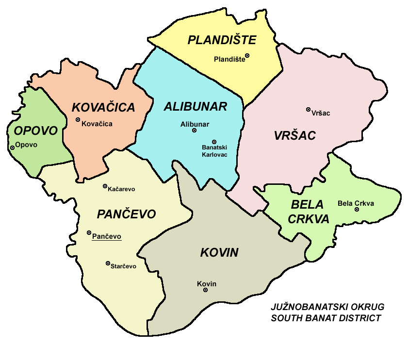
The South Banat District ( sr, ąłčāąČąĮąŠą▒ą░ąĮą░čéčüą║ąĖ ąŠą║čĆčāą│, Ju┼Šnobanatski okrug, ; hu, D├®l-b├Īns├Īgi k├Črzet; ) is one of seven administrative districts of the autonomous province of Vojvodina, Serbia. The administrative center of the district is the city of Pan─Źevo. The district lies in the region of Banat. According to the 2011 census results, it has a population of 291,327 inhabitants. Name In Serbian, the district is known as ''Ju┼Šnobanatski okrug'' (ąłčāąČąĮąŠą▒ą░ąĮą░čéčüą║ąĖ ąŠą║čĆčāą│), in Croatian as ''Ju┼Šnobanatski okrug'', in Hungarian as ''D├®l-b├Īns├Īgi k├Črzet'', in Slovak as ''Juhoban├Ītsky okres'', in Romanian as ''Districtul Banatul de Sud'', and in Rusyn as /ąłčāąČąĮąŠą▒ą░ąĮą░čéčüą║ąĖ ąŠą║čĆčāčģ/. Municipalities It encompasses the cities of Pan─Źevo and Vr┼Īac and the following municipalities: * Plandi┼Īte * Opovo * Kova─Źica * Alibunar * Bela Crkva * Kovin Demographics According to the last official census done in 2011, the South Banat D ... [...More Info...] [...Related Items...] OR: [Wikipedia] [Google] [Baidu] |
Yugoslav Wars
The Yugoslav Wars were a series of separate but related#Naimark, Naimark (2003), p. xvii. ethnic conflicts, wars of independence, and Insurgency, insurgencies that took place in the Socialist Federal Republic of Yugoslavia, SFR Yugoslavia from 1991 to 2001. The conflicts both led up to and resulted from the breakup of Yugoslavia, which began in mid-1991, into six independent countries matching the six entities known as republics which previously composed Yugoslavia: Slovenia, Croatia, Bosnia and Herzegovina, Montenegro, Serbia, and North Macedonia (previously named ''Macedonia''). Yugoslavia's constituent republics declared independence due to unresolved tensions between ethnic minorities in the new countries, which fuelled the wars. While most of the conflicts ended through peace accords that involved full international recognition of new states, they resulted in a massive number of deaths as well as severe economic damage to the region. During the initial stages of the breaku ... [...More Info...] [...Related Items...] OR: [Wikipedia] [Google] [Baidu] |
Croatia
, image_flag = Flag of Croatia.svg , image_coat = Coat of arms of Croatia.svg , anthem = "Lijepa na┼Īa domovino"("Our Beautiful Homeland") , image_map = , map_caption = , capital = Zagreb , coordinates = , largest_city = capital , official_languages = Croatian , languages_type = Writing system , languages = Latin , ethnic_groups = , ethnic_groups_year = 2021 , religion = , religion_year = 2021 , demonym = , government_type = Unitary parliamentary republic , leader_title1 = President , leader_name1 = Zoran Milanovi─ć , leader_title2 = Prime Minister , leader_name2 = Andrej Plenkovi─ć , leader_title3 = Speaker of Parliament , leader_name3 = Gordan Jandrokovi─ć , legislature = Sabor , sovereignty_type ... [...More Info...] [...Related Items...] OR: [Wikipedia] [Google] [Baidu] |
Bosnia
Bosnia and Herzegovina ( sh, / , ), abbreviated BiH () or B&H, sometimes called BosniaŌĆōHerzegovina and often known informally as Bosnia, is a country at the crossroads of south and southeast Europe, located in the Balkans. Bosnia and Herzegovina borders Serbia to the east, Montenegro to the southeast, and Croatia to the north and southwest. In the south it has a narrow coast on the Adriatic Sea within the Mediterranean, which is about long and surrounds the town of Neum. Bosnia, which is the inland region of the country, has a moderate continental climate with hot summers and cold, snowy winters. In the central and eastern regions of the country, the geography is mountainous, in the northwest it is moderately hilly, and in the northeast it is predominantly flat. Herzegovina, which is the smaller, southern region of the country, has a Mediterranean climate and is mostly mountainous. Sarajevo is the capital and the largest city of the country followed by Banja Luka, Tuzla ... [...More Info...] [...Related Items...] OR: [Wikipedia] [Google] [Baidu] |
Refugee Camps In Serbia
A refugee, conventionally speaking, is a displaced person who has crossed national borders and who cannot or is unwilling to return home due to well-founded fear of persecution.FAQ: Who is a refugee? ''www.unhcr.org'', accessed 22 June 2021 Such a person may be called an until granted by the contracting state or the |
Populated Places In South Banat District
Population typically refers to the number of people in a single area, whether it be a city or town, region, country, continent, or the world. Governments typically quantify the size of the resident population within their jurisdiction using a census, a process of collecting, analysing, compiling, and publishing data regarding a population. Perspectives of various disciplines Social sciences In sociology and population geography, population refers to a group of human beings with some predefined criterion in common, such as location, race, ethnicity, nationality, or religion. Demography is a social science which entails the statistical study of populations. Ecology In ecology, a population is a group of organisms of the same species who inhabit the same particular geographical area and are capable of interbreeding. The area of a sexual population is the area where inter-breeding is possible between any pair within the area and more probable than cross-breeding with ind ... [...More Info...] [...Related Items...] OR: [Wikipedia] [Google] [Baidu] |


